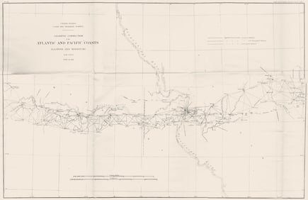
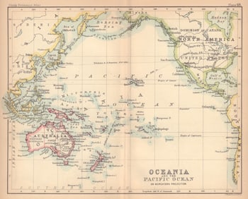
Antique Maps & Prints of the Pacific Ocean

online only auction | 8 day sale | starts today!
Location
New York, NY 10016
Dates

Sale Starts

Wed
Nov 12
8pm

Sale Ends

Wed
Nov 19

Terms & Conditions

1. All bidders and buyers shall present satisfying documentation prior to the approval of this auction.
2. This auction contains items with 'no reserve' or 'reserve' pricing, as indicated in each item description. An item with 'no reserve' means there is no minimum price set, so the item is guaranteed to sell regardless of what the winning bid price is. An item containing a 'reserve' means that there is a minimum price that the bidding must reach to sell.
3. All property is sold 'as is' and neither Chairish Auctions nor the listing agent makes any warranties or representation or any kind or nature with respect to the property, and in no event shall they be responsible for the correctness, nor deemed to have made any representation or warranty, or description, genuineness, authorship, attribution, provenance, period, culture, source, origin, or condition of the property and no statement made at the sale, or in the bill of sale, or invoice, or in the catalog, or elsewhere shall be deemed such a warranty of representation or an assumption of liability. Prospective buyers are urged to inspect those lots in which they have an interest.
4. Chairish Auctions will contact the winning bidders with shipping information after the auction. Buyer pays shipping cost indicated in the auction description, as well as any applicable taxes, duties or fees for items originating from outside of the buyer's home country. For buyer's outside of the Continental United States, the Chairish Auctions team will provide an introduction to global parcel or white glove shipping partners upon request.
5. Except as provided in paragraph 1 above, the highest bidder as determined by Chairish Auctions shall be the purchaser. In the case of a disputed bid, the auctioneer shall have sole discretion in determining the purchaser and may also, at his or her election, withdraw the lot or reoffer the lot for sale. The auctioneer shall have sole discretion to refuse any bid, or refuse to acknowledge any bidder.
6. All merchandise purchased is payable directly to Chairish Auctions and must be paid for upon receipt of the invoice. Invoices are sent the day after the auction.. All merchandise must be removed from Chairish Auctions within fourteen business days of the auction, and in no event shall Chairish Auctions have any liability for any damage to property left on its premises for more than fourteen business days after the sale. If any property has not been removed within fourteen business days from the date of sale, at the option of Chairish Auctions (a) the merchandise may be transferred to and stored at a bonded warehouse and the purchaser agrees to pay all transfer and storage expenses, and/or (b) Chairish Auctions may place the merchandise in a subsequent auction, without reserve, to be sold to the highest bidder, and after deducting the standard commission and any additional charges that may apply, remit the proceeds to the purchaser.
7. Acceptable forms of payment are VISA, MasterCard, American Express, or Discover, payable in U.S. dollars. Invoice must be paid in full. Chairish Auctions reserves the right to hold merchandise purchased until the funds have cleared.
8. If the purchaser breaches any of its obligations under these Conditions of Sale, including its obligation to pay in full the purchase price of all items for which it was the highest successful bidder, Chairish Auctions may exercise all of its rights and remedies under the law including, without limitation, (a) canceling the sale and applying any payments made by the purchaser to the damages caused by the purchaser's breach, and/or (b) offering at public auction, without reserve, any lot or item for which the purchaser has breached any of its obligations, including its obligation to pay in full the purchase price, holding the purchaser liable for any deficiency plus all costs of sale.
9. Chairish Auctions may, in its discretion and at purchaser's request, package and arrange for delivery as directed by the purchaser. In such event, purchaser agrees that (a) all such packaging, handling and delivery is at the sole risk of the purchaser and that Chairish Auctions shall have no liability for any loss or damage to such items, and (b) purchaser shall pay in advance, all packaging expenses, including labor, materials, carrier's fees and all insurance charges. Please arrange seventy-two hours in advance for collection and delivery. Chairish Auctions shall not be responsible for obtaining any permits or licenses on behalf of purchaser and no sale shall be cancelled or refunded for lack of purchaser's noncompliance with permitting and licensing issues. Chairish Auctions WILL NOT CANCEL SALE DUE TO SHIPPING. Should items be returned to the Chairish Auctions listing agent due to incorrect address provided at checkout or shipping errors, the buyer will be obligated to make a 2nd payment for shipping, and will be liable for other fees and taxes that were associated with the lot(s) being directed back. Should the buyer not honor the obligation, they will violate the terms of the sale. Should the buyer want to be released from the sale after the initial payment, it is at Chairish Auctions's discretion to honor that request. However, the shipping cost and excess fees would be withheld from the refund as services rendered.
10. A premium equal to 20% of the final bid price and a 3.99% processing fee will be applied to each lot sold, to be paid by the buyer as part of the purchase price.
11. Bidding on any item indicates your acceptance of these terms and all other terms printed within, posted, and announced at the time of sale.
12. All sales are final and no refunds will be granted.
13. When you win an item, we will send you an invoice for it. If you have a credit card on file with LiveAuctioneers, it will be charged the balance on the invoice within 24 hours after the invoice is sent.
Chairish Auctions Logo

Chairish Auctions

Description & Details

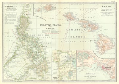
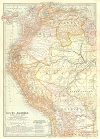
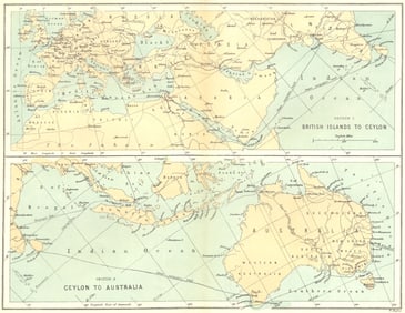
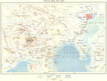
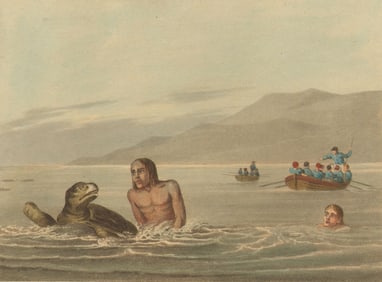
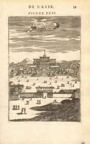
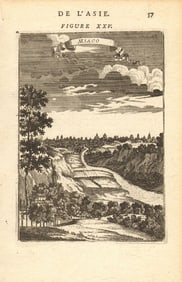
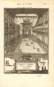
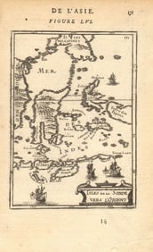
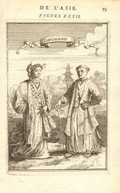
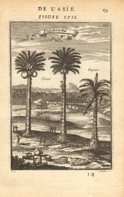
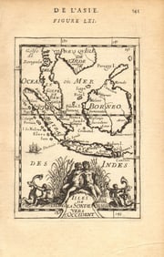
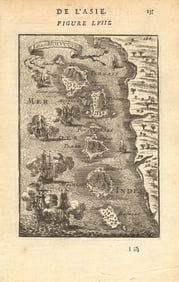
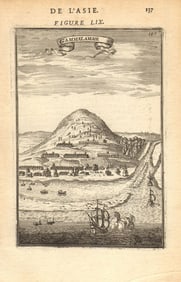
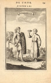
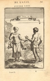
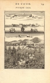
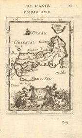
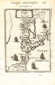
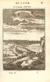
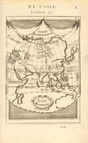
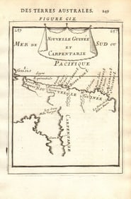
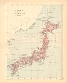
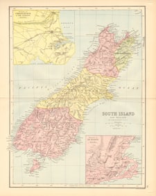
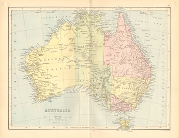
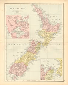
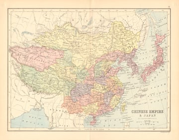
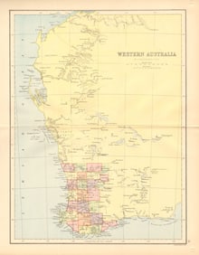
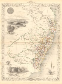
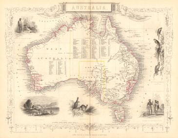
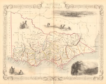
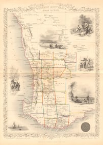
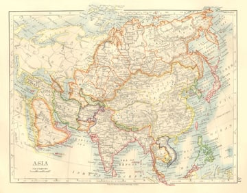
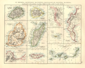
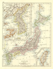
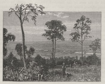
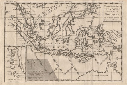
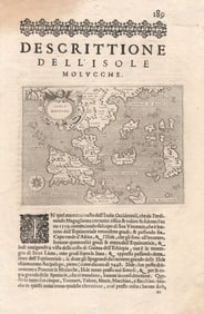
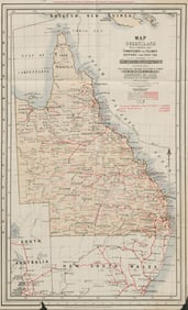
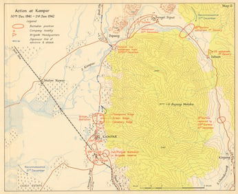
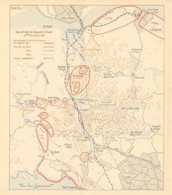
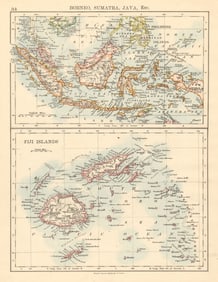
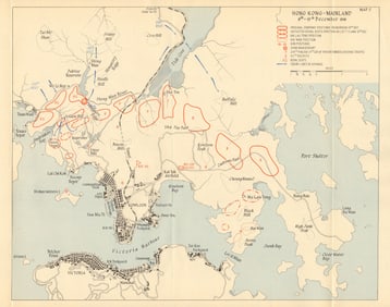
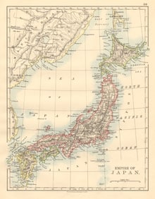
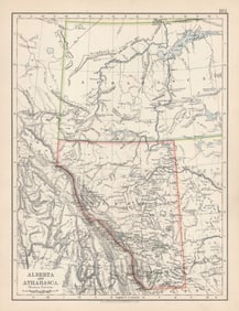
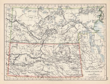
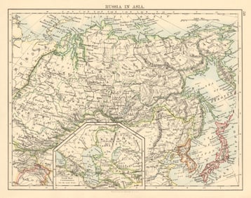
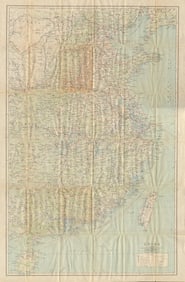
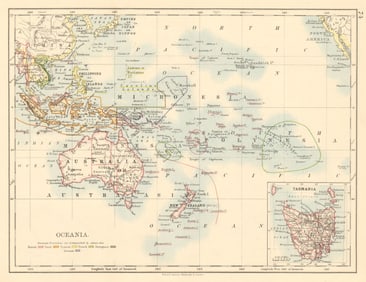
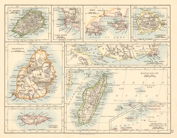
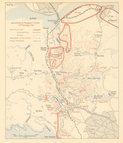
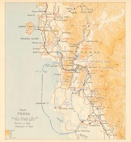
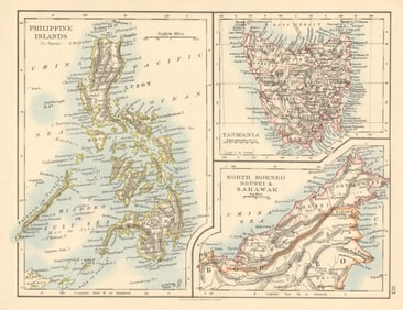
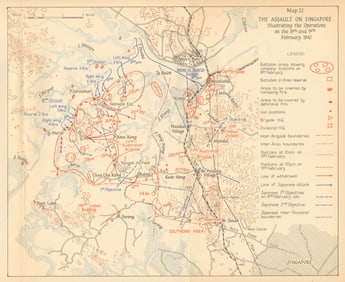
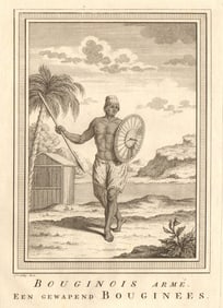
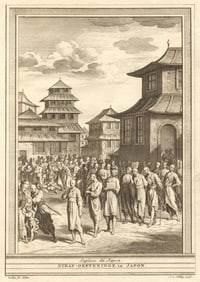
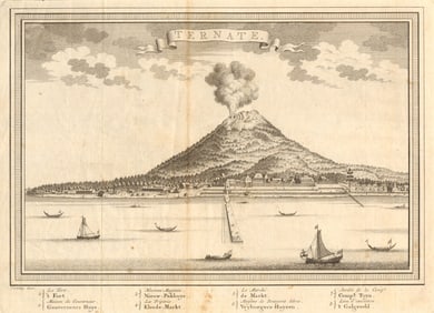
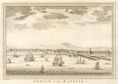
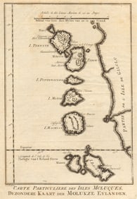
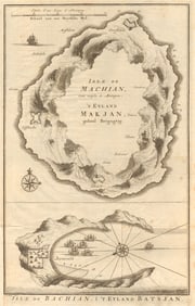
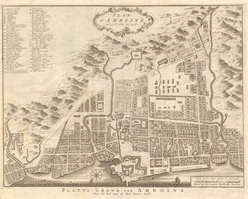
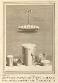
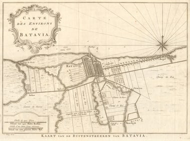
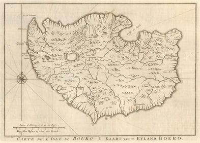
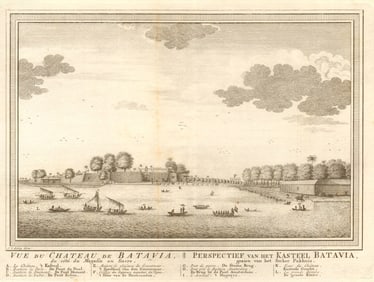
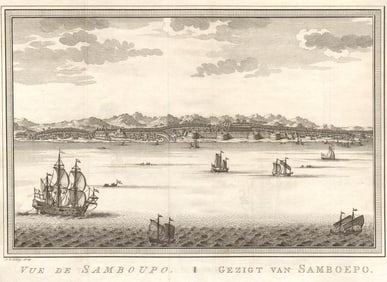
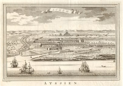
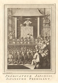
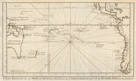
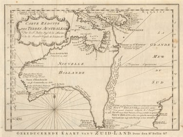
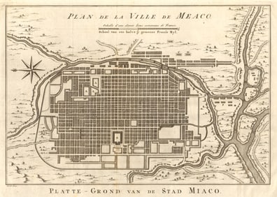
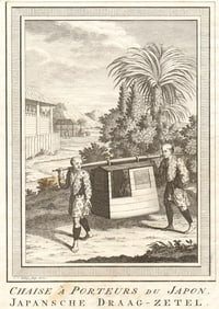
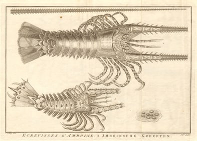
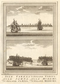
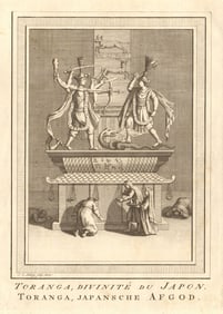
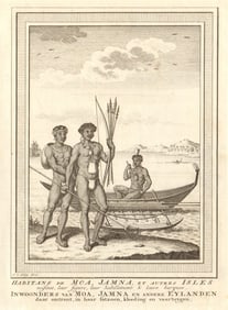
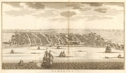
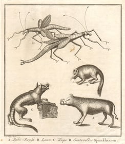
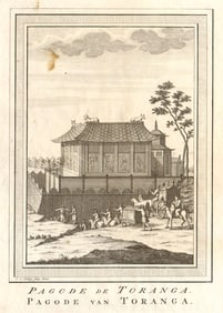
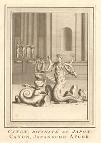
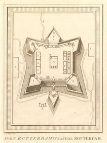
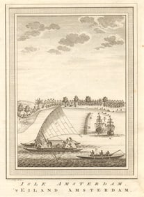
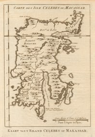
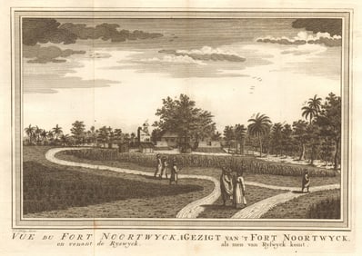
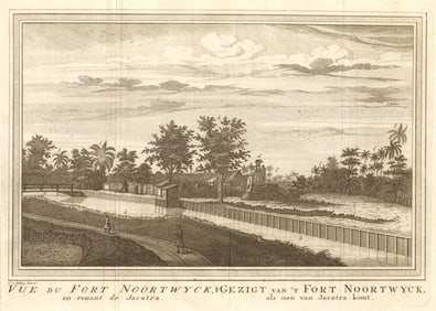
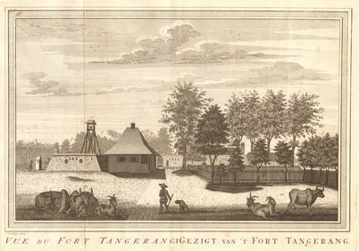
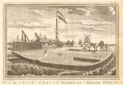
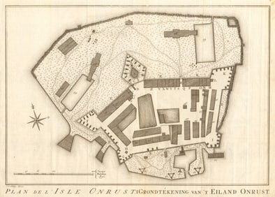
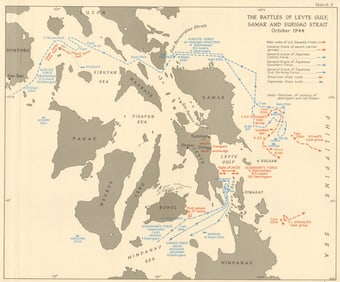
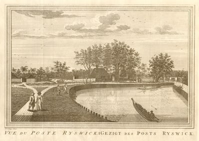
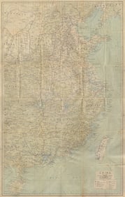
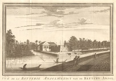
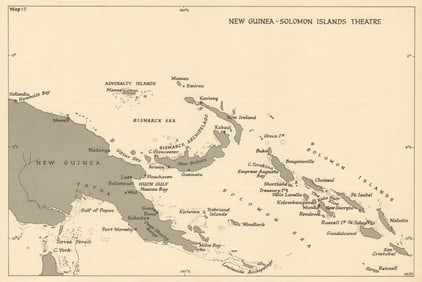
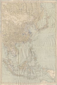
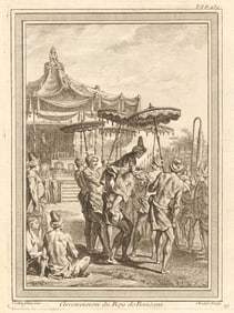
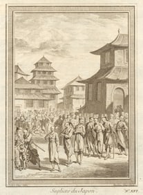
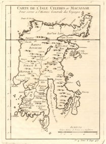
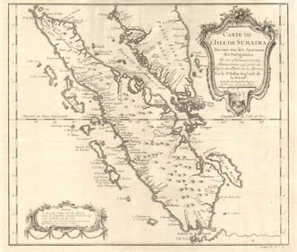
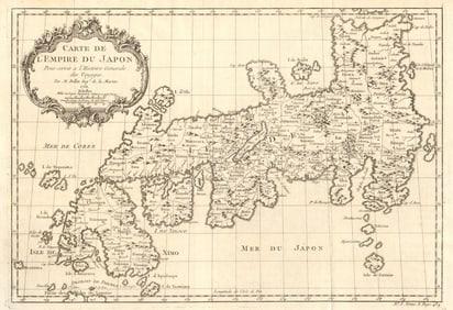
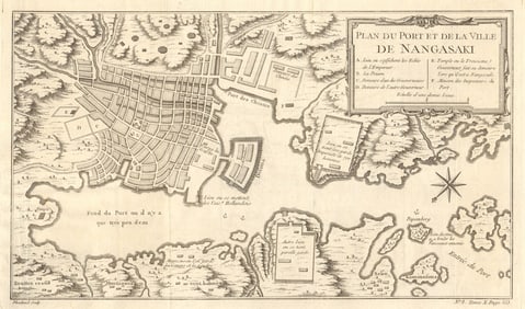
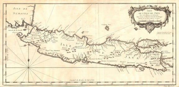
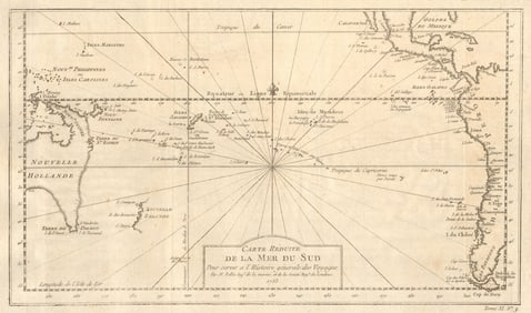
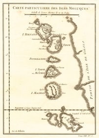
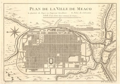
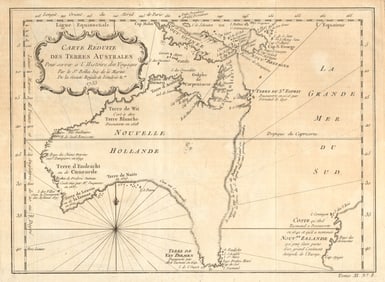
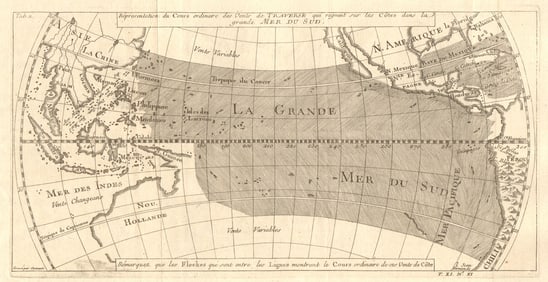
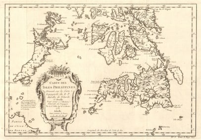
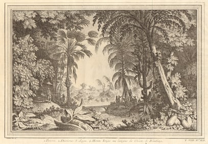
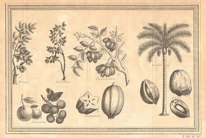
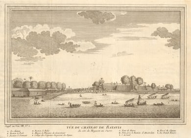
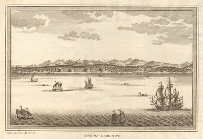
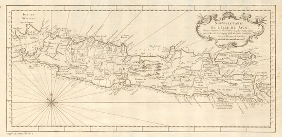
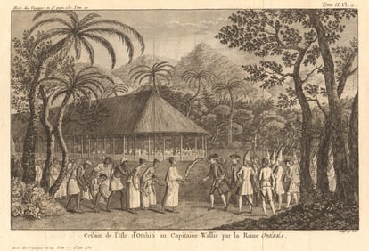
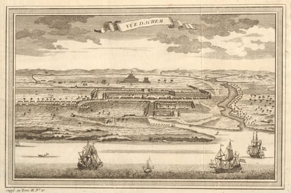
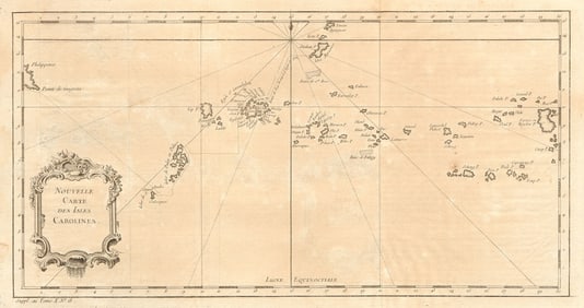
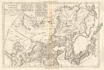
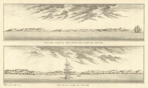
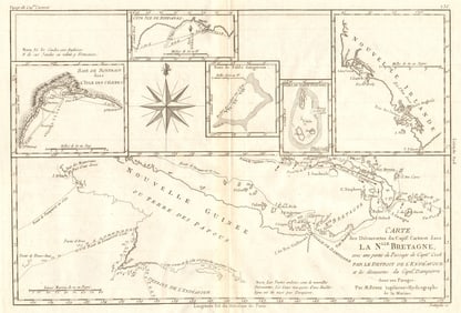
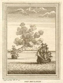
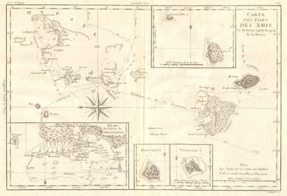
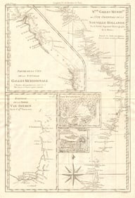
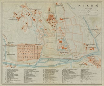
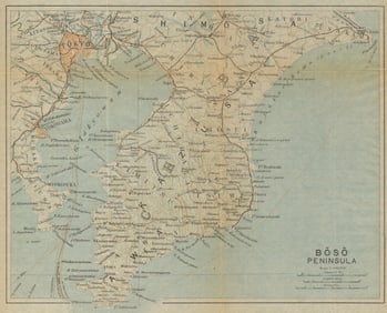
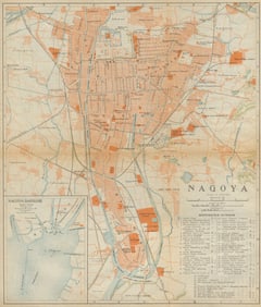
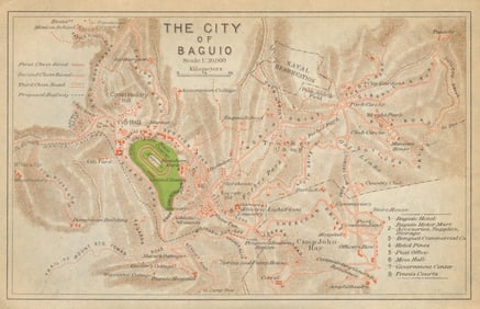
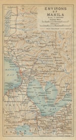
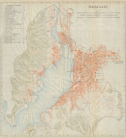
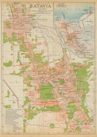
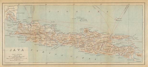
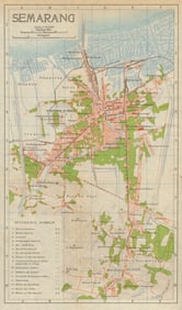
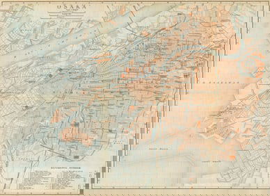
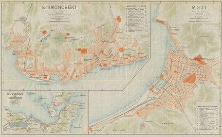
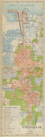
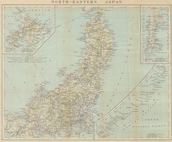
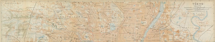
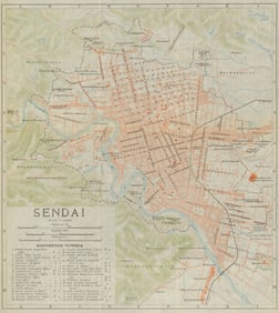
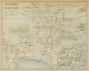
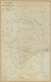
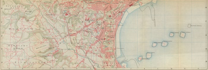
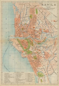
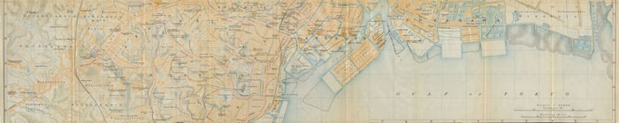
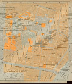
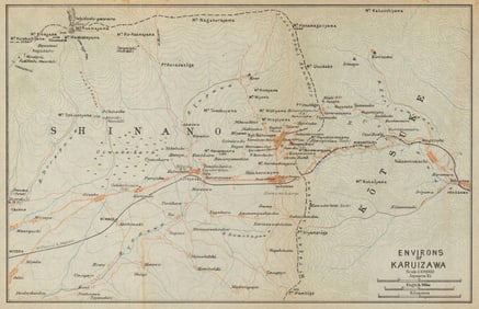
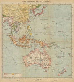
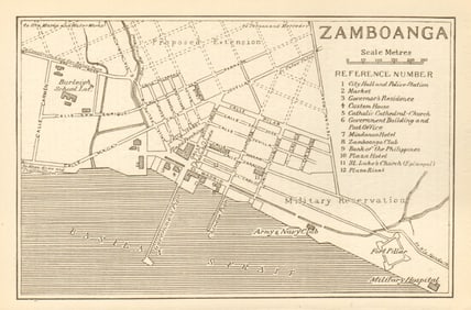
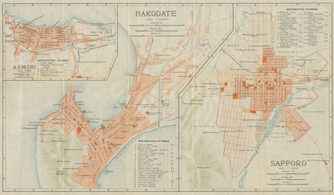
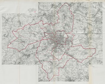
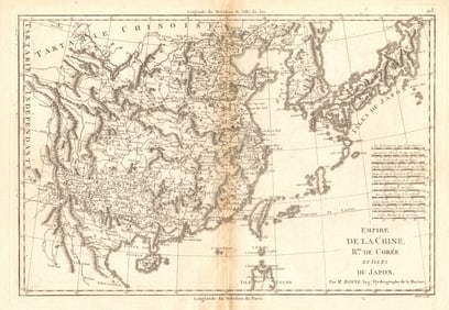
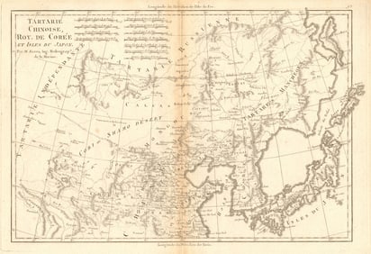
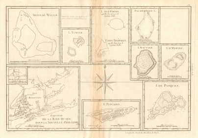
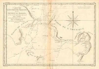
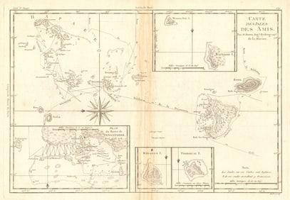
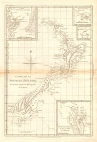
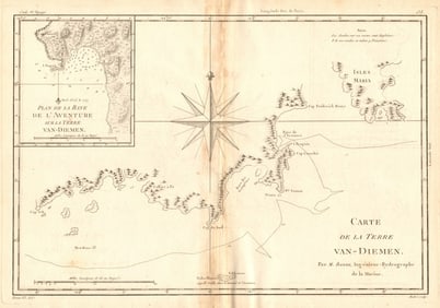
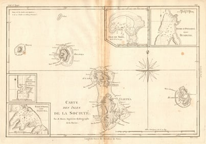
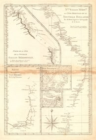
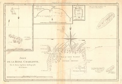
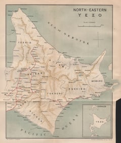
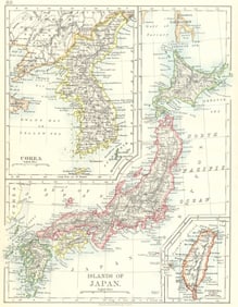
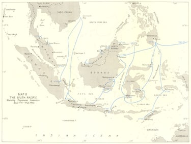
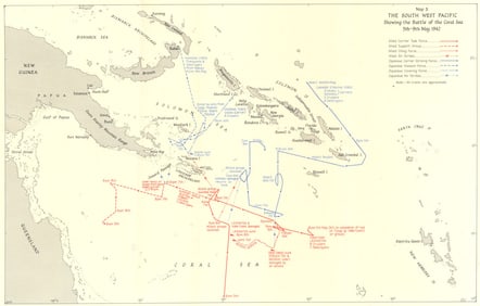
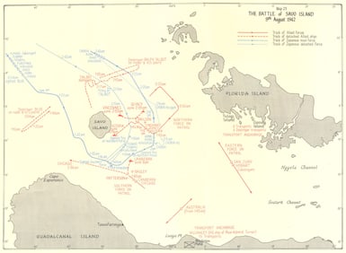
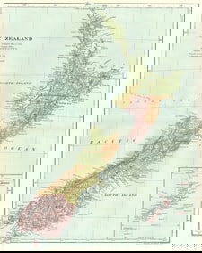
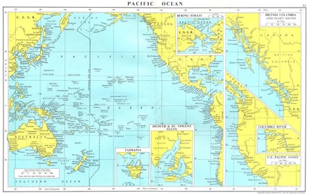
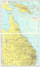
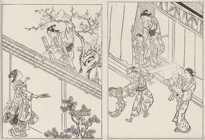
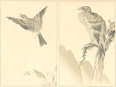
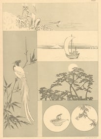
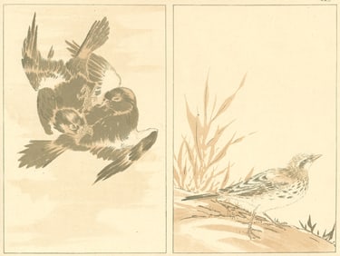
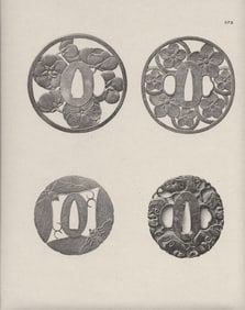
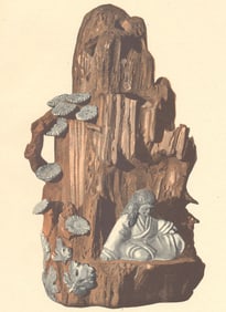
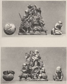
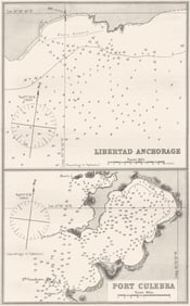
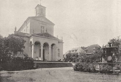
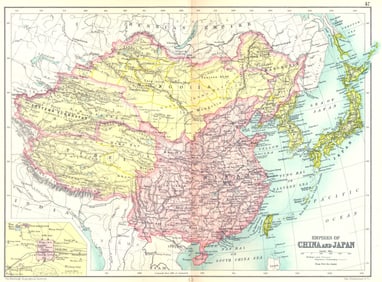
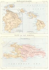
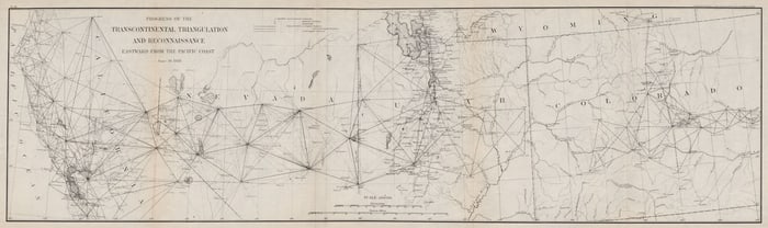
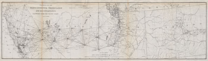
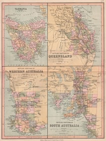
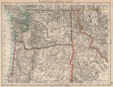
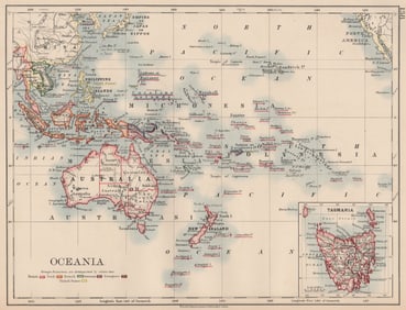
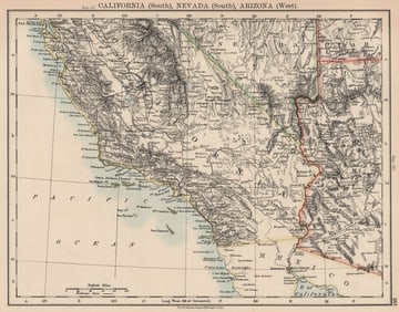
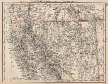
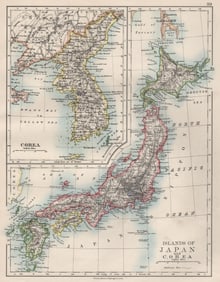
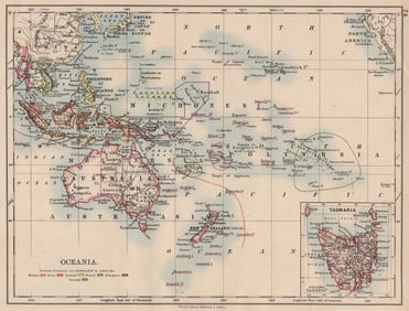
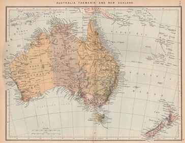
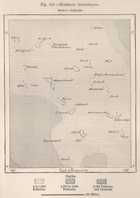
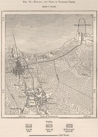
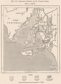
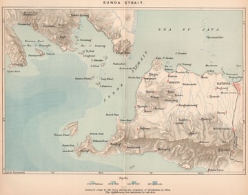
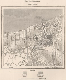
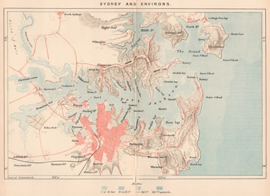
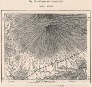
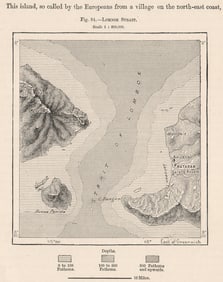
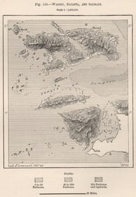
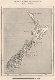
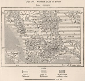
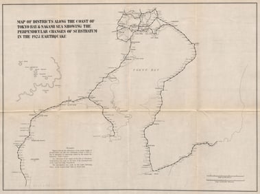
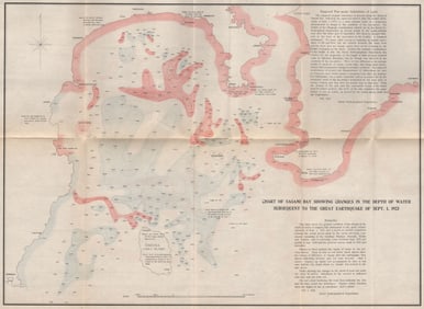
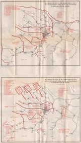
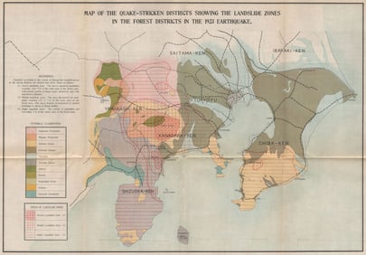
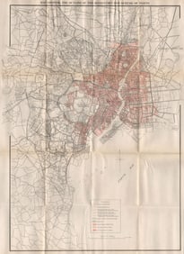
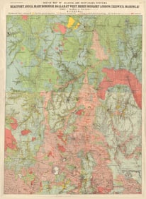
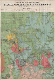
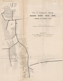
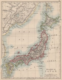
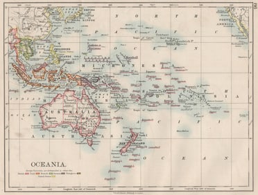
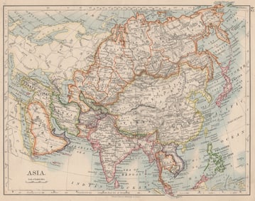
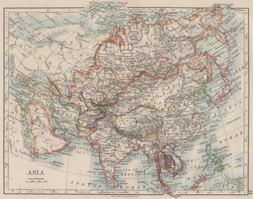
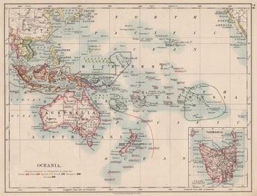
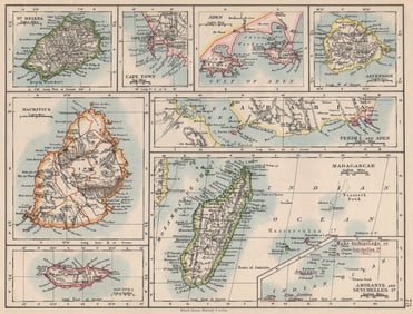
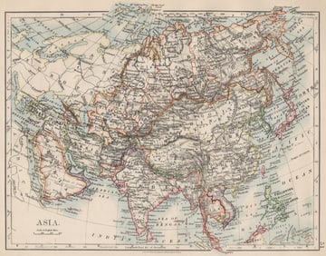
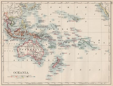
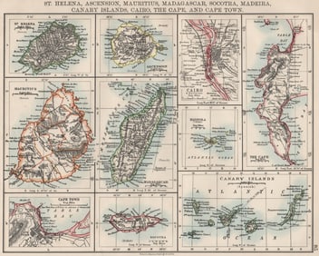
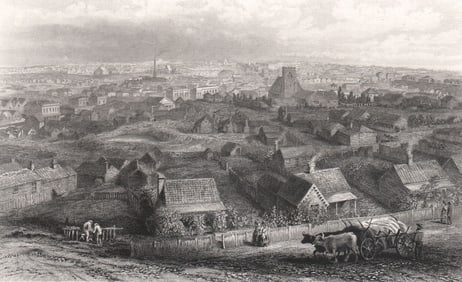
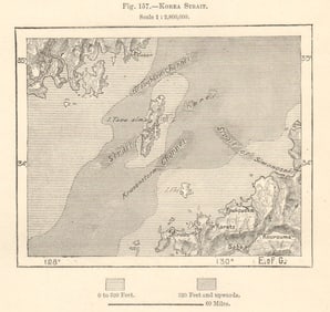
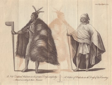
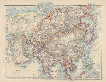
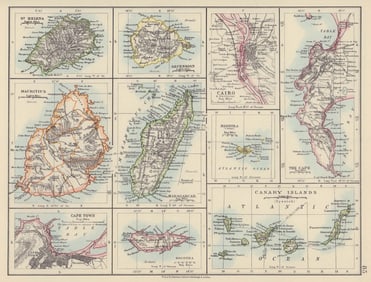
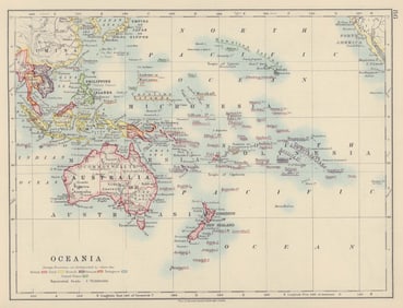
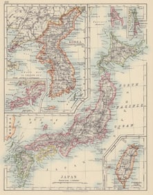
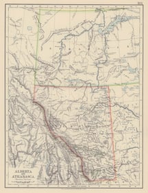
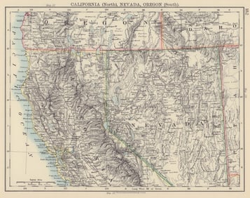
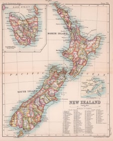
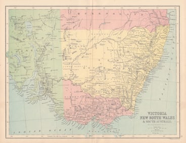
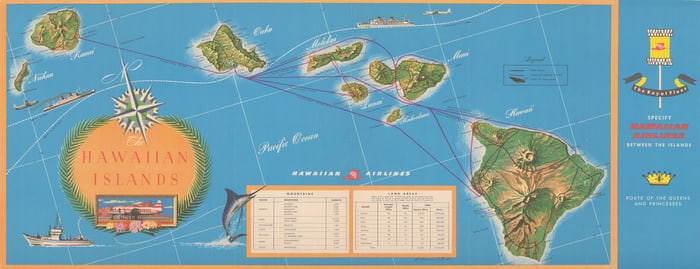
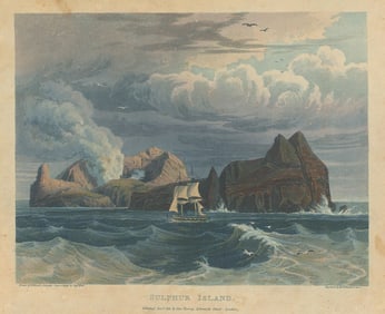
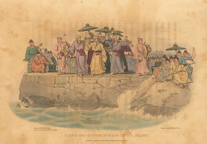
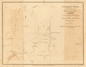
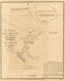
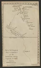
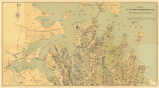
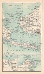
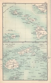
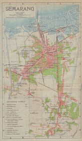
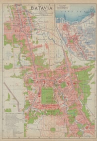
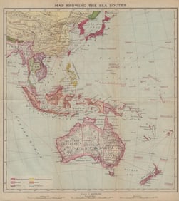
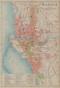
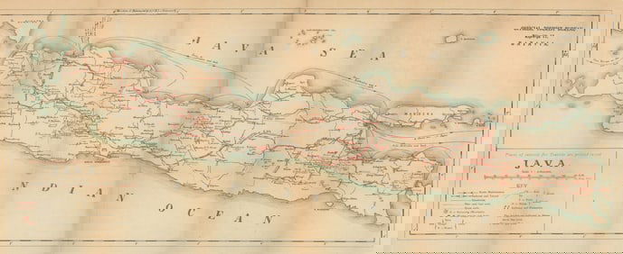
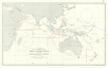
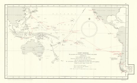
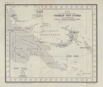
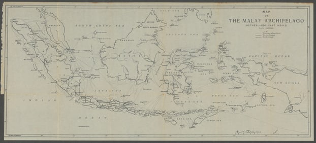
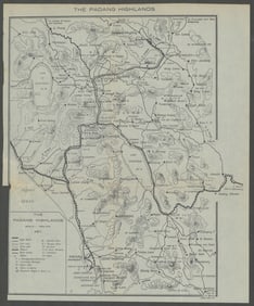
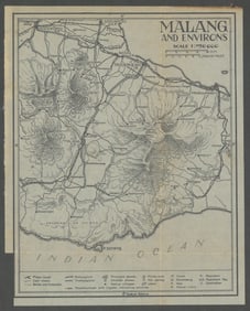
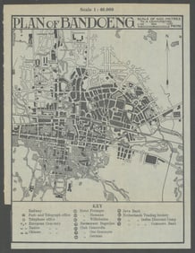
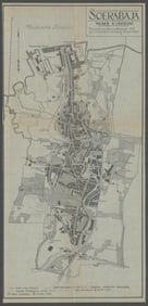
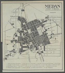
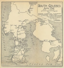
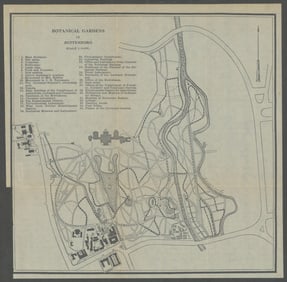
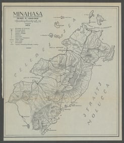
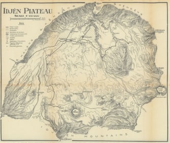
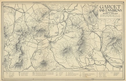
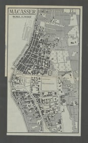
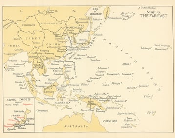
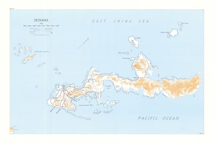
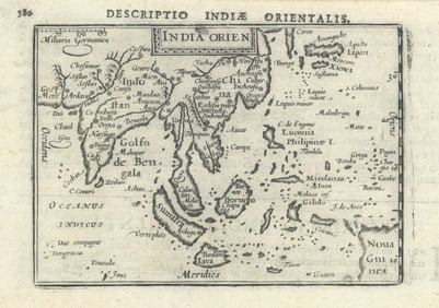
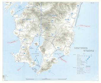
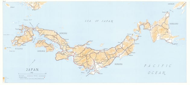
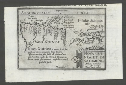
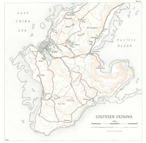
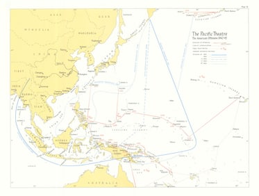
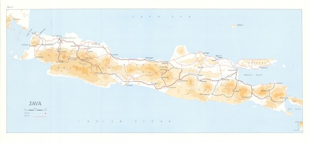
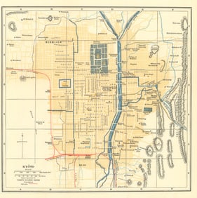
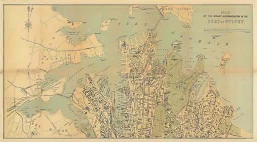
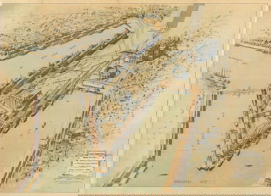
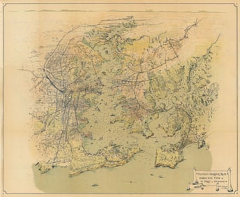
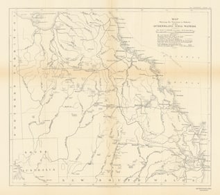
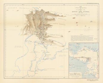
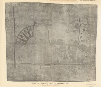
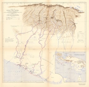
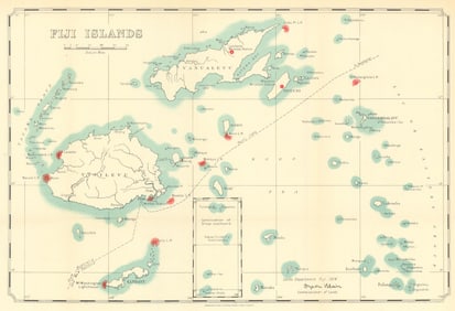
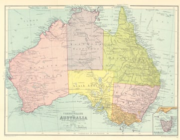
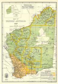
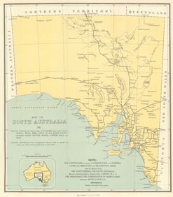
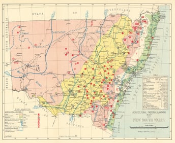
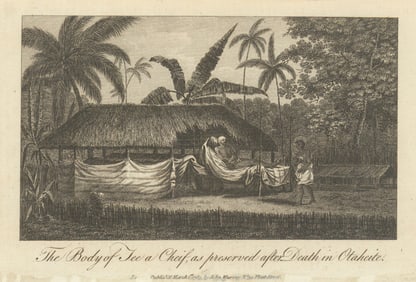
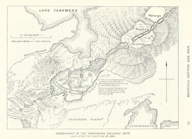
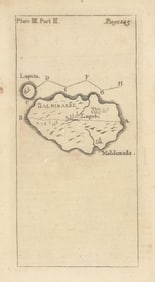
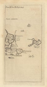
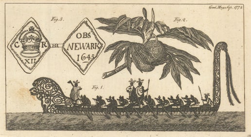
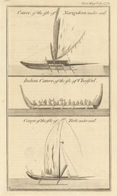
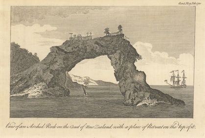
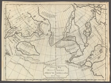
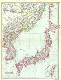
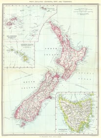
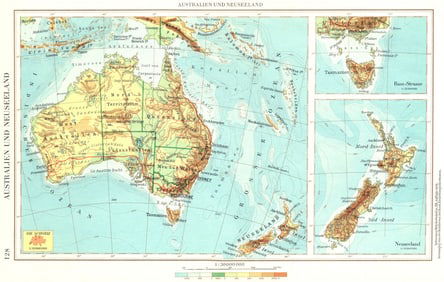
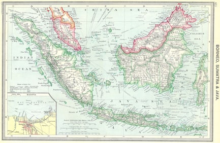
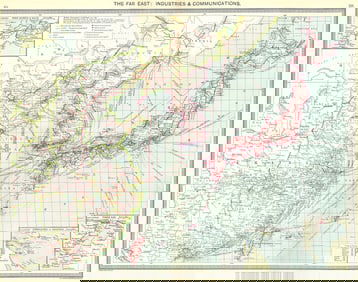
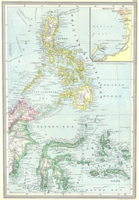
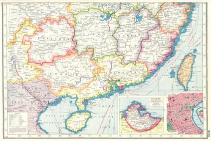
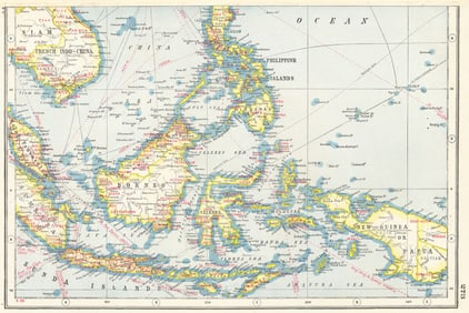
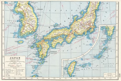
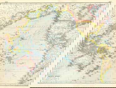
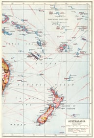
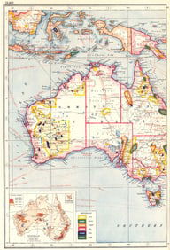
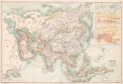
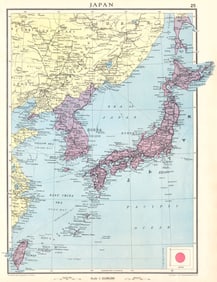
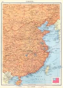
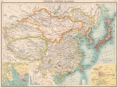
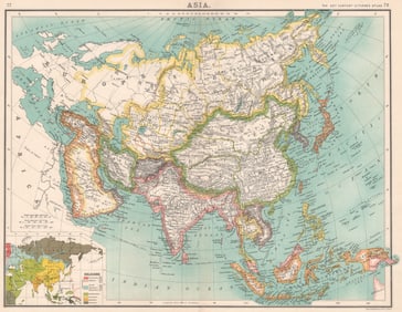
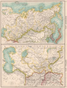
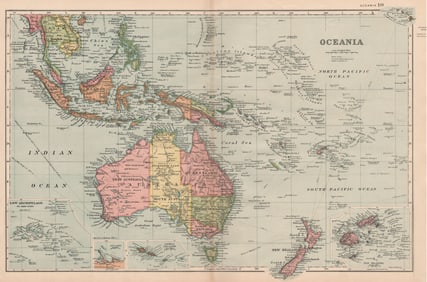
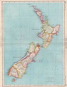
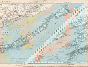
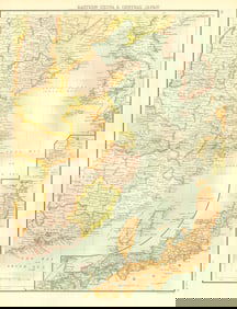
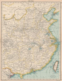
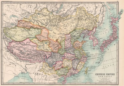
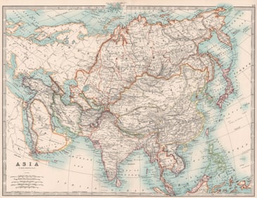
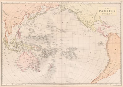
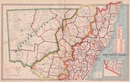
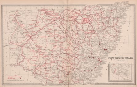
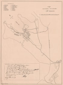
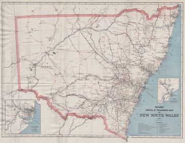
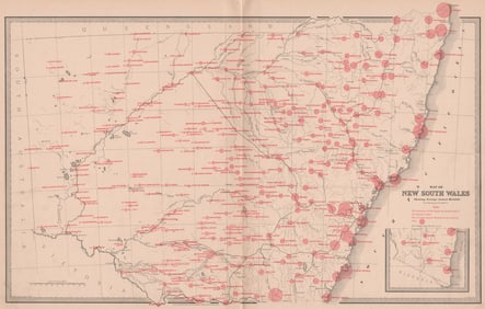
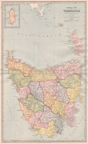
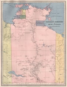
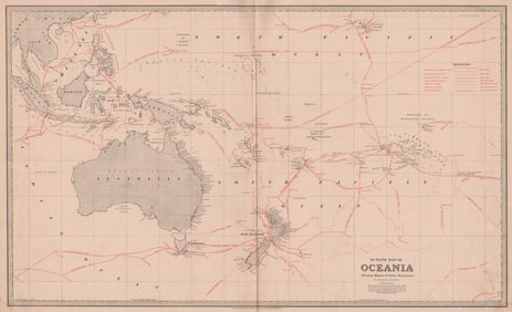
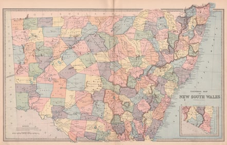
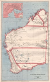
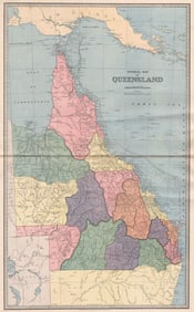
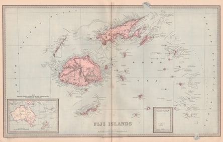
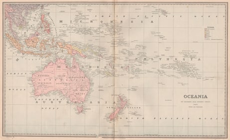
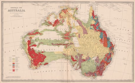
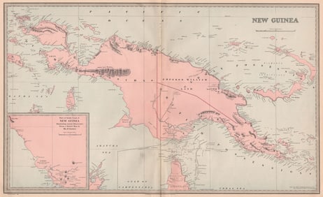
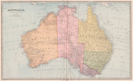
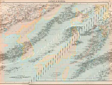
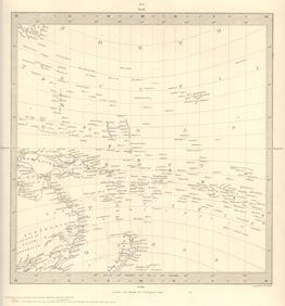
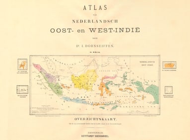
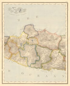
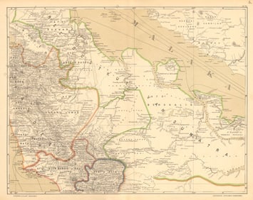
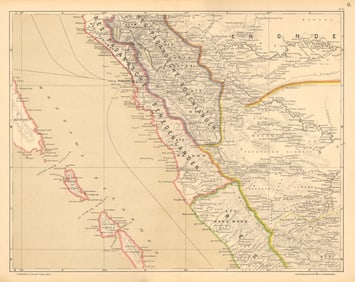
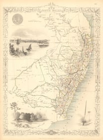
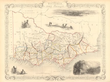
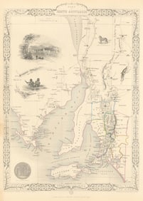
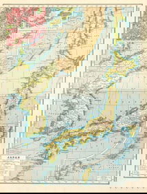
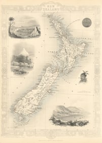
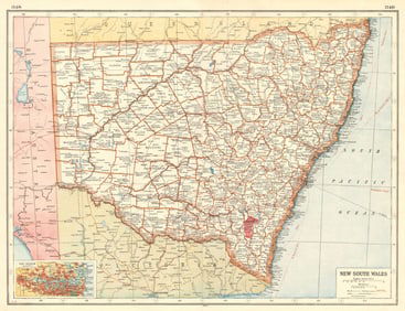
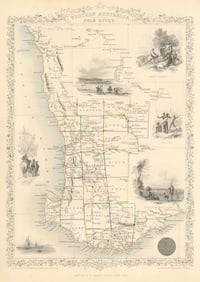
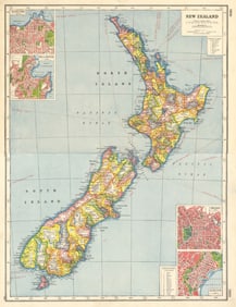
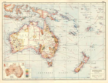
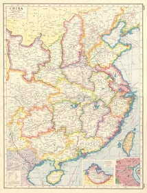
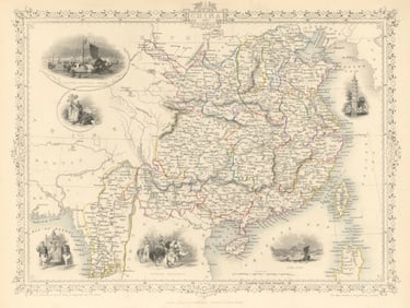
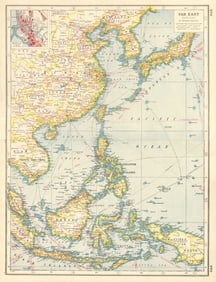
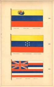
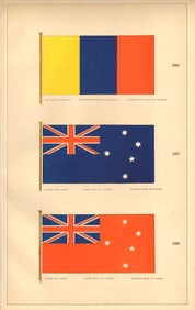
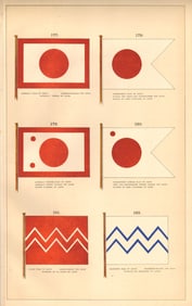
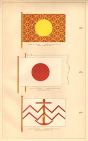
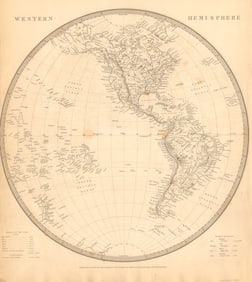
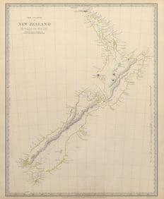
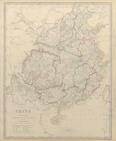
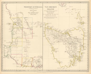
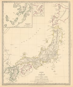
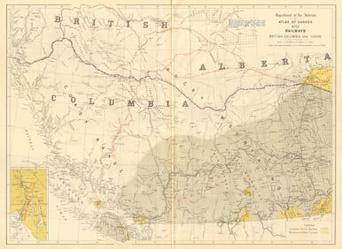
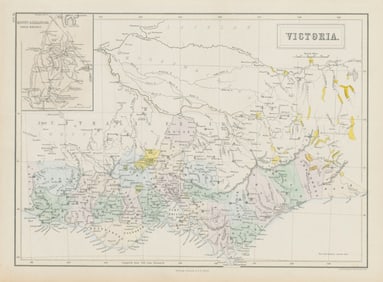
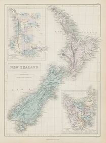
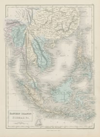
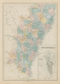
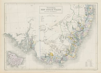
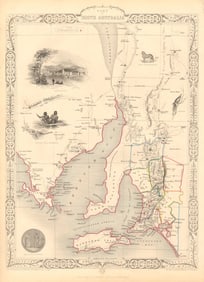
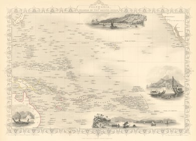
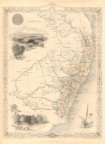
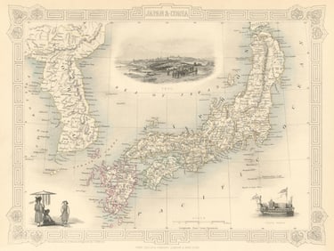
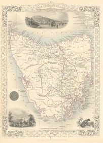
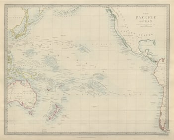
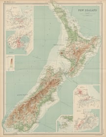
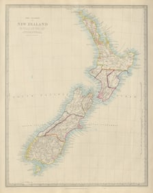
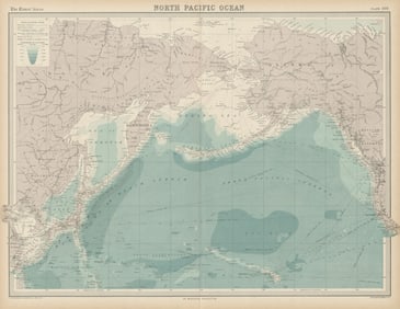
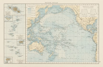
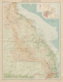
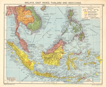
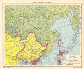
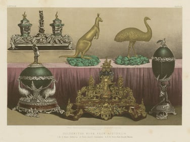
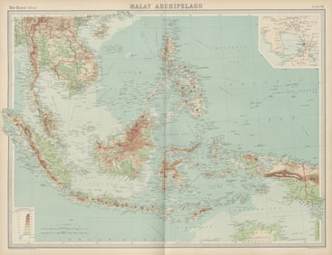
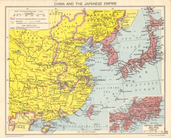
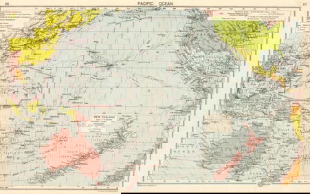
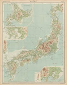
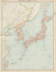
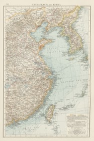
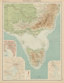
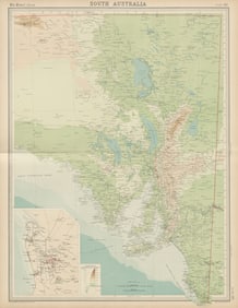
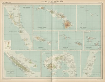
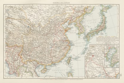
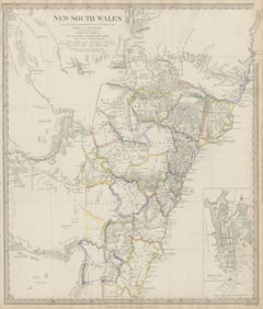
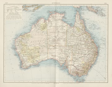
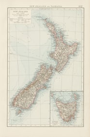
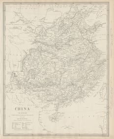
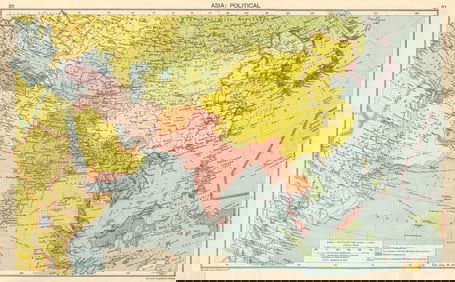
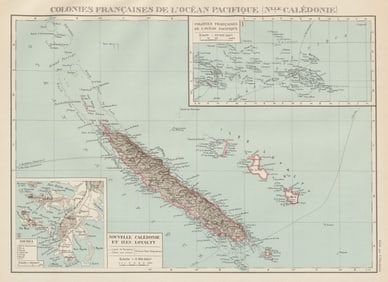
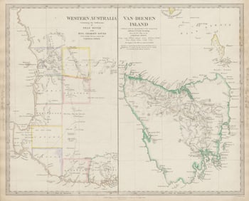
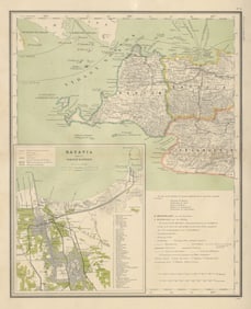
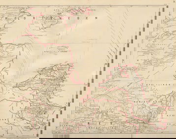
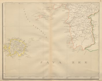
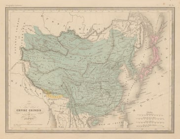
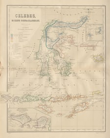
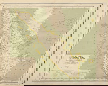
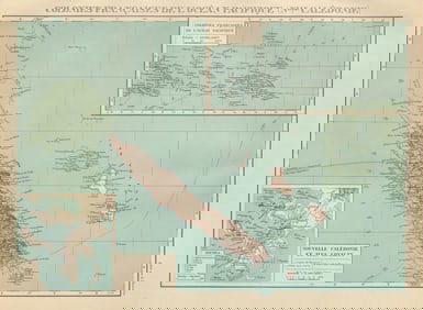
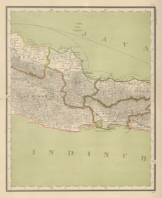
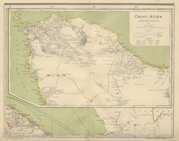
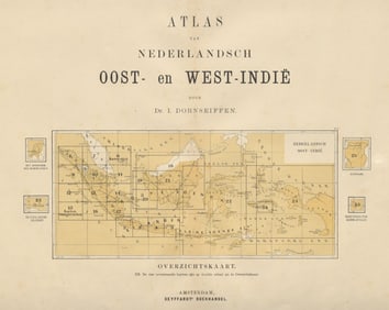
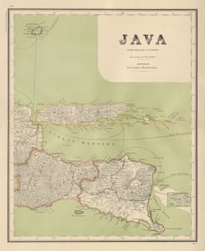
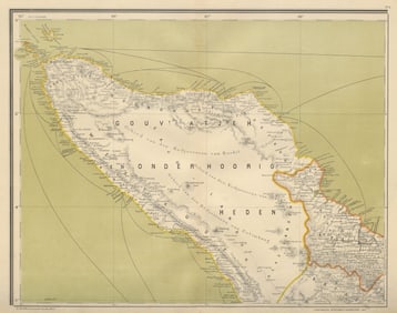
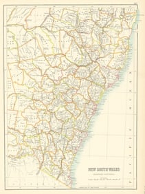
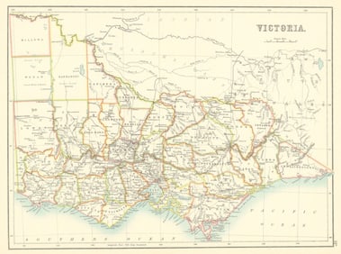
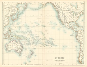
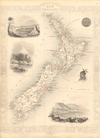
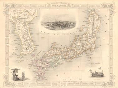
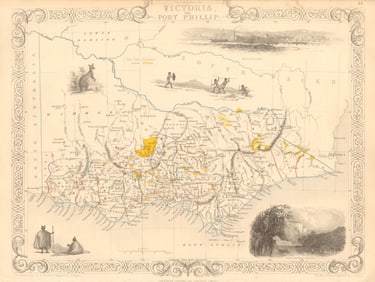
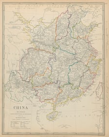
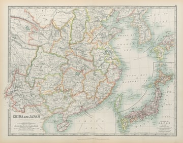
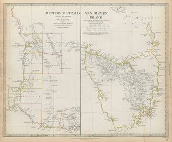
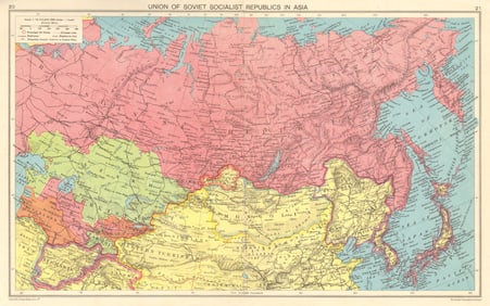
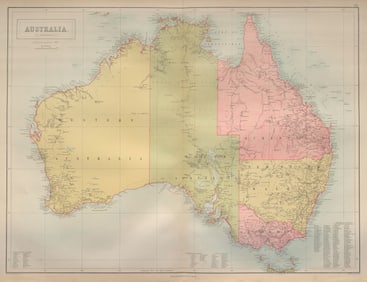
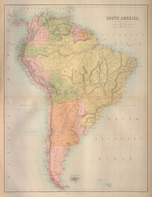
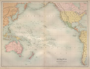
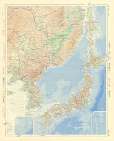
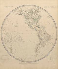
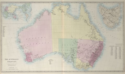
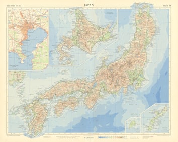
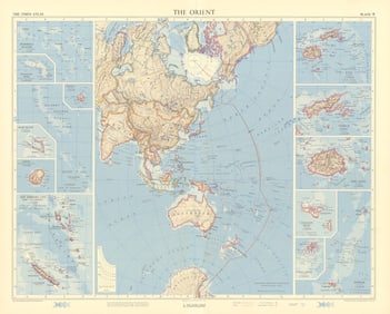
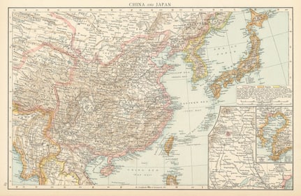
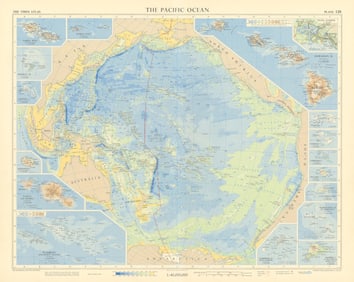
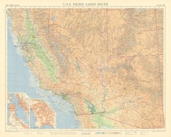
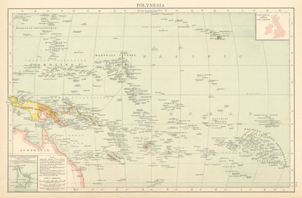
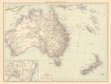
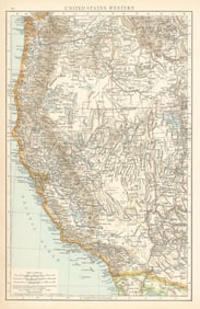
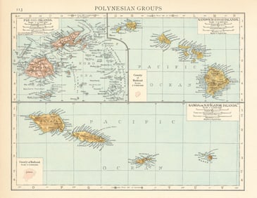
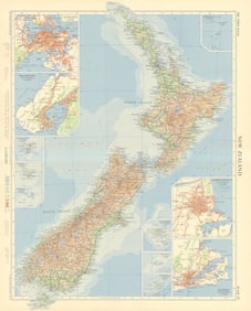
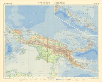
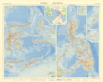
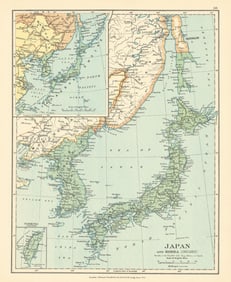
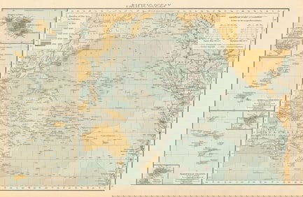
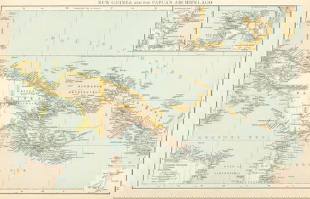
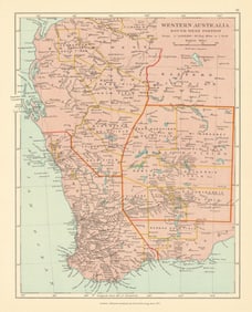
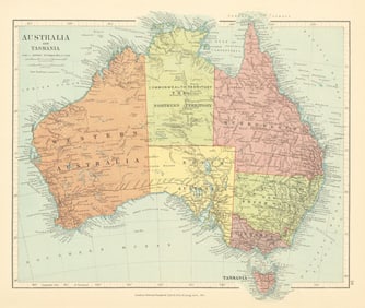
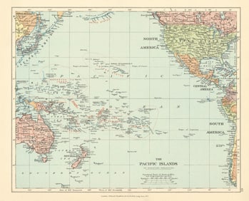
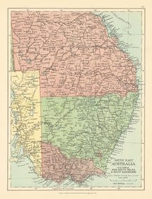
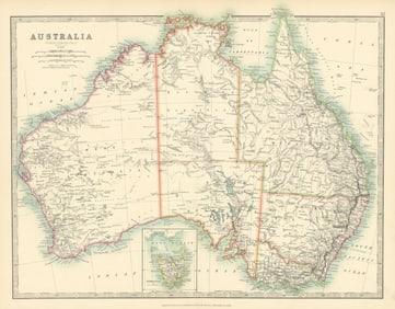
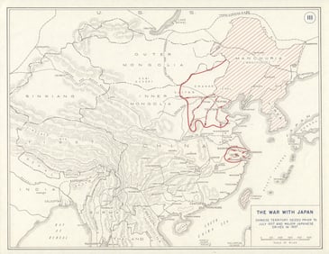
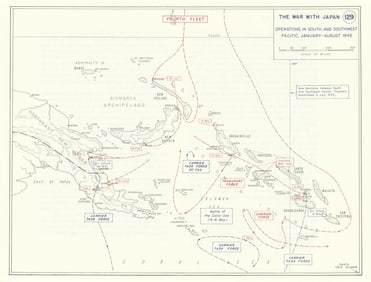
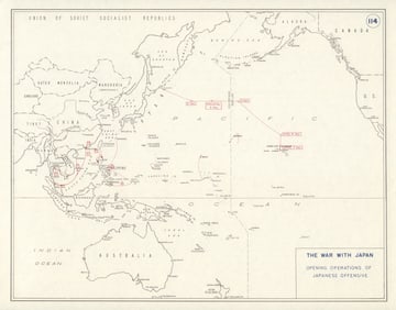
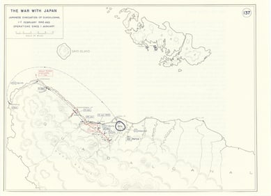
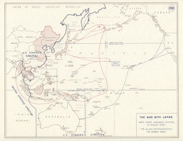
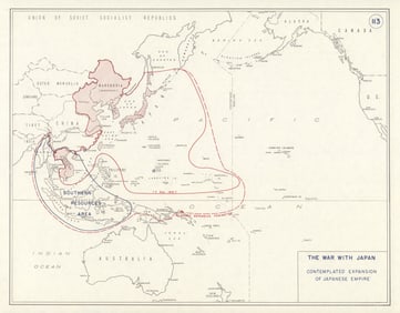
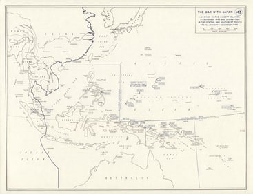
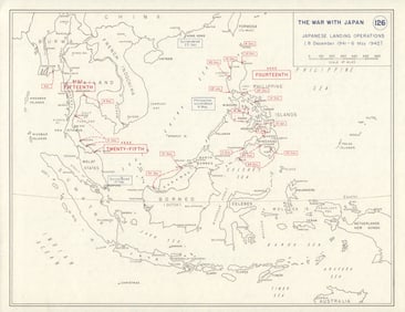
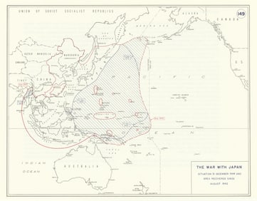
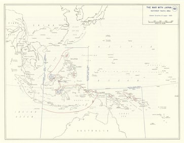
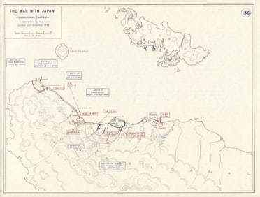
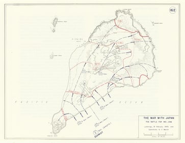
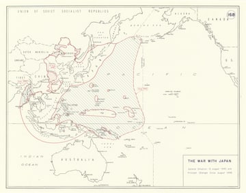
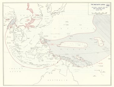
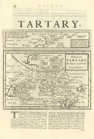
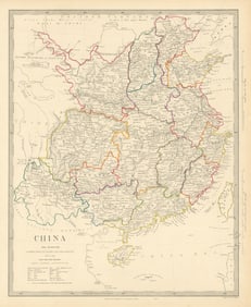
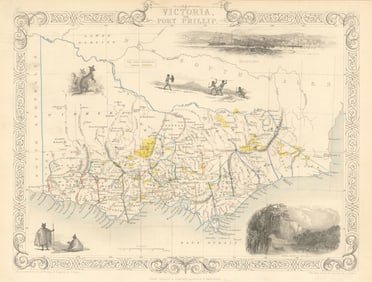
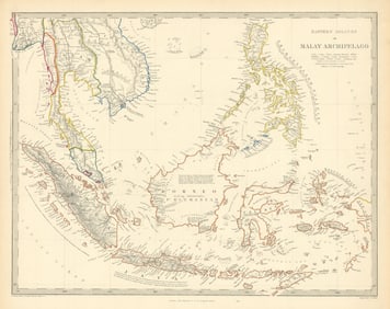
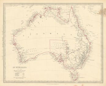
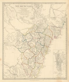
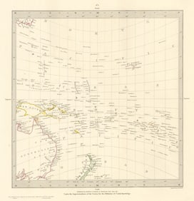
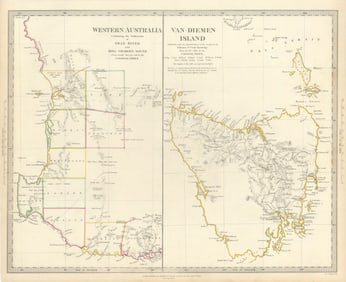
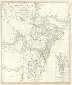
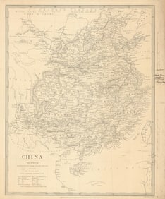
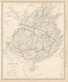
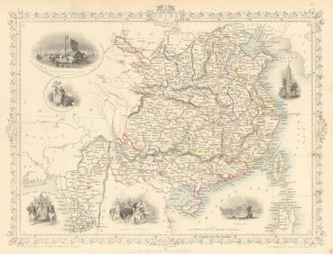
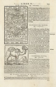
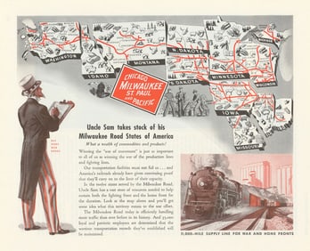
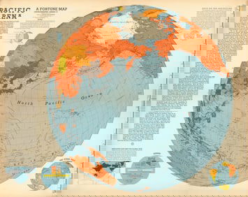
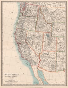
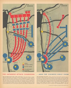
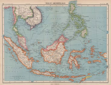
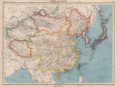
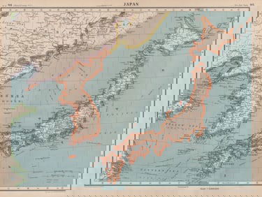
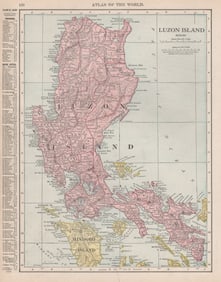
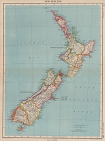
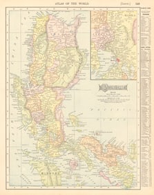
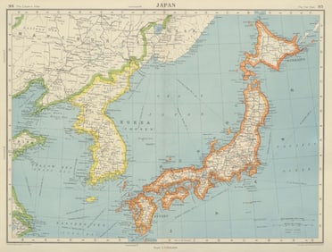
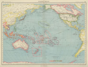
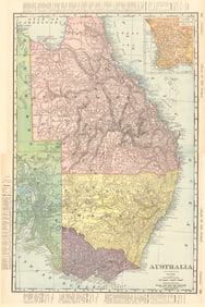
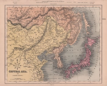
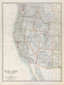
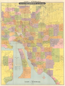
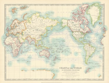
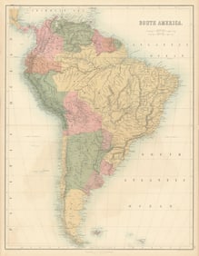
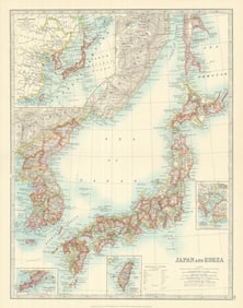
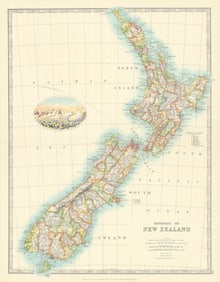
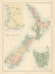
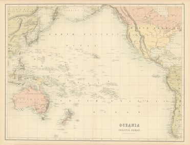
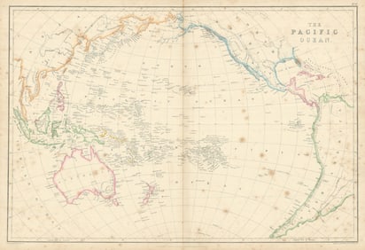
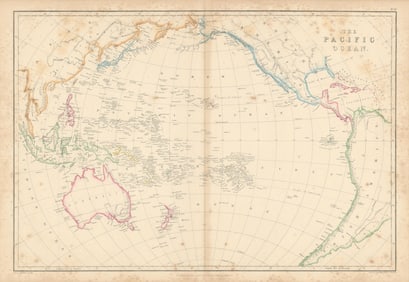
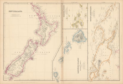
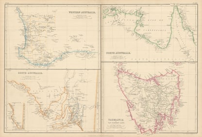
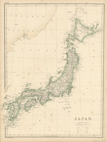
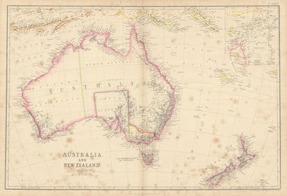
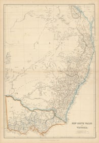
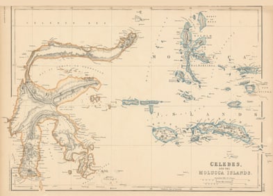
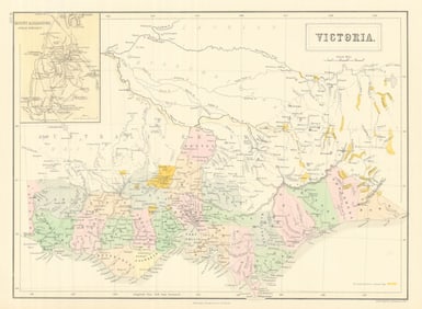
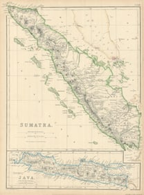
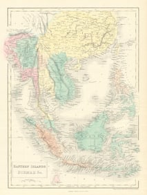
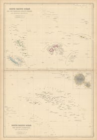
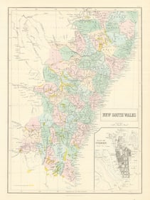
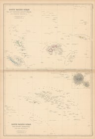
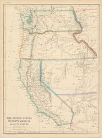
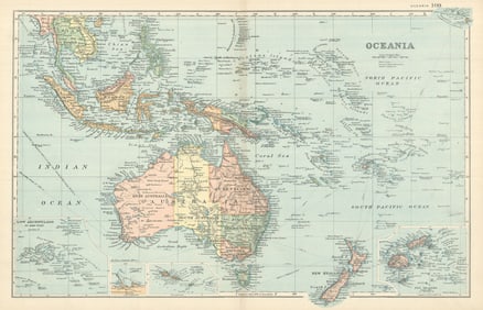
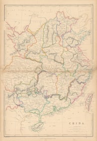
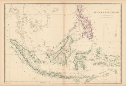
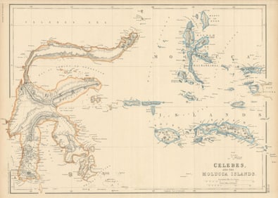
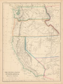
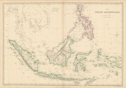
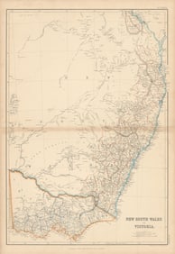
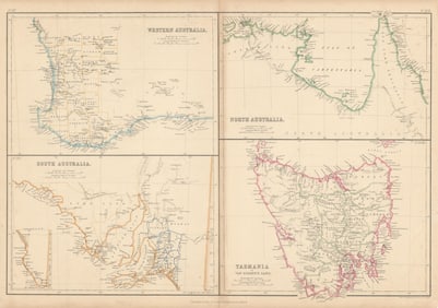
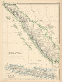
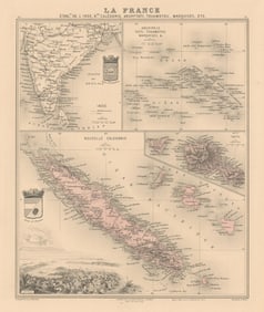
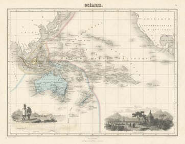
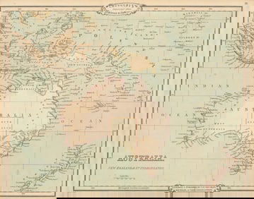
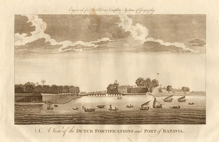
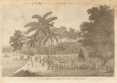
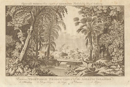
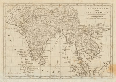
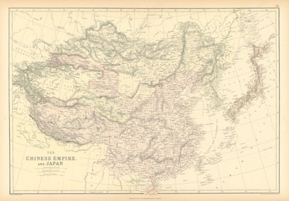
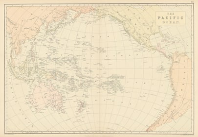
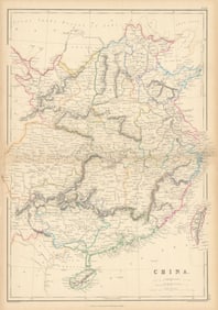
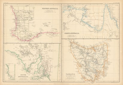
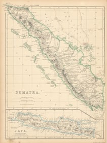
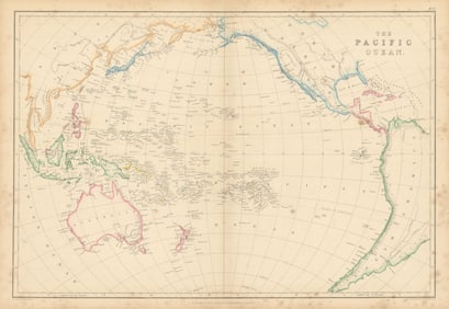
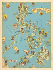
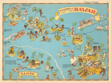
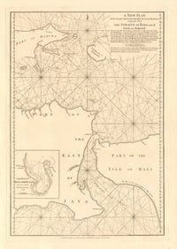
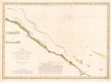
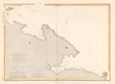
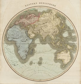
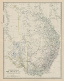
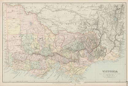
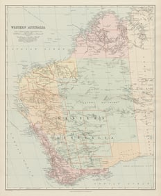
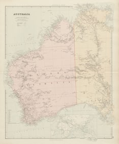
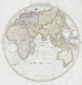
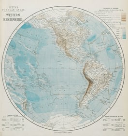
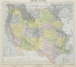
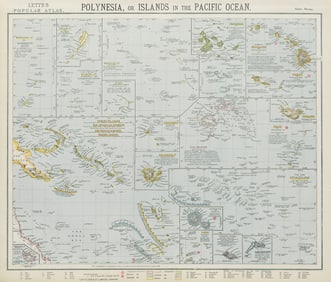
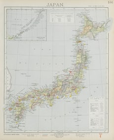
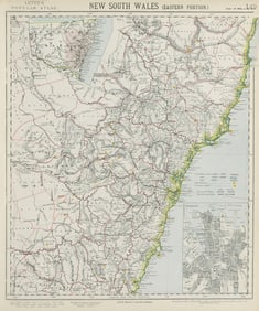
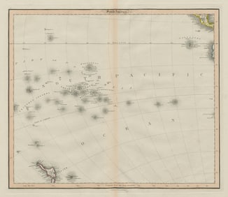
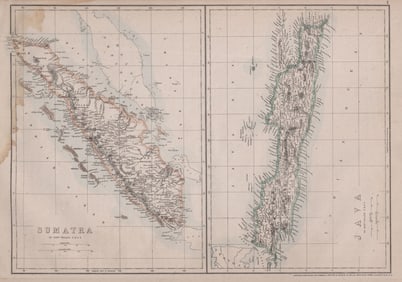
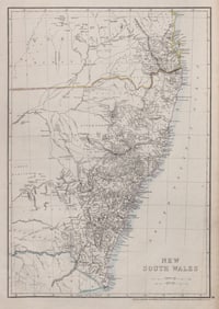
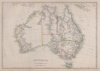
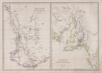
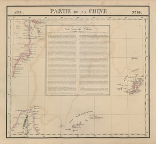
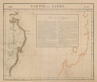
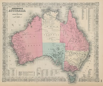
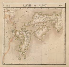
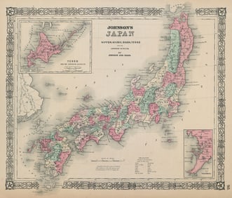
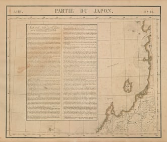
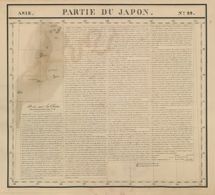
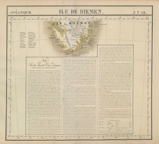
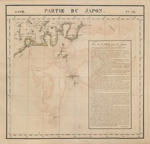
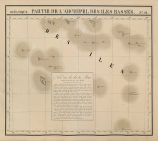
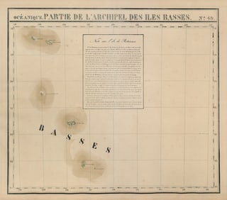
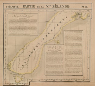
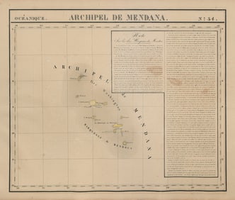
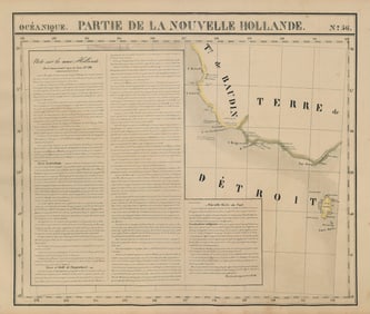
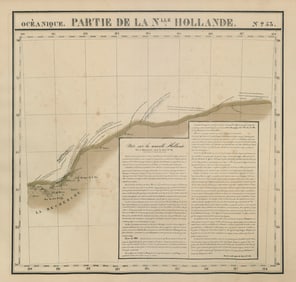
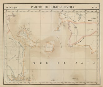
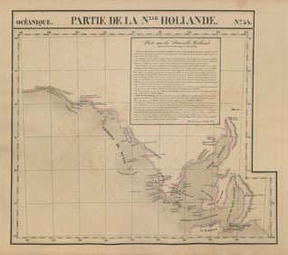
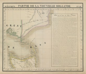
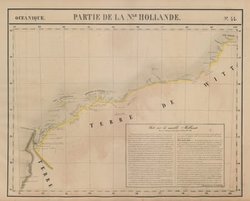
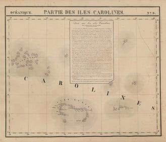
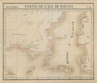
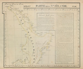
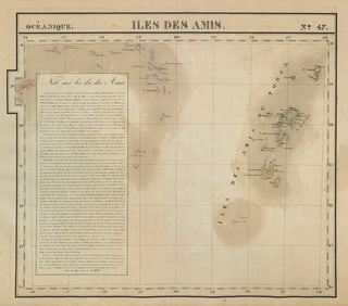
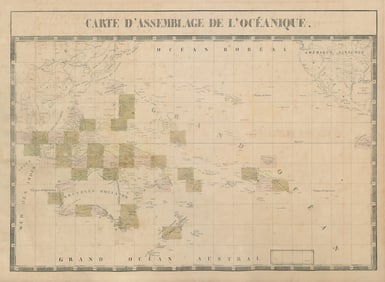
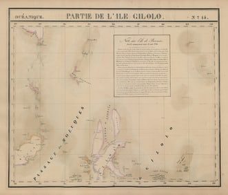
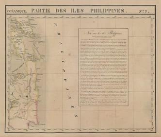
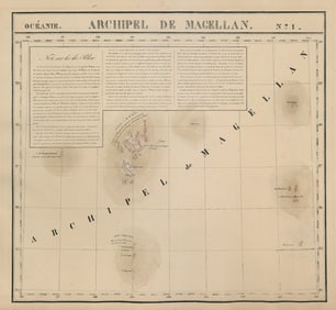
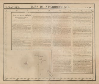
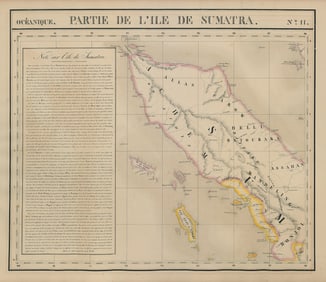
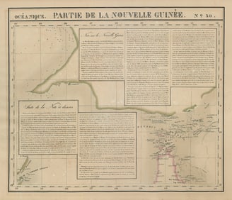
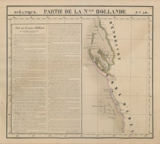
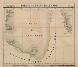
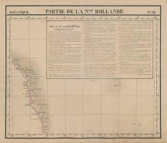
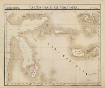
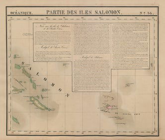
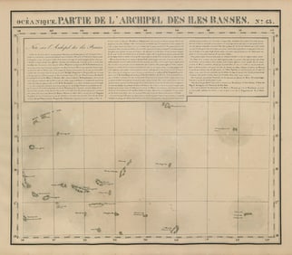
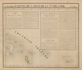
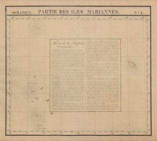
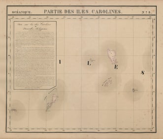
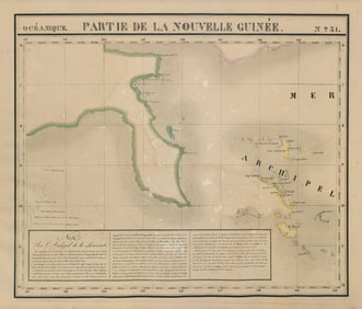
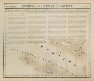
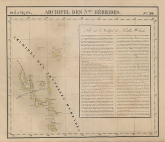
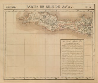
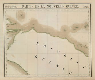
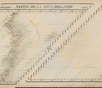
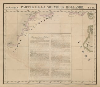
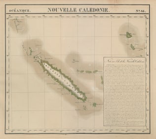
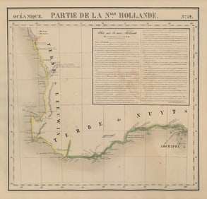
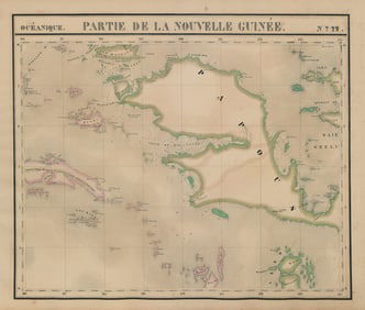
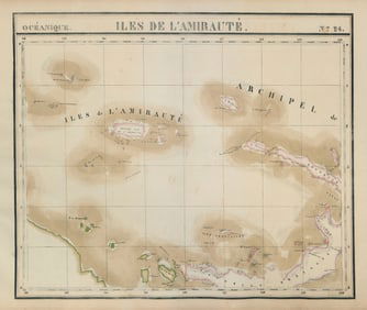
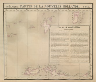
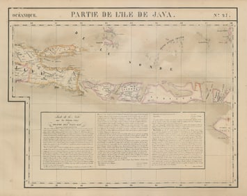
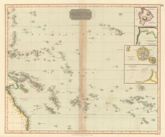
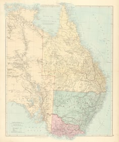
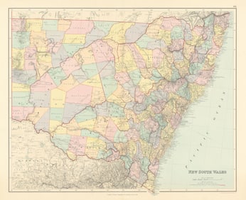
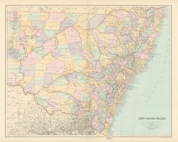
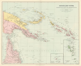
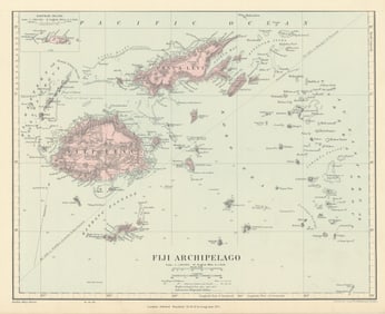
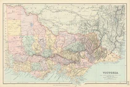
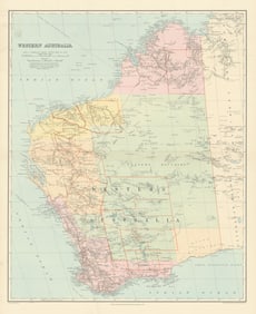
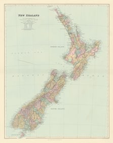
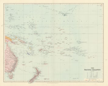
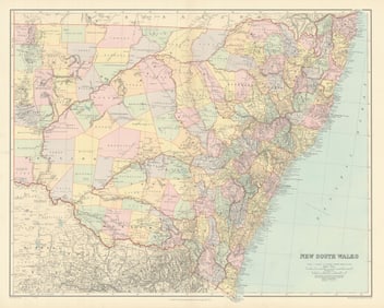
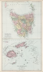
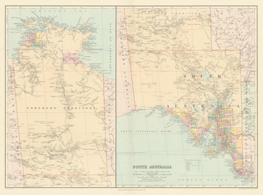
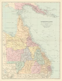
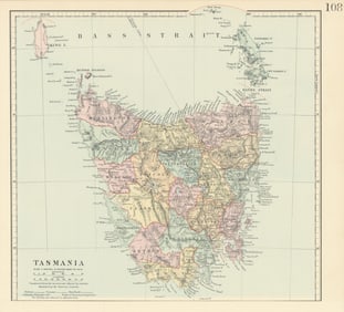
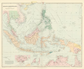
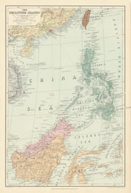
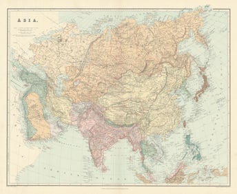
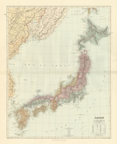
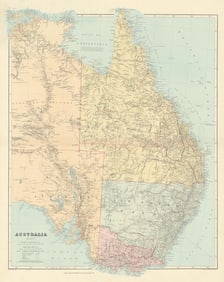
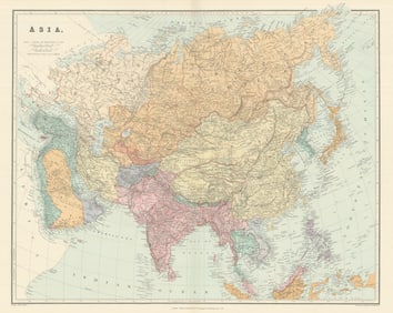
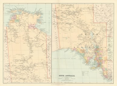
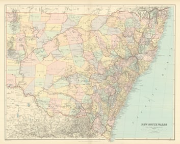
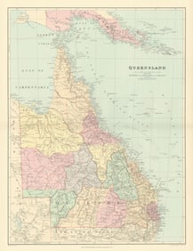
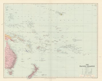
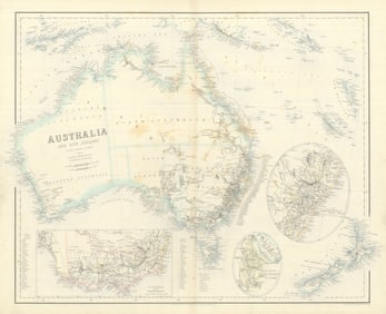
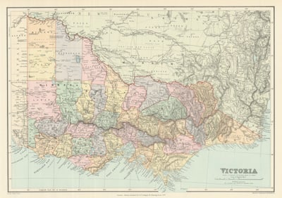
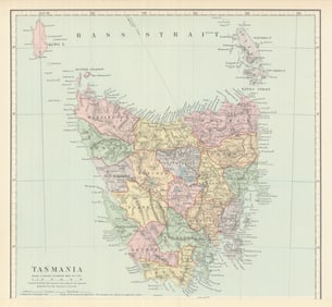
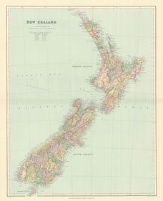
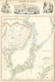
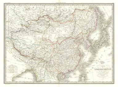
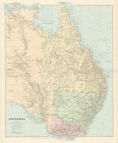
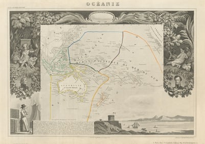
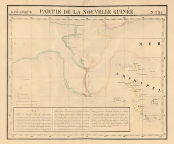
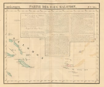
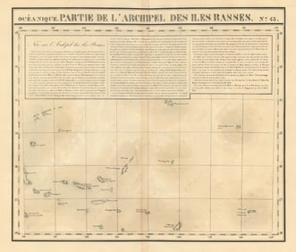
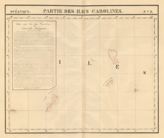
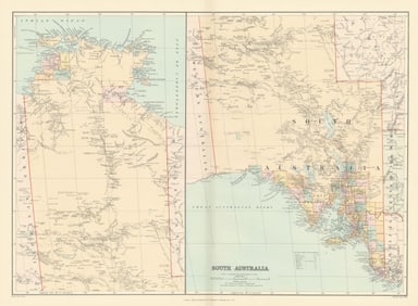
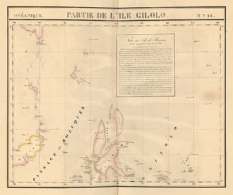
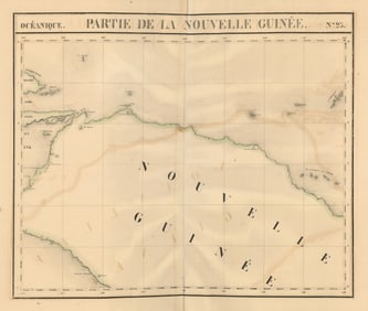
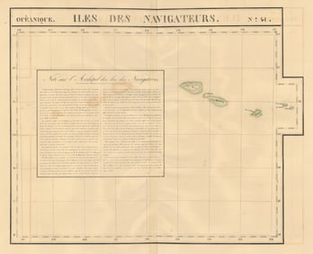
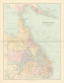
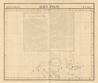
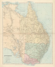
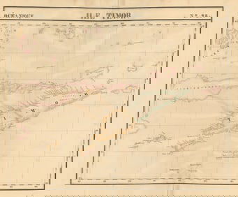
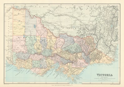
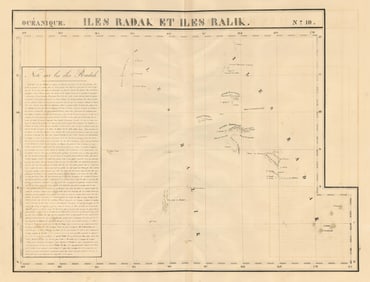
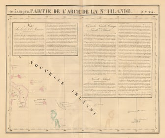
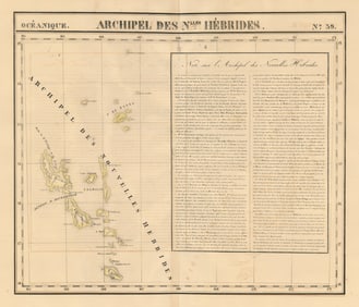
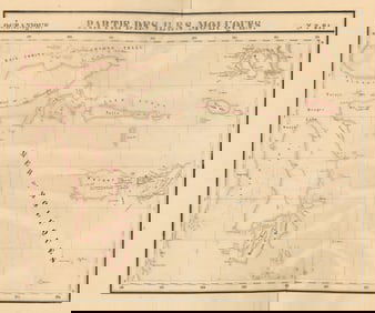
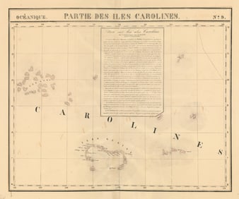
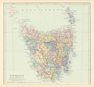
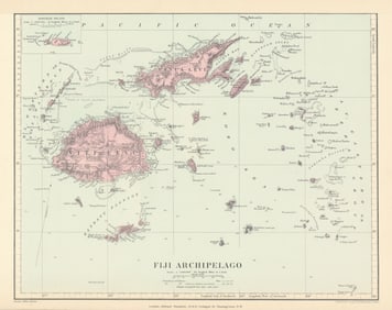
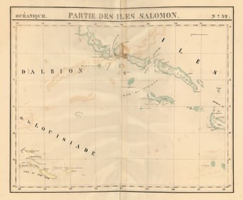
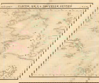
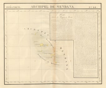
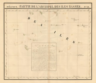
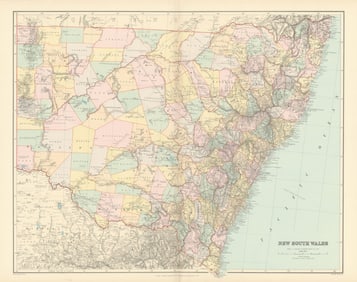
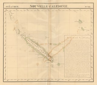
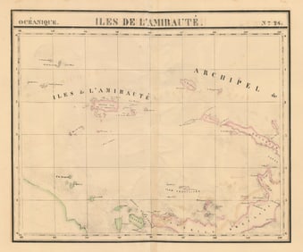
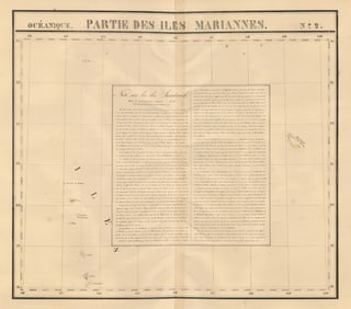
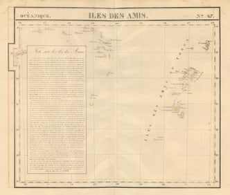
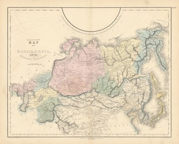
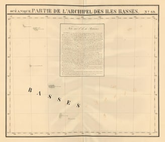
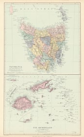
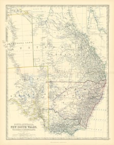
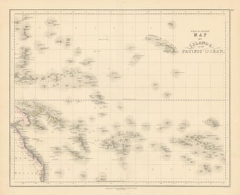
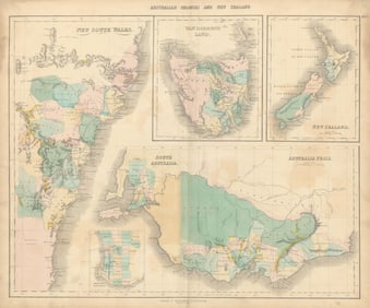
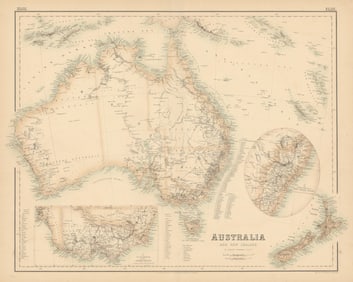
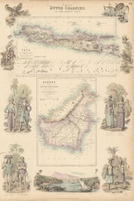
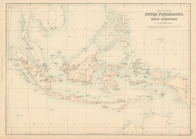
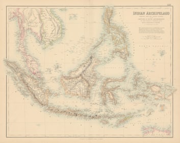
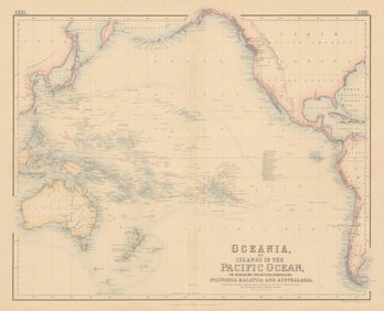
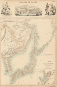
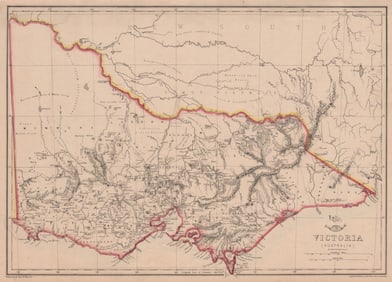
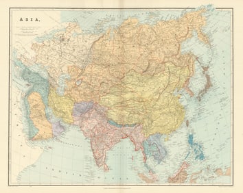
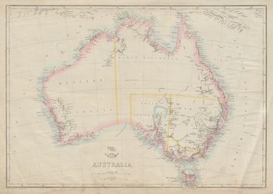
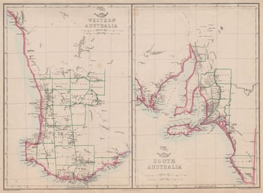
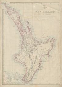
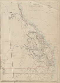
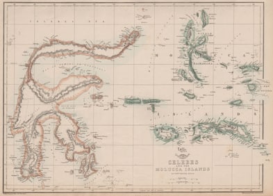
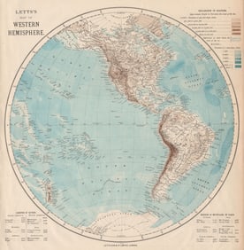
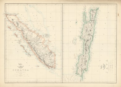
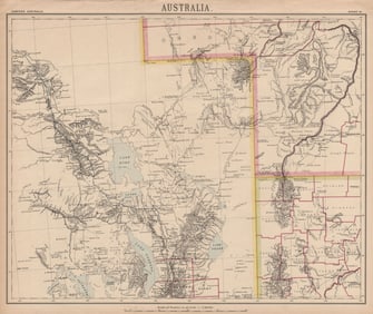
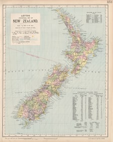
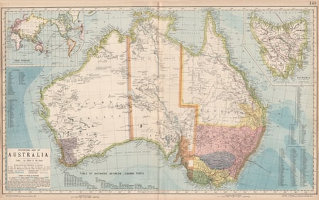
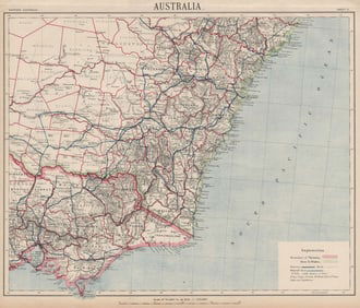
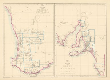
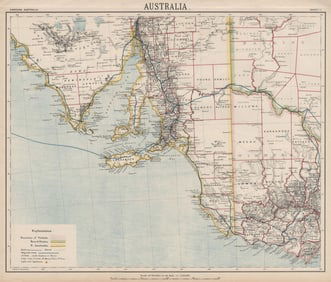
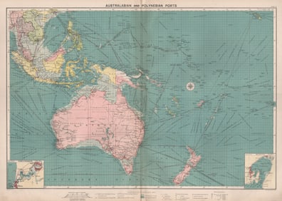
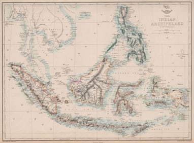
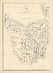
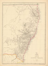
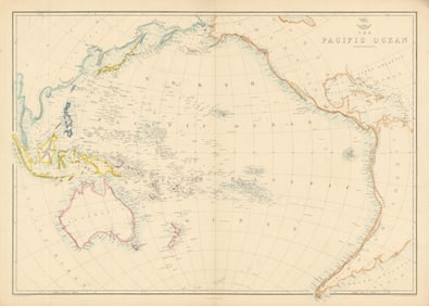
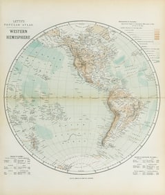
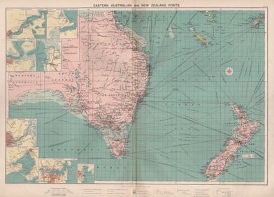
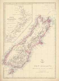
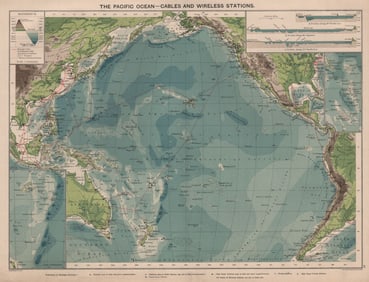
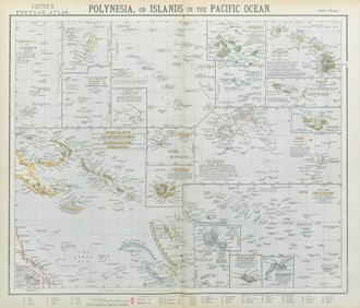
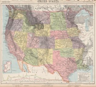
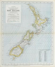
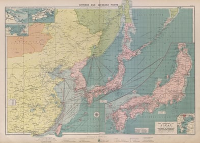
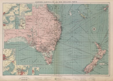
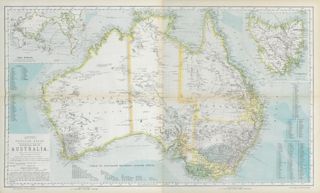
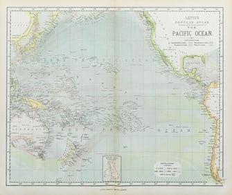
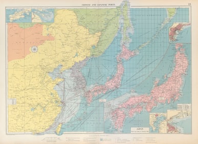
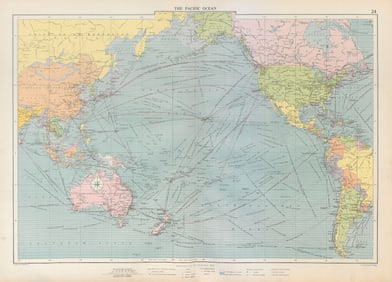
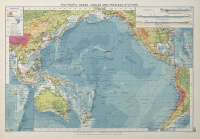
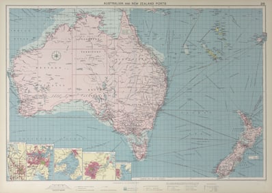
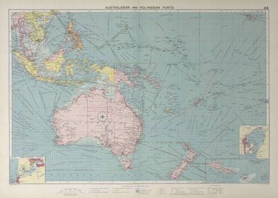
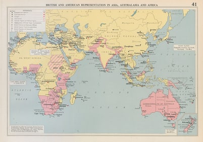
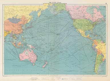
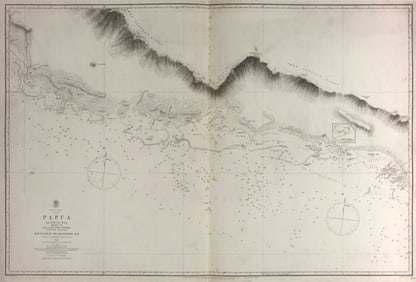
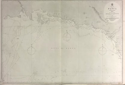
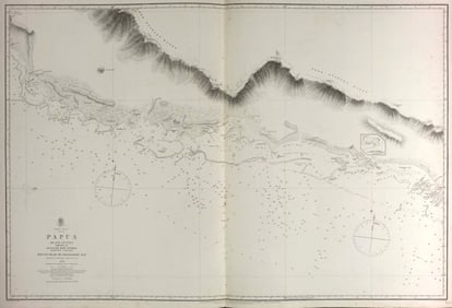
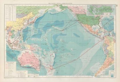
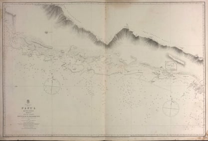
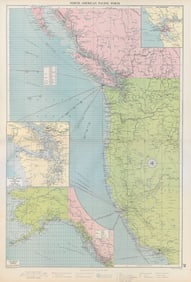
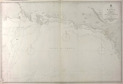
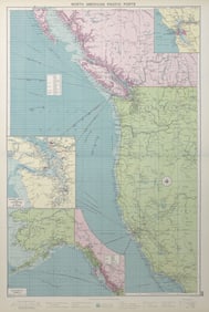
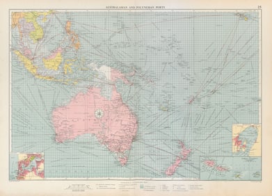
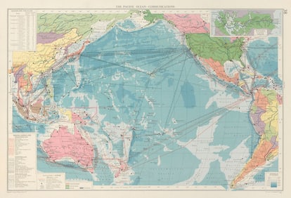
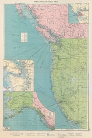
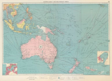
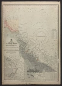
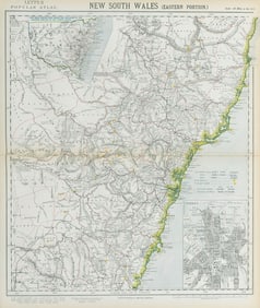
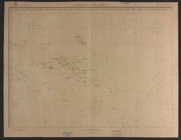
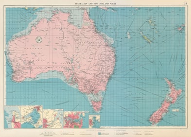
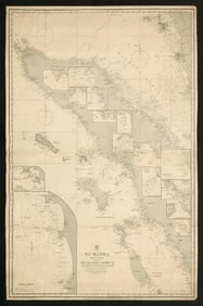
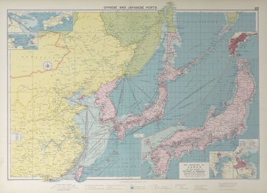
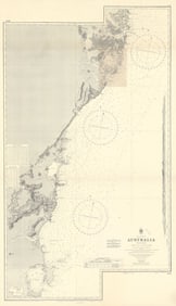
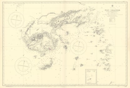
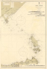
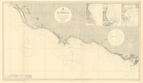
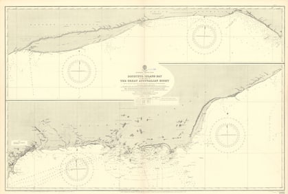
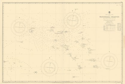
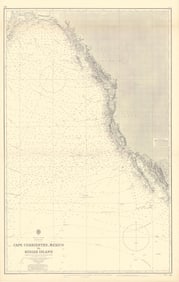
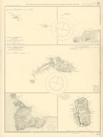
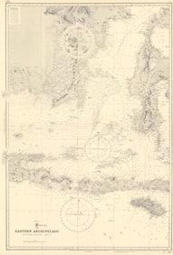
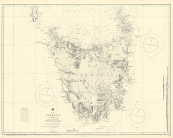
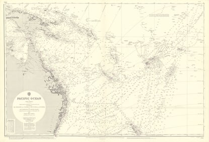
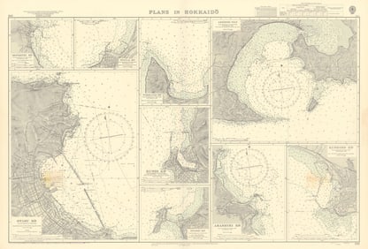
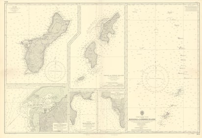
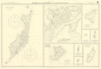
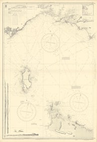
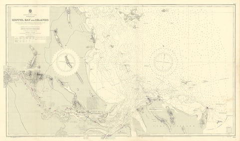
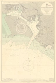
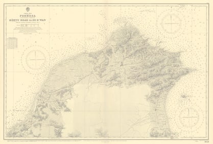
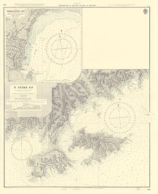
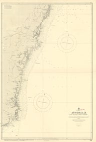
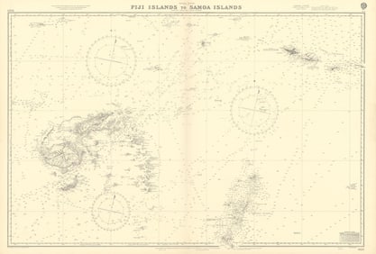
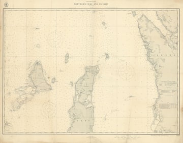
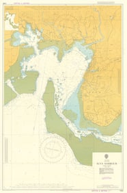
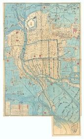
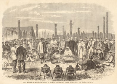
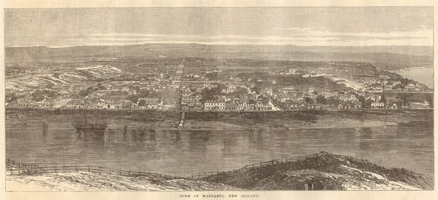
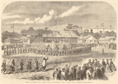
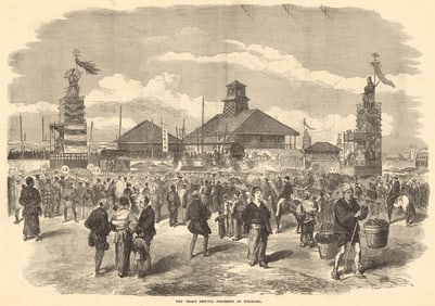
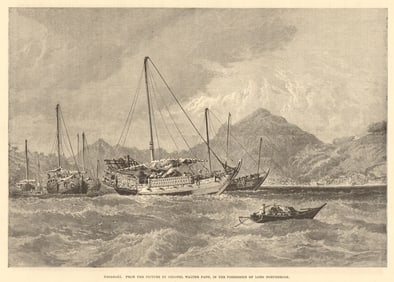
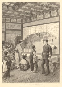
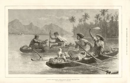
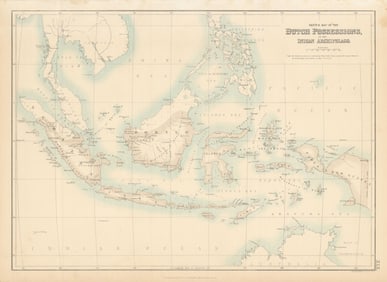
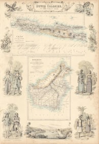
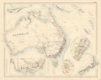
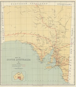
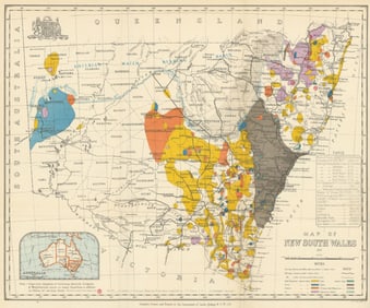
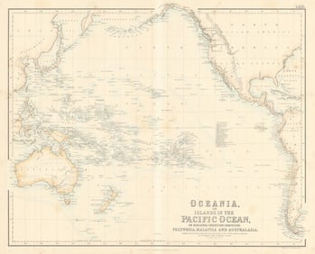
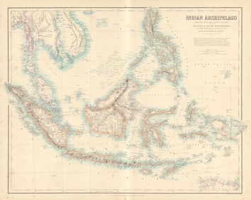
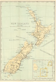
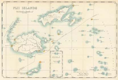
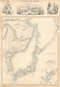
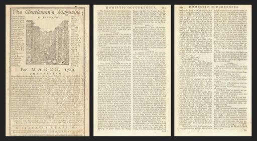
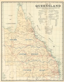
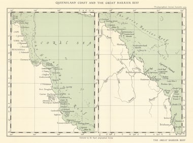
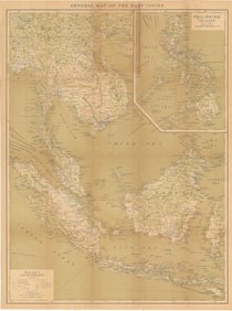
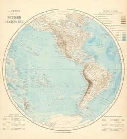
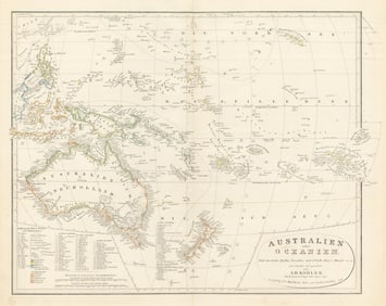
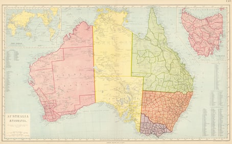
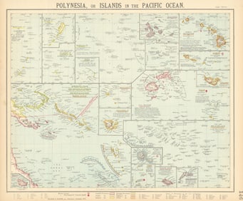
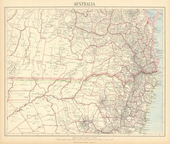
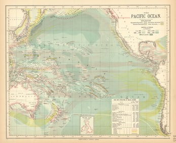
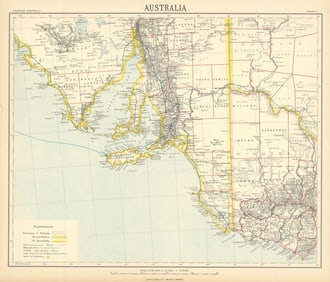
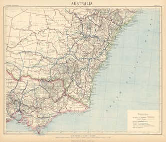
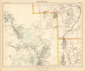
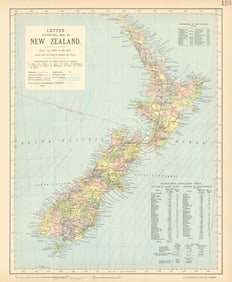
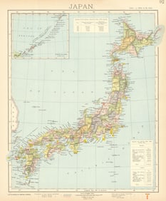
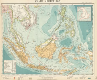
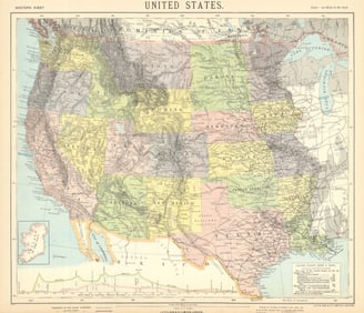
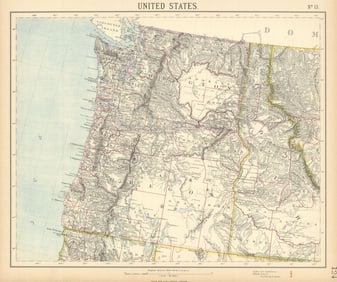
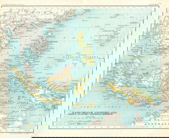
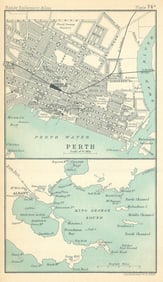
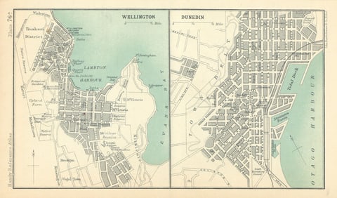
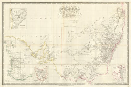
This auction offers antique maps & prints of the Pacific Ocean & its smaller islands, archipelagos, shipping routes, currents & people. We have old maps & prints of Polynesia, Melanesia & Micronesia including Fiji, Samoa, the Cook Islands, Marshall Islands, New Caledonia and the Solomon Islands. See separate country categories for the Hawaii archipelago, Galapagos, Easter island, New Zealand, Japan, Indonesia, Philippines etc.
PHILIPPINES & HAWAII. inset Honolulu Pearl Harbor Manila 1903 old antique mapPERU BOLIVIA CHILE.shows battles/dates inc.War of the Pacific 1877-80 1903 mapAUSTRALIA. Overland route from UK c1885 old antique vintage map plan chartJAPAN. Tokyo Bay c1885 old antique vintage map plan chartAUSTRALIA ABORIGINES. Smoking out the Opossum. New South Wales (Orme) 1814PACIFIC. Turtle- fishing Water. boat. (Field Sports- Edward Orme) 1814 printKYOTO. Palais du Dairo (Kyoto Imperial Palace) 京都市. Japan. MALLET 1683 printKYOTO. View of the city of Miyako (Kyoto) 京都市. Japan. MALLET 1683 old printKYOTO. Amida temple of 1000 idols'Temple d'Amida' 京都市 Japan. MALLET 1683 printEAST INDIES INDONESIA. Sulawesi Celebes Sunda Maluku New Guinea. MALLET 1683 mapJAPAN COSTUME. Man & woman in 17C dress. Sumarai sword Katana. MALLET 1683CELEBES SULAWESI. Coconut & fig trees. East Indies'Palmiers'. MALLET 1683EAST INDIES. Sunda Sumatra Java Borneo Malaya. Indonesia. MALLET 1683 old mapNORTH MALUKU MOLUCCAS. Ternate Halmahera Tidore Makian Bacan. MALLET 1683 mapEAST INDIES. Mount Gamalama, Ternate, Moluccas Maluku. 'Gammalamme'. MALLET 1683EAST INDIES. Warrior & woman of the Moluccas Maluku. 'Molucquois'. MALLET 1683EAST INDIES. 'Habitans des Isles de la Sonde' (Sunda) Indonesia. MALLET 1683DUTCH EAST INDIES. 'Citadelle de Batavia' (Jakarta) Indonesia. MALLET 1683JAPAN. 'Isles du Iapon'. Yedo (Tokyo) Miyako (Kyoto). MALLET 1683 old mapJAPAN Terre de Yesso (Hokkaido). Sungar (Tsugaru) strait. Honshu MALLET 1683 mapTOKYO. View of the city of Yedo (Tokyo) 'Iedo' 東京. Japan. MALLET 1683 printASIA. 'Asie Moderne'. India China Japan Arabia Persia (Iran). MALLET 1683 mapTOKYO IMPERIAL PALACE. 'Palais d'Iedo' 皇居. Japan. Decorative. MALLET 1683JAPAN. Japanese Emperor. 'Emporeur du Iapon'. MALLET 1683 old antique printCAPE YORK QUEENSLAND & NEW GUINEA shown joined no Torres Strait. MALLET 1683 mapJapan Islands'. Yedo (Tokyo) Nippon Yezo. BARTHOLOMEW 1876 old antique mapSOUTH ISLAND NEW ZEALAND. Shows 1870 provinces. Dunedin Christchurch 1876 mapAUSTRALIA. Shows NT as 'Alexandra Land', part of SA. BARTHOLOMEW 1876 old mapNEW ZEALAND. Showing 1870 provinces. Auckland environs. BARTHOLOMEW 1876 mapEAST ASIA. 'Chinese Empire & Japan'. China Korea Formosa. BARTHOLOMEW 1876 mapWESTERN AUSTRALIA. State map showing only 26 counties. Perth 1876 oldNEW SOUTH WALES. Sydney vignette. Explorers routes.TALLIS/RAPKIN 1849 old mapAUSTRALIA.Sydney view.Pre-Queensland (est 1859).Counties.TALLIS/RAPKIN 1849 mapVICTORIA OR PORT PHILIP'. Melbourne vignette. Australia.TALLIS/RAPKIN 1849 mapWESTERN AUSTRALIA, SWAN RIVER. Perth vignette. Counties.TALLIS/RAPKIN 1849 mapASIA POLITICAL. Persia Siam Hejaz China Japan Corea Turkestan. JOHNSTON 1906 mapAFRICAN ISLANDS.Mauritius Madagascar Madeira Canaries St Helena 1906 old mapCOREA JAPAN FORMOSA. Korea Taiwan. Hachijo "penal settlement". JOHNSTON 1906 mapThe Emu Plains and Nepean River. The Blue Mountains. Australia 1890 old printCarte des Isles de la Sonde et des Isles Moluques. East Indies. BONNE 1780 mapDescrittione dell' Isole Molucche. PORCACCHI. East Indies & Indochina 1620 mapQueensland rail network. Railways Commissioner's Report. Livestock 1908 mapBattle of Kampar, 30 Dec 1941-2 Jan 1942. Japanese invasion of Malaya 1957 mapJapanese assault on Singapore Island, 10th February 1942 1957 old vintage mapINDONESIA & FIJI Sunda Islands Borneo Java Sumatra Viti/Vanua Levu 1892 mapJapanese occupation of Hong Kong. Mainland, 8th -13th December 1941 1957 mapIslands of JAPAN. Hachijo "penal settlement". Manchuria JOHNSTON 1892 old mapALBERTA & ATHABASCA. Province map w/ Canadian Pacific Railroad. JOHNSTON 1901SASKATCHEWAN & ASSINIBOIA Province map. Canadian Pacific Railroad. JOHNSTON 1901RUSSIA IN ASIA Siberia Caspian & Aral seas Korea Japan JOHNSTON 1892 old mapGeneral map of China Proper'. Taiwan Formosa. Antique map 1924 oldCOLONIAL OCEANIA PACIFIC British Dutch Spanish French German Port 1892 mapAFRICAN ISLANDS Mauritius Madagascar St Helena Ascension Socotra 1892 old mapJapanese invasion of Malaya. Kota Bharu. 8 December 1941. Malaysia 1957 mapJapanese assault on Singapore Island, 11th February 1942 1957 old vintage mapPerak. Japanese invasion of Malaya 1941. Malaysia 1957 old vintage map chartEAST ASIA Philippines Tasmania North Borneo Brunei Sarawak JOHNSTON 1892 mapThe Japanese assault on Singapore. 8th & 9th February 1942 1957 old mapJapanese invasion of Dutch East Indies. Strategic Plan 1942. Indonesia 1957 mapSouthern Johore. Japanese invasion of Malaya. 24th-31st January 1942 1957 mapJapanese strategic plans 1941. Pacific & South east Asia. Indochina 1957 mapBatavia avec tous ses changemens…'. Jakarta, Indonesia. BELLIN/SCHLEY 1753 mapBouginois armé'. Armed Buginese man, Boni, South Sulawesi Celebes. SCHLEY 1755Suplices du Japon'. Japanese punishments. SCHLEY 1747 old antique printDeux Alfouriens qui se battent'. Nuaulu fighting. Seram, Maluku. SCHLEY 1755Ternate town & Gamalama volcano, Molucca Maluku islands. Indonesia. SCHLEY 1755View of the city of Batavia, Dutch East Indies. Jakarta, Indonesia. SCHLEY 1753Carte particulière des Isles Moluques'. Moluccas Maluku. BELLIN/SCHLEY 1755 mapIsles de Machian & de Bachian'. Makian & Bacan, Maluku. BELLIN/SCHLEY 1755 mapPlan d’Amboine, tel qu'il étoit en 1718'. Ambon, Maluku. BELLIN/SCHLEY 1755 mapTabor drums. Tambourines. Molucca / Maluku islands. Indonesia. SCHLEY 1755Carte des Environs de Batavia'. Jakarta, Indonesia. BELLIN/SCHLEY 1753 mapCarte de I’lsle de Bouro'. Buru island, Molucca/Maluku. BELLIN/SCHLEY 1755 mapChâteau de Batavia'. Castle. Dutch East Indies. Jakarta, Indonesia. SCHLEY 1753Femme Mestice de Ternate'. Mestizo woman, Ternate, Maluku islands. SCHLEY 1755Homme & Femme de Macassar'. Sulawesi. Man & woman of Makassar. SCHLEY 1757Vue de Samboupo'. View of Makassar, Sulawesi, Indonesia. Celebes. SCHLEY 1757Tabor drummer. Tambourine. Molucca / Maluku islands. Indonesia. SCHLEY 1755Achem'. Kutaraja (Banda Aceh), Sumatra. Indonesia. East Indies. SCHLEY 1755Prédicateur Japonois'. Japanese preacher. SCHLEY 1756 old antique printTropical fruit & spice trees & plants. Guava. Pepper. Orange. SCHLEY 1763Carte réduite de la Mer du Sud'. Pacific Ocean. BELLIN/SCHLEY 1757 old mapHabitans de l’lsle Amsterdam'. Tongans, Tongatapu. Tasman 1643. SCHLEY 1758Carte réduite des Terres Australes'. Pre-Cook Australia. BELLIN/SCHLEY 1758 mapLa Fête des Ames'. Buddhist festival of souls Japan Obon Reception. SCHLEY 1756Town city 'Plan de la Ville de Meaco' (Kyoto). Japan. BELLIN / SCHLEY 1756 mapChaise à porteurs du Japon'. Japanese litter sedan chair koshi ren. SCHLEY 1756LIV - Ecrevisses d'Amboine. Indonesia. Crayfish of Ambon. Maluku. SCHLEY 1763LV - Ecrevisses d'Amboine. Indonesia. Crayfish of Ambon. Maluku. SCHLEY 1763Indonesia. New Guinea north coast. Takel, Jamna & Modemo islands. SCHLEY 1758Toranga, divinité du Japon'. Japan. Toranga, a Japanese deity. SCHLEY 1756LVI - Cancres ou Crabbes. Indonesia. Crabs. Maluku Moluccas. SCHLEY 1763 printHabitans de Moa, Jamna'. New Guinea. Pirogue boat. West Papua. SCHLEY 1758Samboupo', Sulawesi Indonesia. Makassar town/city plan. BELLIN/SCHLEY 1757 mapBabirusa. White-striped Dorcopsis. Toupe. Locusts. Indonesia. SCHLEY 1763La Fête des Ames'. Buddhist festival of souls, Japan. Obon Renewal. SCHLEY 1756Pagode de Toranga'. Japan. Pagoda of Toranga. SCHLEY 1756 old antique printLVII - Cancres ou Crabbes. Indonesia. Crabs. Maluku Moluccas. SCHLEY 1763Kannon, Japanese deity. Canon Guanyin Kannon Kanzeon. Bodhisattva. SCHLEY 1756Fort Rotterdam', Makassar Sulawesi. Dutch East Indies. BELLIN / SCHLEY 1757 mapLVIII - Cancres ou Crabbes. Indonesia. Crabs. Maluku Moluccas. SCHLEY 1763Habitans de l'Isle Rotterdam'. Tongans, Nomuka island. Tasman 1643. SCHLEY 1758Isle Amsterdam'. Abel Tasman at Tongatapu, Tonga 1643. Pirogues. SCHLEY 1758Carte de I’Isle Celebes ou Macassar'. Sulawesi. BELLIN/SCHLEY 1757 old mapVue du Fort Noortwyck' #1. Pasar Baru, Batavia/Jakarta. Razed 1808. SCHLEY 1763Vue du Fort Noortwyck' #2. Pasar Baru, Batavia/Jakarta. Razed 1808. SCHLEY 1763Vue du Fort Tangerang', Batavia, Dutch East Indies. Jakarta. SCHLEY 1763Tropical fruit. Kokum Brinda Jambul Java plum Indian sour cherry. SCHLEY 1763View of Onrust Island. Pulau Onrust (Kapal island), Jakarta. SCHLEY 1763 printPlan de I'Isle Onrust'. Jakarta. Pulau Kapal island. BELLIN/SCHLEY 1763 mapBattles of Leyte Gulf, Samar & Surigao Strait Oct 1944. Philippines WW2 1965 mapTropical fruit. Malay rose apple. Jambolan. Java/black plum jamun. SCHLEY 1763Fort Rijswijk/Ryswick, Petojo Utara, Batavia/Jakarta. Razed 1729. SCHLEY 1763General map of China Proper'. Taiwan Formosa. Antique map 1915 oldTropical fruit. Areca palm or Betel nut tree. Bilimbi tree & fruit. SCHLEY 1763Vue de la Batterie Anjol'. Fort Ancol battery, Batavia. Jakarta. SCHLEY 1763Tropical fruit. Carambola Star Carandas plum Bengal currant karanda SCHLEY 1763New Guinea & Solomon Islands Theatre. World War 2. Pacific 1954 old mapGeneral Map of Eastern Asia'. China Japan Philippines Indonesia 1913 oldCircumcision of the King or Sultan of Banten (Bantam), Java 1746 old printSuplices du Japon'. Japanese punishments. Execution by sword 1746 old printCarte de I’Isle Celebes ou Macassar'. Sulawesi. East Indies. BELLIN 1752 mapCarte de l’lsle de Sumatra'. Malay peninsula. Singapore Strait. BELLIN 1751 mapCarte de l’Empire du Japon'. Empire of Japan. BELLIN 1752 old antique mapPlan du port et de la ville de Nangasaki'. Nagasaki, Japan. BELLIN 1752 mapIdée de l'Isle de Java'. Indonesia. Dutch East India Co. VOC. BELLIN 1750 mapCarte réduite de la Mer du Sud'. South Pacific. Australia. BELLIN 1753 mapCarte particulière des Isles Moluques'. Ternate Tidore Bacan. BELLIN 1750 mapPlan de la Ville de Meaco'. Kyoto town city plan, Japan. BELLIN 1752 old mapCarte réduite des Terres Australes'. Pre-Cook Australia & NZ. BELLIN 1753 mapVents de Traverse… Mer du Sud'. Pacific Ocean trade winds. BELLIN 1753 mapCarte des Isles Philippines 2e feuille'. Visayas Mindanao. BELLIN 1752 mapTropical fruit & vegetables. Pepper. Durian. Sago. Dog Tongue. Bilimbi 1750Tropical fruit. Carandas Bengal currant plum. Orange/Carambola/Coconut Star 1753Vue du Château de Batavia'. Castle. Dutch East Indies. Jakarta, Indonesia 1761Bilimbi tree. Bilimbi fruit. Cashew Tree. Cashew. Cinammon Tree 1753 old printVue de Samboupo'. View of Makassar, Sulawesi, Indonesia. Celebes 1761 printAsafreira. Sugar apple, sweetsop or custard apple. Areca palm or Betel 1753Tropical fruit. Papaya tree. Papaya. Guava tree. Guava. Pepper tree 1753 printNouvelle Carte de l’Isle de Java'. Dutch East India Company. BELLIN 1761 mapTropical fruit. Malay rose apple. Jambul. Jambolan. Java/black plum/Jamun 1753Tahiti being ceded to Captain Wallis by Queen Obere. Otahiti. Reine Obéréa 1789Vue d'Achem'. View of Kutaraja (Banda Aceh), Sumatra. East Indies 1761 printNouvelle Carte des Isles Carolines' Islands. Micronesia Palau. BELLIN 1761 mapTartarie Chinoise, Royaume de Corée &… Japon. China Korea Japan. BONNE 1790 mapMicronesia. Tinian coast profiles, Northern Mariana Islands. Anson's voyage 1761Nouvelle Bretagne. Carteret's discoveries New Britain New Guinea. BONNE 1790 mapIsle Brûlante'. Manam Motu volcano, New Guinea. Tasman 1643 1761 old printCarte des Isles des Amis. Friendly or Tonga Islands. Tongatapu. BONNE 1790 mapNouvelle Galles Méridionale. Australia East Coast. NSW QLD TAS. BONNE 1790 mapTokyo 2 centre Ushilome Yotsuya Kanda Nihombashi Honjo Fukagawa 1914 old mapNikko antique town city plan. Tochigi. Japan 1914 old map chartBoso Peninsula. Chiba & Tokyo Bay. Japan 1914 old antique map plan chartNagoya antique town city plan. Japan 1914 old vintage map chartThe City of Baguio town plan. Luzon. Philippines 1920 old antique map chartManila & environs. Luzon. Philippines 1920 old antique vintage map plan chartBogor, West Java. "Botanical Gardens at Buitenzorg". Indonesia 1920 old mapNagasaki antique town city plan. Kyushu. Japan 1914 old map chartBatavia antique town city plan. Jakarta. Indonesia 1920 old map chartThe island of Java. Dutch East Indies. Indonesia 1920 old antique map chartSemarang antique town city plan. Central Java. Indonesia 1920 old mapOsaka antique town city plan. Honshu. Japan 1914 old map chartShimonoseki & Moji antique town city plan. Moji-ku, Kitakyushu. Japan 1914 mapSurabaya antique town city plan. "Soerabaja". East Java, Indonesia 1920 mapNorth-Eastern Japan. Honshu, Hokkaido, Sakhalin & Kurile islands 1914 old mapTokyo 1 north. Koishikawa Hongo Shitaya Asakusa antique town city plan 1914 mapSendai antique town city plan. Miyagi. Japan 1914 old map chartKamakura & environs. Japan 1914 old antique vintage map plan chartMount Hakone & envirosn. Odawara. Kanagawa Prefecture, Japan 1914 old mapTokyo 4. Shiba antique town city plan. Minato City. Japan 1914 old mapManila antique town city plan. Philippines 1920 old map chartTokyo 3 south. Akasaka, Azabu antique town city plan. Japan 1914 old mapAsakusa Park antique town city plan. Taito, Tokyo. Japan 1914 old mapKaruizawa & environs. Mount Asama. Japan 1914 old antique map plan chartEast Asia, East Indies & Australasia sea & shipping routes 1920 old mapZamboanga town city sketch plan. Mindanao. Philippines 1920 old antique mapAomori, Hakodate & Sapporo antique city plans. Honshu/Hokkaido. Japan 1914 mapBradford Parliamentary Borough. BOUNDARY COMMISSION. Close 1917 old mapEmpire de la Chine, Royaume de Corée &… Japon. China Korea Japan. BONNE 1788 mapTartarie Chinoise, Royaume de Corée &… Japon. China Korea Japan. BONNE 1788 mapPacific Islands. Dusky Sound. Wallis Tonga Cook Easter Pitcairn. BONNE 1788 mapEntrée de Norton & Détroit de Bhering. Bering Strait Norton Sound BONNE 1788 mapCarte des Isles des Amis. Friendly or Tonga Islands. Tongatapu. BONNE 1788 mapCarte de la Nouvelle Zéelande. New Zealand. Cook Strait. Thames. BONNE 1788 mapCarte de la Terre Van Diemen. Tasmania. Adventure Bay. Australia. BONNE 1788 mapIsles de la Société. Society Islands. Huaheine Raiatea Polynesia. BONNE 1788 mapNouvelle Galles Méridionale. Australia East Coast. NSW QLD TAS. BONNE 1788 mapIsles de la Reine Charlotte. Nendo, Santa Cruz, Solomon Islands. BONNE 1788 mapJAPAN. Yezo(Hokkaido); North-east 1907 old antique vintage map plan chartCOREA JAPAN FORMOSA. Korea Taiwan. Hachijo "penal settlement".JOHNSTON 1899 mapINDONESIA. South Pacific showing Japanese assaults Dec 1941-Feb 1942 1956 mapSOUTH WEST PACIFIC. Battle of the Coral Sea 5th-9th May 1942 1956 old mapPACIFIC OCEAN. The Battle of Savo Island 9th August 1942 1956 old vintage mapNEW ZEALAND. showing provinces. STANFORD 1906 old antique map plan chartPACIFIC.Spencer S Vincent Tasmania Bering British Columbia Puget river 1971 mapAUSTRALIA. Queensland; Inset map New Guinea 1962 old vintage plan chartUSCGS Triangulation. Atlantic-Pacific coasts ILLINOIS MISSOURI St Louis 1881 mapJAPAN. Patterns for Graving on Metal 1890 old antique vintage print pictureJAPAN. Two Pieces of Pottery 1890 old antique vintage print pictureJAPAN. Statuette of a Priest, in Pottery 1890 old antique print pictureJAPAN. 2 pieces Ceramic Ware. Pot. Fig. made form Saké- Bottle 1890 old printJAPAN. Anonymous study of Birds 1890 old antique vintage print pictureJAPAN. Bottle of Kutani ware 1890 old antique vintage print pictureJAPAN. Bouquet- holder in Kyoto Stoneware. A Stooping figure 1890 printJAPAN. Two Familiar Scenes. School of Sukenobu 1890 old antique print pictureJAPAN. Two Birds. Anonymous Study 1890 old antique vintage print pictureJAPAN. Small Sketches. By Keisai Yeisen 1890 old antique vintage print pictureJAPAN. Birds 1890 old antique vintage print pictureJAPAN. Four Sabre Guards 1890 old antique vintage print pictureJAPAN. Bouquet- holder of Kyoto ware 1890 antique vintage print pictureJAPAN. Five Ivories 1890 old antique vintage print pictureJAPAN. Decorative design- Cocks 1890 old antique vintage print picturePACIFIC. Sea chart of Libertad Anchorage; Port Culebra 1881 old antique mapREUNION ISLAND. St- denis. Cathédrale 1895 old antique vintage print pictureASTRONOMY. Zodiacal Light seen in Japan. Jones 1877 old antique print pictureCHINA & JAPAN. Empires; Inset Beijing Peking. Tibet Mongolia Manchuria 1909 mapHAWAII HISPANIOLA. Hawaiian Isles; Haiti San Domingo Dominican Republic 1898 mapGAME FOWL.Wright.Bantams.Frizzles;Buff Pekins;Golden Sebrights;Japanese 1910AUSTRALIAN MILITIA UNIFORMS (AUSTRALIA) . The Victorian Mounted Rifles 1890AUSTRALIAN MILITIA UNIFORMS (AUSTRALIA) . The Victorian Artillery 1890 printUSA.Transcontinental triangulation from Pacific Coast.CA UT NV CO.USCGS 1889 mapUSA.Transcontinental triangulation from Pacific Coast.CA UT NV CO.USCGS 1889 mapAUSTRALIA.Tasmania.Settled Queensland Western/South Australia.COLLINS 1880 mapUSA PACIFIC NORTHWEST.Washington State Oregon Idaho.Railroads.JOHNSTON 1906 mapCOLONIAL OCEANIA PACIFIC.British Dutch Spanish French German Portuguese 1906 mapSOUTHERN CALIFORNIA. US Pacific. Nevada South, Arizona West. Railroads 1906 mapUSA WEST/PACIFIC. Northern California & Nevada; South Oregon. Railroads 1906 mapThe Bread Fruit of Otaheite'. TAHITI. Food. EDWARDS 1794 old antique printCOREA JAPAN FORMOSA. Korea Taiwan Hachijo "penal settlement".JOHNSTON 1897 mapCOLONIAL OCEANIA PACIFIC.British Dutch Spanish French German Port. 1897 mapManila. Philippines 1885 old antique vintage map plan chartKrakatoa & neighbouring islets after the eruption. Indonesia 1885 old mapPort Moresby. Papua New Guinea. Papuasia 1885 old antique map plan chartAustralia Tasmania and New Zealand. Australasia 1885 old antique map chartMarshall Islands. Archipelago. Pacific Ocean. Micronesia 1885 old antique mapBatavia (Jakarta) port Tanjung Priok. Java, Indonesia. E Indies 1885 old mapAdelaide, Spencer and St. Vincent Gulfs. Australia 1885 old antique map chartSunda Strait.Java/Sumatra.Batavia(Jakarta).Indonesia.East Indies 1885 old mapSemarang, Java, Indonesia. East Indies 1885 old antique vintage map plan chartSydney and environs. Australia 1885 old antique vintage map plan chartMount Merapi and Yogyakarta, Java, Indonesia. East Indies 1885 old antique mapLombok Strait. Indonesia. East Indies 1885 old antique vintage map plan chartRaja Ampat Islands.Waigeo Batanta Salawati.Papua Indonesia New Guinea 1885 mapRailways of New Zealand 1885 old antique vintage map plan chartCentral part of Luzon. Philippines 1885 old antique vintage map plan chartPort Chalmers. New Zealand 1885 old antique vintage map plan chartEquatorial Polynesia, by Tupaïa. French Polynesia 1885 old antique map chartPapeete. French Polynesia 1885 old antique vintage map plan chartHawaii. Hawaii 1885 old antique vintage map plan chartGREAT KANTO EARTHQUAKE 1923. Tokyo Bay. Perpendicular substratum change 1926 mapGREAT KANTO EARTHQUAKE 1923. Sagami Bay sea depth changes. Japan Tokyo 1926 mapGREAT KANTO EARTHQUAKE 1923. Areas subject to Martial Law. Japan Tokyo 1926 mapGREAT KANTO EARTHQUAKE 1923. Landslides zones. Japan Tokyo 1926 old mapGREAT KANTO EARTHQUAKE 1923. Tokyo reconstruction scheme. Japan 1926 old mapBeaufort Avoca Maryborough Ballarat West Berry-Moolort-Loddon Creswick 1909 mapStawell Ararat Raglan Landsborough. Alluvial & deep leads. Victoria 1909 mapMadam Berry West Mine, Spring Hill. Victoria, Australia. Mining 1909 old mapIslands of JAPAN. Hachijo "penal settlement". JOHNSTON 1895 old antique mapCOLONIAL OCEANIA PACIFIC.British Dutch Spanish French German Port. 1900 mapASIA POLITICAL. Persia Siam Hejaz China Japan Corea Turkestan. JOHNSTON 1895 mapASIA POLITICAL. Persia Siam Hejaz China Japan Corea Turkestan. JOHNSTON 1900 mapCOLONIAL OCEANIA PACIFIC.British Dutch Spanish French German Port. 1895 mapAFRICAN ISLANDS.Mauritius Madagascar Madeira Canaries St Helena 1895 old mapASIA POLITICAL. Persia Siam Hejaz China Japan Corea Turkestan. JOHNSTON 1903 mapCOLONIAL OCEANIA PACIFIC.British Dutch Spanish French German Port. 1903 mapAFRICAN ISLANDS.Mauritius Madagascar Madeira Canaries St Helena 1900 old mapBallarat. Edwin Carton BOOTH/James Charles ARMYTAGE. Victoria, Australia c1874Korea Straight. Tsushima & Iki islands. Busan Fukuoka Japan. Sketch map 1885New Zealand Warrior. A Native of Otaheite. Tahiti. Maori. GENTS MAG 1784 printASIA POLITICAL. Persia Siam Hejaz China Japan Korea Turkestan. JOHNSTON 1910 mapAFRICAN ISLANDS Mauritius Madagascar Madeira Canaries St Helena Socotra 1910 mapCOLONIAL OCEANIA PACIFIC British Dutch Spanish French German Portuguese 1910 mapKOREA JAPAN FORMOSA. Taiwan. Hachijo "penal settlement". JOHNSTON 1910 old mapATHABASCA & ALBERTA Province map w/ Canadian Pacific Railroad. JOHNSTON 1901USA WEST/PACIFIC. Northern California & Nevada; South Oregon. Railroads 1901 mapNew Zealand & Tasmania. BARTHOLOMEW 1893 old antique vintage map plan chartOceania & the Pacific Ocean. BARTHOLOMEW 1888 old antique map plan chartVictoria, New South Wales & South Australia. COLLINS 1873 old antique mapHawaiian Airlines between the islands. Pictorial network route map. 9"x24" 1954Sulphur Island. Iotorishima, Ryukyu islands, Japan. HAVELL/HALL 1818 old printPriest and Gentleman of Loo Choo. Okinawa, Japan. HAVELL/BROWNE 1818 old printScene after the Prince of Loo Choo's Feast. Okinawa, Japan. HAVELL/BROWNE 1818Napakiang Roads on… the Great Loo Choo Island. Naha, Okinawa. HALL 1818 mapGentleman of Loo Choo in his Cloak. Okinawa, Japan. HAVELL/BROWNE 1818 printDraught of Port Melville on… Great Loo-Choo Island. Nakijin, Okinawa 1818 mapThe tropical discoveries of HMS Resolution… New Caledonia Vanuatu. COOK 1776 mapMap of the Wharf Accommodation of the Port of Sydney. Harbour Commissioners 1919Batavia/Jakarta sketch plan. North Borneo Java Sea Singapore. Indonesia 1898 mapHawaii & the Fiji Islands. Kauai. Honolulu. BARTHOLOMEW 1898 old antique mapSemarang antique town city plan. Central Java. Indonesia 1917 old mapBatavia antique town city plan. Jakarta. Indonesia 1917 old map chartEast Asia, East Indies & Australasia sea & shipping routes 1917 old mapManila antique town city plan. Philippines 1917 old map chartJava Official Tourist Bureau map. Dutch East Indies. Indonesia c1917 oldIndian & Pacific Oceans. Australasian Convoy 1914. First World War. 1920 mapGerman East Asia Squadron Pacific movements 1914. Von Spee. WW1. 1920 old mapAustralia Occupation of German New Guinea 1914. First World War. 1920 old mapThe Malay Archipelago (Netherlands East Indies), Indonesia. VAN STOCKUM 1930 mapBandoeng & environs. Bandung, Java, Indonesia. VAN STOCKUM 1930 old mapThe Padang Highlands. Sumatra, Dutch East Indies. Indonesia VAN STOCKUM 1930 mapSemarang & environs. Town city plan. Java, Indonesia. VAN STOCKUM 1930 old mapMalang environs. Mount Bromo. Java, Dutch East Indies. VAN STOCKUM 1930 mapPlan of Bandoeng. Bandung city plan, Java, Indonesia. VAN STOCKUM 1930 old mapSoerabaya. Surabaya city plan, Java, Indonesia. VAN STOCKUM 1930 old mapMedan city plan. Sumatra, Dutch East Indies. Indonesia. VAN STOCKUM 1930 mapSouth Celebes auto map. Sulawesi. Dutch East Indies. VAN STOCKUM 1930 oldBotanical gardens in Buitenzorg. Bogor, Java, Indonesia. VAN STOCKUM 1930 mapMinahasa. North Celebes/Sulawesi, Dutch East Indies. VAN STOCKUM 1930 old mapIdjen Plateau. Mount Ijen Java Dutch East Indies Indonesia. VAN STOCKUM 1930 mapGaroet and Environs. Garut, Java, Indonesia. VAN STOCKUM 1930 old vintage mapMacasser/Makassar city plan Celebes/Sulawesi Dutch East Indies. STOCKUM 1930 mapThe Far East in 1945. Atomic bomb targets in Japan. World War Two 1956 old mapOkinawa 1945. Road railways airfield. World War Two 1969 old vintage map chartIndiae Orientalis / India Orien by Bertius / Langenes. East Asia/Indies 1603 mapOperation Olympic. Planned 1945 US invasion of Southern Kyushu, Japan 1969 mapUS incendiary bombing of Japanese cities 1945. World War Two 1969 old mapNova Guinea & In. Salomonis by Bertius. New Guinea Solomon Islands 1603 mapOperation Olympic. Planned US invasion of kyushu, Japan 1945. WW2 1969 old mapSourabaya/Surabaya city plan 1945. World War Two 1969 old vintage map chartSumatra July 1946. Indonesian National Revolution. Surrendered Japanese 1969 mapSouthern Okinawa 1945. World War Two 1969 old vintage map plan chartAmerican offensive 1942-45. World War Two Pacific Theatre 1969 old vintage mapJava in 1945. Airfields & roads. World War Two 1969 old vintage map plan chartKyoto town/city plan. Japan antique tourist map 1930 old chartMap of the Wharf Accommodation of the Port of Sydney. Harbour Commissioners 1924Bird's Eye View Glebe Island Port Jackson Balmain Sydney Harbour 1915 (1924) mapBird's Eye View of the Port of Sydney. 77x63cm. Harbour Trust 1919 (1924) mapVariation in salinity of the Queensland well waters. Australia. RGS 1911 mapThe expeditions of H. A. Lorentz in Dutch New Guinea, 1907-1909. RGS 1911 mapCopy of Tasman's chart of Tasmania, 1643. Indistinct! RGS 1911 old antique mapNew Guinea. Rawling / British ornithologists' union expedition. RGS 1911 mapFiji Islands showing wireless stations & lighthouses by Dyson Blair 1938 mapThe Commonwealth of Australia by George Philip 1938 old vintage map plan chartMap of Western Australia showing Goldfield Boundaries by J.P. Camm 1938Map of South Australia by C. Wall, Government Photolithographer 1938 oldAgricultural, Pastoral & Mining Map of New South Wales. Gold metals 1938The body of Tee, a Chief, as preserved after Death in Otaheite. Tahiti 1785Tarawera Volcanic Rift topography after 1886 eruption. New Zealand. RGS 1912 mapBalnibarbi & Laputa flying island. Jonathan Swift. Gulliver's Travels 1751 mapLaputa, Balnibarbi, Luggnagg, Glubbdubdrib & Japan. Gulliver's Travels 1751 mapMaori waka taua / war canoe. Breadfruit tree. Charles I Obsidional Coin 1773Sailing canoes of Navigators Islands (Samoa), Choiseul (Solomons) & Tahiti 1772Manuscript land claims map. Calder, Wellington County, Tasmania 1890 oldCathedral Cove arch, Mercury Bay, Whanganui A Hei, New Zealand. Gent's Mag 1795General map of the Discoveries of the Admiral de Fonte. After de l'Isle 1754JAPAN. Japanese Empire, including Korea & Sakhalin; map of Formosa Taiwan 1907NEW ZEALAND. Tasmania Fiji Friendly Samoa Sandwich Hawaii Islands 1907 old mapAUSTRALIA.Australien Neuseeland;Tasmanien Tasmania;Inset Schweiz 1958 old mapINDONESIA. Borneo, Sumatra and Java; Inset map of Jakarta 1907 old antiqueJAPAN KOREA CHINA TAIWAN. Industry Communications; Tokyo; Port Arthur 1907 mapPHILIPPINES. Philippine Islands; map of Manila Bay 1907 old antique chartSOUTH CHINA. inset Weihaiwei (Weihai) & Shanghai. Taiwan Formosa 1920 old mapINDONESIA PHILIPPINES. South East Asia.Industrial showing key products 1920 mapCHINA JAPAN KOREA. inset Hong Kong & Beijing Peking. HARMSWORTH 1920 old mapSOUTHERN JAPAN KOREA & FORMOSA. South Korea Taiwan railways 1920 old mapPACIFIC OCEAN. Mercator Projection. Railways cables steamship routes 1920 mapNEW ZEALAND FIJI PACIFIC ISLANDS. Industrial showing key products 1920 old mapAUSTRALIA MINERALS & MINING.Goldfields Coal Copper Tin.Farm products 1920 mapASIA. Inset Aden; Isotherms. Persia (Iran) Siam Japan Arabia Siberia &c 1891 mapJAPANESE EMPIRE. Japan Korea Taiwan Port Arthur (Kwang-tung territory) 1938 mapCHINA. Kwang-chow Taiwan Hong Kong 1938 old vintage map plan chartEAST ASIA. China Chinese Turkistan Tibet Korea Japan. HK Peking Beijing 1901 mapASIA POLITICAL & RELIGIOUS.China India Persia(Iran)Japan Annam Arabia 1901 mapNORTH & CENTRAL ASIA. Siberia Japan Korea Khiva Bukhara Turkistan 1901 old mapOCEANIA.shows Alexandra Land.New Zealand Polynesia Fiji E Indies.BACON 1893 mapNEW ZEALAND. Showing provinces. BARTHOLOMEW 1952 old vintage map plan chartJAPAN & KOREA. Shows Korea pre-war division along 38th parallel 1952 old mapEAST ASIA. Eastern China Central Japan Korea. BARTHOLOMEW 1898 old antique mapCHINA. Port Arthur (Ryojun) Formosa Taiwan as Japanese. BARTHOLOMEW 1924 mapEAST ASIA. Chinese Empire and Japan. Korea. BARTHOLOMEW 1890 old antique mapASIA.Korea a Japanese Protectorate.Japanese Formosa Taiwan.JOHNSTON 1906 mapPACIFIC OCEAN. Australia New Zealand E.Indies Polynesia Melanesia Japan 1882 mapNEW SOUTH WALES. Territorial Divisions Land Board Districts. MACDONALD 1888 mapNEW SOUTH WALES. Stock Routes Tanks Wells Trucking Stations. MACDONALD 1888 mapSYDNEY 1792 map by ARTHUR PHILLIP. 19C copy. 'The settlement in NSW' 1888NEW SOUTH WALES. Railway Post Telegraph routes offices 1886. MACDONALD 1888 mapNEW SOUTH WALES with average annual rainfall. BIG.Australia. MACDONALD 1888 mapLarge map of TASMANIA. Counties. Railways in use/UC/planned. GARRAN 1888NORTHERN TERRITORY of South Australia.5 counties.Telegraph line.GARRAN 1888 mapOCEANIA w/ explorers routes. Cook Tasman Torres Quiros.LARGE.MACDONALD 1888 mapNEW SOUTH WALES. Railways in use/planned/being built. LARGE .MACDONALD 1888 mapWESTERN AUSTRALIA. Explorers' routes. Planned trans-Oz railway. GARRAN 1888 mapLarge map of QUEENSLAND. Railways in use & planned. Districts. GARRAN 1888FIJI ISLANDS. Viti Levu Vanua Levu. Pacific islands. Large map. GARRAN 1888OCEANIA. Australasia East Indies Australia. Large map. For GARRAN 1888 oldLarge 'GEOLOGICAL MAP OF AUSTRALIA' by WILKINSON for GARRAN 1888 oldLarge NEW GUINEA map reflecting 1885 RGSA/Lawes expedition for GARRAN 1888Large map of AUSTRALIA for GARRAN. Shows Northern Territory part of SA 1888JAPAN & KOREA. Inset Tokyo bay. Formosa Taiwan. Railways. BARTHOLOMEW 1912 mapAUSTRALASIA POLYNESIA PACIFIC OCEAN. On Gnomonic Projection. SDUK 1848 old mapDUTCH EAST INDIES. Indonesia. DORNSEIFFEN 1892 old antique map plan chartDUTCH EAST INDIES. Indonesia. JAVA. Yogyakarta Semarang. DORNSEIFFEN 1892 mapDUTCH EAST INDIES.Indonesia.SUMATRA. Malacca Strait. Riau.DORNSEIFFEN 1892 mapDUTCH EAST INDIES.Indonesia.SUMATRA Bengkulu Jambi Padang.DORNSEIFFEN 1892 mapNEW SOUTH WALES. w/ Mitchell/Leichhardt explorers routes.TALLIS/RAPKIN 1851 mapVICTORIA OR PORT PHILIP'. Showing Goldfields. Australia.TALLIS/RAPKIN 1851 mapPART OF SOUTH AUSTRALIA'. Shows mining districts. TALLIS/RAPKIN 1851 old mapJAPAN KOREA TAIWAN. Railways steamship routes. Chosen. Tokyo plan 1920 old mapNEW ZEALAND. Shows NZ Company settlements in 1851. TALLIS/RAPKIN 1851 old mapNEW SOUTH WALES. Counties Railways. Sydney plan.Commonwealth Territory 1920 mapWESTERN AUSTRALIA,SWAN RIVER.Helpman Gregory Gray routes.TALLIS/RAPKIN 1851 mapNEW ZEALAND. Counties. Auckland Wellington Christchurch Dunedin plans 1920 mapAUSTRALASIA INDUSTRIES. Australia New Zealand E Indies.Metals Minerals 1920 mapCHINA. Provinces railways.Inset Weihaiwei.Shanghai plan.Formosa Taiwan 1920 mapCHINA & BURMAH. Hong Kong vignette. Burma Formosa Taiwan.TALLIS/RAPKIN 1851 mapEAST ASIA INDUSTRIES. China Korea East Indies Philippines. Manila plan 1920 mapVENEZUELA/HAWAII FLAGS. Ensign Merchant. "Hawanan" Islands. HOUNSELL 1873AUSTRALIAN/COLOMBIAN FLAGS. New Grenada Merchant; Victoria Blue/Red Ensign 1873JAPANESE MILITARY/NAVAL FLAGS.Admiral Commodore Tender/Guard/Transport Flag 1873JAPANESE FLAGS. Imperial, National & Admirality Flag. Japan. HOUNSELL 1873WESTERN HEMISPHERE. Americas Mexican Texas Pacific New Zealand. SDUK 1844 mapNEW ZEALAND. The Islands of. Tavai Poenammoo Eaheinomauwe. SDUK 1844 old mapCHINA.From Du Halde Jesuits McCartney Kyaikkami. Formosa Taiwan.SDUK 1844 mapAUSTRALIA. Western Australia & Van Diemen's Land (Tasmania) . SDUK 1844 mapEMPIRE OF JAPAN. Inset Nagasaki Harbour; Yeso. Niphon Nippon. SDUK 1844 mapCANADA Railways. British Columbia & Yukon. Canadian Pacific. Mackenzie 1906 mapVictoria, Australia. Gold rush districts & Mount Alexander gold region 1856 mapNew Zealand "New Ulster" & "New Munster" (North & South I). HUGHES 1856 mapEastern Islands, Birmah &c. Indochina & East Indies. Indonesia. HALL 1856 mapNew South Wales showing gold rush districts. Inset Sydney city plan 1856 mapVictoria, New South Wales & South Australia Goldfields. Norfolk Island 1856 mapPART OF SOUTH AUSTRALIA. Shows mining districts. TALLIS & RAPKIN 1851 old mapPOLYNESIA/PACIFIC ISLANDS. inc Sandwich/Hawaiian islands. RAPKIN/TALLIS 1851 mapNEW SOUTH WALES. w/ Mitchell/Leichhardt explorers routes. RAPKIN/TALLIS 1851 mapJAPAN & COREA. Yedo (Tokyo) King-ki-Tao (Seoul). Korea. TALLIS & RAPKIN 1851 mapVAN DIEMEN'S ISLAND OR TASMANIA. Shows extinct Thylacine. RAPKIN/TALLIS 1851 mapPACIFIC OCEAN. Australasia Polynesia Oceania Sandwich Islands. SDUK 1874 mapNew Zealand relief. Wellington Auckland Christchurch Dunedin. THE TIMES 1922 mapWestern United States. Rocky Mountains. California Pacific NW USA TIMES 1922 mapNEW ZEALAND provinces inc. Westland. Tavai Poenammoo Eaheinomauwe. SDUK 1874 mapNorth Pacific Ocean. Bering Sea. Siberia Alaska Japan Kamchatka. TIMES 1922 mapPacific Ocean depths & telegraph cables. Marquesas Tahiti Tonga. TIMES 1900 mapEastern Queensland & Great Barrier Reef. Relief railways Brisbane TIMES 1922 mapWORLD WAR 2 Japanese occupied Philippines Malaya Indochina Thailand 1942 mapSECOND WORLD WAR. Russia & Japanese-occupied Manchuria. China 1942 old mapINTERNATIONAL EXHIBITION. Goldsmiths work from Australia 1862 printMalay Archipelago. Indonesia Philippines Dutch East Indies. THE TIMES 1922 mapWORLD WAR 2 Japanese occupied China, Korea, Taiwan, Hong Kong 1942 old mapWW2 Pacific Ocean. Japanese-occupied China Indochina Philippines 1942 old mapJapanese Islands relief. THE TIMES 1922 old antique vintage map plan chartJapanese Empire. Korea Japan Taiwan Formosa. THE TIMES 1922 old antique mapChina (East) & Korea. Taiwan. Railways complete & planned. THE TIMES 1900 mapVictoria & Tasmania. Melbourne & Hobart plans. Australia. THE TIMES 1922 mapSouth Australia. Relief & railways. Adelaide. THE TIMES 1922 old antique mapHawaii Cook Fiki Samoa Tonga Tahiti New Hebrides/Caledonia islands 1922 mapChina Japan Korea. Railways complete planned mooted. Great Wall. TIMES 1900 mapNEW SOUTH WALES based on Cunningham routes. Inset Sydney plan. SDUK 1844 mapAustralia showing goldfields coral reefs railways. THE TIMES 1900 mapNew Zealand and Tasmania. THE TIMES 1900 old antique vintage map plan chartCHINA.From Du Halde Jesuits McCartney Kyaikkami. Formosa Taiwan SDUK 1844 mapWW2 ASIA. Japanese-occupied China Indochina Philippines. Middle East 1942 mapNEW CALEDONIA. Nouvelle Caledonie. Loyalty Islands/Îles Loyauté. Nouméa 1929 mapAUSTRALIA. Western Australia & Van Diemen's Land (Tasmania). SDUK 1844 old mapDUTCH EAST INDIES Indonesia W JAVA Banten Batavia Jakarta DORNSEIFFEN 1902 mapDUTCH EAST INDIES SUMATRA Bangka Palembang Jambi Lingga DORNSEIFFEN 1902 mapDUTCH EAST INDIES SW Borneo Kalimantan Belitung Indonesia DORNSEIFFEN 1902 mapEmpire Chinois et Japon. Chinese Empire & Japan. China. MALTE-BRUN c1871 mapDUTCH EAST INDIES Celebes Sulawesi Lesser Sunda Isles Bali DORNSEIFFEN 1902 mapSUMATRA. Dutch East Indies. Indonesia. DORNSEIFFEN 1902 old antique map chartNEW CALEDONIA. Nouvelle Caledonie. Loyalty Islands/Îles Loyauté. Nouméa 1931 mapDUTCH EAST INDIES Indonesia West Central JAVA Bandung DORNSEIFFEN 1902 old mapDUTCH EAST INDIES Indonesia North Sumatra Groot Atjeh Aceh DORNSEIFFEN 1902 mapDUTCH EAST INDIES. Indonesia. Index map. DORNSEIFFEN 1902 old antiqueDUTCH EAST INDIES Indonesia. East JAVA. Madura Surabaya DORNSEIFFEN 1902 mapDUTCH EAST INDIES Indonesia N SUMATRA Banda Aceh Medan DORNSEIFFEN 1902 mapNew South Wales Eastern / coast. Australia. Railways. BARTHOLOMEW 1898 old mapVictoria. Australia. Railways. BARTHOLOMEW 1898 old antique map plan chartOceania & Pacific Ocean. Australasia Polynesia Australia. BARTHOLOMEW 1898 mapNEW ZEALAND showing NZ Company settlements in 1851. TALLIS & RAPKIN 1851 mapJAPAN & COREA /Korea. Yedo (Tokyo) King-ki-Tao (Seoul). TALLIS & RAPKIN 1851 mapVICTORIA OR PORT PHILIP Goldfields Melbourne Australia. TALLIS & RAPKIN 1851 mapCHINA From Du Halde & Jesuits. British Hong Kong. Taiwan Formosa SDUK 1844 mapNEW SOUTH WALES showing Gold Rush fields/diggings. Sydney RAPKIN/TALLIS 1851 mapEAST ASIA China Japan Korea Formosa Taiwan JOHNSTON 1901 old antique map chartWESTERN AUSTRALIA & Van Diemen's Land (Tasmania). SDUK 1844 old antique mapWORLD WAR 2. USSR. Japanese occupied Korea & Manchuria 1943 old vintage mapAustralia. Stuart Tasman Alexandra Burkes Arnhem Land. BARTHOLOMEW 1870 mapSouth America. Bolivia w/ Litoral pre War of the Pacific. BARTHOLOMEW 1870 mapOceania & Pacific Ocean. Australasia Polynesia Australia. BARTHOLOMEW 1870 mapNorth-east China Korea Japan Russian Far East. North East Asia. TIMES 1958 mapWESTERN HEMISPHERE Americas Mexican Texas New Zealand Pacific SDUK 1844 mapAUSTRALIAN COLONIES w/ counties. Predates Queensland (Est. 1859). SDUK 1857 mapJapan. Tokyo Bay. Hokkaido. Iwo Jima. Okinawa. TIMES 1958 old vintage mapOrient. Western Pacific Islands. Fiji Tonga Melanesia Micronesia. TIMES 1958 mapChina Japan Korea. Peking environs. Formosa Tibet. TIMES 1895 old antique mapPacific Ocean & islands. Hawaii Polynesia Tahiti. TIMES 1957 old vintage mapUSA Pacific southwest. California Arizona Nevada Utah. TIMES 1957 old mapPacific Islands. Polynesia Micronesia Melanesia. Fiji Caroline &c TIMES 1895 mapAustralia & New Zealand. Australasia Melanesia New Caledonia. THE TIMES 1895 mapWestern United States. California Pacific North West Nevada. TIMES 1895 mapPolynesia. Fiji, Hawaiian & Samoan islands. Vanua/Viti-Levu. THE TIMES 1895 mapNew Zealand. Auckland Wellington Christchurch Dunedin. TIMES 1958 old mapNetherlands New Guinea & Papua. Solomon Islands. Melanesia. TIMES 1958 old mapCelebes Sulawesi Moluccas Philippines Manila Guam Palau Truk. TIMES 1958 mapJapan & Korea (Chosen) inc. Southern Sakhalin. Tawain Formosa STANFORD c1925 mapPacific Ocean depths & telegraph cables. Marquesas Tahiti Tonga. TIMES 1895 mapNew Guinea & Papuan Archipelago. Solomon & Bismarck islands. THE TIMES 1895 mapChina in provinces. Formosa Taiwan. STANFORD c1925 old vintage map plan chartWestern Australia, South-West Portion. Goldfields. Perth. STANFORD c1925 mapAustralia Tasmania Northern Territory Commonwealth Territory STANFORD c1925 mapPacific Islands & Ocean. Micronesia mandated to Japan. STANFORD c1925 old mapSouth-East Australia Victoria New South Wales S. Queensland STANFORD c1925 mapAUSTRALIA Showing explorers' routes with dates Railways JOHNSTON 1897 old mapSecond Sino-Japanese War 1937. Japanese Manchuria. China 1959 old vintage mapWorld War 2. Jan-Aug 1942. SW Pacific Ops. New Guinea Solomon Islands 1959 mapWorld War 2. Opening Japanese Offensive 1941. Pearl Harbor Malaya 1959 old mapWorld War 2. Japanese Guadalcanal evacuation 1-7 Feb 1943. January Ops 1959 mapWorld War 2. Aug 1942 Japanese controlled area. Allied reorganisation 1959 mapWorld War 2. Planned expansion of Japanese Empire 1959 old vintage map chartWorld War 2. Nov 1943-Dec 1944. Gilbert Islands. Pacific landings & Ops 1959 mapWorld War 2. Dec 1941-May 1942 Japanese Landings. Philippines Indochina 1959 mapWorld War 2. Pacific Theatre. August 1942-December 1944 area recovered 1959 mapWorld War 2. Southwest Pacific. 15 August 1945 Japanese surrender 1959 old mapWorld War 2. Guadalcanal Campaign. October & November 1942 Operations 1959 mapWorld War 2. Japan. February-March 1945 Battle for Iwo Jima. Landings 1959 mapWorld War 2. Pacific/Japan. 15 August 1945 & changes since August 1942. 1959 mapWorld War 2. East Asia Pacific Theatre Aug 1942-Jan 1945 area recovered 1959 mapGreat Tartary, the Isle of Iapon by Herman Moll. Central Asia & Japan 1709 mapCHINA from du Halde and the Jesuits. McCartney. Formosa Taiwan. SDUK 1851 mapVICTORIA OR PORT PHILIP Goldfields Melbourne Australia. TALLIS & RAPKIN 1851 mapMALAY ARCHIPELAGO. Indonesia Malaysia Philippines Indochina. SDUK 1851 old mapAUSTRALIA IN 1846. Shows dates colonies established. Population. SDUK 1851 mapNEW SOUTH WALES based on Cunningham routes. SYDNEY city plan. SDUK 1851 mapAUSTRALASIA POLYNESIA PACIFIC OCEAN. On Gnomonic Projection. SDUK 1844 old mapAUSTRALIA. Western Australia & Van Diemen's Land (Tasmania) . SDUK 1844 mapNEW SOUTH WALES. based on Cunningham routes. Inset Sydney plan. SDUK 1844 mapCHINA from Du Halde Jesuits McCartney Kyaikkami. Formosa Taiwan SDUK 1844 mapCHINA.From Du Halde Jesuits McCartney Kyaikkami. Formosa Taiwan.SDUK 1844 mapCHINA & BURMAH. Hong Kong vignette. Burma Formosa Taiwan. RAPKIN/TALLIS 1851 mapJava Insula. Iava Maior. The Island of Java, Indonesia. MÜNSTER 1572 old mapThe Progressive Union Pacific Railroad. The Strategic Middle Route. Advert 1942Chicago Milwaukee St. Paul & Pacific - Uncle Sam takes stock… Advert 1943 mapBell Aircraft - Pied Piper of the Pacific - Airacobras for victory. Advert 1943World War 2 Pacific Arena persuasive map. Richard Edes Harrison for Fortune 1942UNITED STATES of AMERICA WESTERN SHEET. USA. Pacific States. JOHNSTON 1912 mapThe Japanese attack Changhsa …and the Chinese rout them. 3rd Battle 1942 mapMALAY ARCHIPELAGO Franco-Thai war border changes. East Indies Indonesia 1944 mapEAST ASIA. Independent Tibet Xinjiang Tuva. Japanese occupied Manchuria 1944 mapJAPAN & KOREA. Shows Japanese occupied Manchuria. BARTHOLOMEW 1944 old mapLUZON ISLAND. Philippines. RAND MCNALLY 1912 old antique map plan chartNEW ZEALAND. Showing provinces. BARTHOLOMEW 1944 old vintage map plan chartLUZON ISLAND. Philippines. Manila environs. RAND MCNALLY 1906 old antique mapJAPAN & KOREA. Manchuria Chosen. BARTHOLOMEW 1947 old vintage map plan chartPACIFIC OCEAN showing British French Dutch US territory. US Philippines 1947 mapEastern AUSTRALIA. Queensland Victoria New South Wales. RAND MCNALLY 1906 mapCentral Asia (Eastern). Japan Korea NE China Russian Far East. HUGHES 1876 mapUNITED STATES of AMERICA WESTERN SHEET. USA. Pacific States. JOHNSTON 1915 mapMap of Melbourne and Suburbs by Sands & McDougall. 114x86cm 1959 oldAUSTRALIAN/COLOMBIAN FLAGS. New Grenada Merchant; Victoria Blue/Red Ensign 1873WORLD ON MERCATOR'S PROJECTION unusually Pacific-centred. JOHNSTON 1913 mapSouth America. Bolivia w/ Litoral pre War of the Pacific. BARTHOLOMEW 1862 mapJAPAN & KOREA including southern Sakhalin Island. Taiwan. JOHNSTON 1913 mapDOMINION OF NEW ZEALAND in counties. Godley Glacier vignette. JOHNSTON 1913 mapNew Zealand. New Ulster & New Munster. North & South Islands. HUGHES 1862 mapOceania & Pacific Ocean. Australasia Polynesia Australia. BARTHOLOMEW 1862 mapUNITED STATES of AMERICA WESTERN SHEET. USA. Pacific States. JOHNSTON 1913 mapChina in provinces by Edward Weller. Hong Kong Formosa/Taiwan 1860 old mapThe Pacific Ocean by Edward Weller. Polynesia Micronesia Melanesia 1860 mapThe Pacific Ocean by Edward Weller. Polynesia Micronesia Melanesia 1860 mapNew Zealand Sandwich Galapagos Islands. Papuan Archipelago. Melanesia 1860 mapWestern, South, North Australia. Tasmania Van Diemen's Land BARTHOLOMEW 1860 mapJapan by Edward Weller 1860 old antique vintage map plan chartAustralia & New Zealand. Torres Str. New Ulster/Munster/Leinster WELLER 1860 mapQueen's Land, New South Wales and Victoria. Queensland. BARTHOLOMEW 1860 mapCelebes and the Molucca Islands by Edward Weller. Indonesia Sulawesi 1860 mapVictoria, Australia. Gold rush districts & Mount Alexander gold region 1854 mapSumatra & Java showing volcanoes by Edward Weller. Indonesia 1860 old mapEastern Islands, Birmah &c. Indochina & East Indies. Indonesia. HALL 1854 mapSouth Pacific Islands. New Hebrides Loyalty Fiji Friendly Polynesia 1860 mapNew South Wales showing gold rush districts. Inset Sydney city plan 1854 mapSouth Pacific Islands. New Hebrides Loyalty Fiji Friendly Polynesia 1860 mapUnited States of North America, Pacific States by Joseph Wilson Lowry 1860 mapOCEANIA Australia Polynesia Melanesia Pacific Ocean Indonesia. GW BACON 1898 mapChina in provinces by Edward Weller. Hong Kong Formosa/Taiwan 1860 old mapThe Indian Archipelago. East Indies Indonesia Philippines. WELLER 1860 old mapCelebes and the Molucca Islands by Edward Weller. Indonesia Sulawesi 1860 mapUnited States of North America, Pacific States by Joseph Wilson Lowry 1860 mapThe Indian Archipelago. East Indies Indonesia Philippines. WELLER 1860 old mapQueen's Land, New South Wales and Victoria. Queensland. BARTHOLOMEW 1860 mapWestern, South, North Australia. Tasmania Van Diemen's Land BARTHOLOMEW 1860 mapSumatra & Java showing volcanoes by Edward Weller. Indonesia 1860 old mapFrench colonies in India, New Caledonia, Polynesia. Tahiti. Vuillemin 1890 mapOcéanie by Migeon. Australasia Oceania Pacific Australia New Zealand 1861 mapAustralia, New Zealand & East India Islands. Antique map by George Cruchley 1843The Dutch fortifications & port of Batavia. Jakarta, Indonesia. MIDDLETON 1779View in Anamooka and the inhabitants. Nomuka, Tonga. BANKES 1789 old printTropical fruit & veg. Blimbing Dogs tongue Sago Durian Pepper. BANKES 1789An accurate map of the East Indies from the latest improvements. BOWEN 1789EAST ASIA. Chinese Empire & Japan. Scale in Chinese Li. BLACKIE 1886 old mapPACIFIC OCEAN. Australia New Zealand E.Indies Polynesia Melanesia Japan 1886 mapChina in provinces by Edward Weller. Hong Kong Formosa/Taiwan 1859 old mapWestern, South, North Australia. Tasmania Van Diemen's Land BARTHOLOMEW 1859 mapSumatra & Java showing volcanoes by Edward Weller. Indonesia 1859 old mapThe Pacific Ocean by Edward Weller. Polynesia Micronesia Melanesia 1859 mapPhilippine Islands. Pictorial map by Ruth Taylor White 1935 old vintageHawaii & American Samoa. Pictorial state map by Ruth Taylor White 1935 oldThe Straits … to the East of Java'. Bali Straits. LAURIE & WHITTLE 1794 mapEmpire du Japon divisée en sept principales parties. Japan. DE VAUGONDY 1750 mapCôte Nord-Est de la Nouvelle Calédonie…'. ROUBET. New Caledonia 1849 old mapNouvelle Caledonie. Baies de Kuakue et de Uinne'. CHAMBEYRON sea chart 1891 mapEastern hemisphere. Europe Africa Asia Australasia. THOMSON 1817 old mapSouth Australia New South Wales Victoria Queensland 50x60cm. JOHNSTON 1879 mapVictoria, Australia. Explorers routes. Landscape observations. STANFORD 1904 mapWestern Australia. Explorers' routes. Landscape observations. STANFORD 1904 mapWestern Australia. Districts. Explorers' routes. Large 66x55cm STANFORD 1887 mapEmpress of Britain ocean liner 1906. Canadian Pacific. Fairfield, Clyde 1961Eastern hemisphere. Europe Africa Asia Australasia. THOMSON 1830 old mapWESTERN HEMISPHERE. The Americas; Pacific Ocean; New Zealand. LETTS 1884 mapWESTERN USA States & territories Central Pacific Railroad section LETTS 1884 mapPACIFIC ISLANDS Polynesia Hawaii Samoa Fiji Tahiti Galapagos. LETTS 1884 mapJAPAN. Lighthouses & British Consuls. Silk & tea exports. LETTS 1884 old mapNEW SOUTH WALES showing gold mining stations. Sydney city plan. LETTS 1884 mapSouth Pacific Ocean. Polynesia "Dangerous Archipelago" Galapagos LIZARS 1842 mapSUMATRA & JAVA. Dutch East Indies. Singapore. Indonesia. WELLER 1868 old mapNEW SOUTH WALES boundary adopted on the suggestion of W Dennison WELLER 1868 mapAUSTRALIA. Colony of North Australia (Northern Territory). WELLER 1868 old mapWESTERN & SOUTH AUSTRALIA. Land Divisions. Perth Adelaide. WELLER 1868 old mapAsie. Partie de la Chine #88 Taiwan Okinawa Zhejiang China VANDERMAELEN 1827 mapAsie. Partie du Japon #62 Japan. East-central Honshu coast VANDERMAELEN 1827 mapJohnson's Australia showing states 1865 old antique vintage map plan chartAsie. Japon #75 SW Japan Kyushu Shikoku Chugoku Korea VANDERMAELEN 1827 mapJohnson's Japan, Nippon, Kiusiu, Sikok, Yesso & Kuriles. Nagasaki Bay 1865 mapAsie. Partie du Japon #61 Japan. West-central Honshu coast VANDERMAELEN 1827 mapAsie. Partie du Japon #89 Amami/Ryukyu Islands Japan. VANDERMAELEN 1827 mapOcéanique. Ile de Diemen #58. South Tasmania. VANDERMAELEN 1827 old mapAsie. Partie du Japon #76 Honshu, Japan. Chubu & Kanto. VANDERMAELEN 1827 mapOcéanique Partie… des Iles Basses 48 SE Tuamotus Polynesia VANDERMAELEN 1827 mapOcéanique. Partie… des Iles Basses #49 Gambiers Polynesia. VANDERMAELEN 1827 mapOcéanique Partie de la Nle Zélande 60 New Zealand South Is VANDERMAELEN 1827 mapOcéanique. Archipel de Mendana #34. Marquesas Polynesia. VANDERMAELEN 1827 mapOcéanique. Partie… Nlle Hollande #56. Victoria S Australia VANDERMAELEN 1827 mapOcéanique Partie… Nle Hollande #53 W Australia Goldfields. VANDERMAELEN 1827 mapOcéanique. Partie de l'ile Sumatra #19. Borneo Bangka. VANDERMAELEN 1827 mapOcéanique. Partie… Nlle Hollande #54 South Australia coast VANDERMAELEN 1827 mapOcéanique. Partie… Nlle Hollande #57. Victoria Tasmania. VANDERMAELEN 1827 mapOcéanique. Partie de la Nle Hollande #44 Western Australia VANDERMAELEN 1827 mapOcéanique. Partie des Iles Carolines #9. Yap Micronesia. VANDERMAELEN 1827 mapOcéanique. Partie de l'ile de Bornéo #20. Sulawesi. VANDERMAELEN 1827 old mapOcéanique Partie de la Nle Zélande 59 New Zealand North Is VANDERMAELEN 1827 mapOcéanique. Iles des Amis #47. Tonga. Lau & Moala, Fiji. VANDERMAELEN 1827 mapCarte d'Assemblage de l'Océanique. Pacific Ocean Oceania. VANDERMAELEN 1827 mapOcéanique. Partie de l'Ile Gilolo #15. Halmahera & Manado. VANDERMAELEN 1827 mapOcéanique. Partie des Iles Philippines #7. Mindanao Leyte. VANDERMAELEN 1827 mapOcéanie. Archipel de Magellan #1. Bonin Ogasawara Islands. VANDERMAELEN 1827 mapOcéanique Iles du Scarborough #16 Gilbert Islands Kiribati VANDERMAELEN 1827 mapOcéanique. Partie de l'Ile de Sumatra #11. North Sumatra. VANDERMAELEN 1827 mapOcéanique. Partie de la Nouvelle Guinée #30. Torres Strait VANDERMAELEN 1827 mapOcéanique. Nlle Hollande 50 Gascoyne Western Australia VANDERMAELEN 1827 mapOcéanique. Partie de la Nlle Hollande #37 Carpentaria Gulf VANDERMAELEN 1827 mapOcéanique. Partie de la Nlle Hollande #38 Queensland coast VANDERMAELEN 1827 mapOcéanique. Partie des Iles Moluques #21. Sulawesi Moluccas VANDERMAELEN 1827 mapOcéanique. Partie des Iles Salomon #33. Solomon Islands. VANDERMAELEN 1827 mapOcéanique Partie… des Iles Basses 43 NE Tuamotus Polynesia VANDERMAELEN 1827 mapOcéanique. Partie… de la Nouvelle Irlande #25. New Ireland VANDERMAELEN 1827 mapOcéanique. Partie… Iles Mariannes #2 North Mariana Islands VANDERMAELEN 1827 mapOcéanique. Partie des Iles Carolines #8. Palau Micronesia. VANDERMAELEN 1827 mapOcéanique. Partie de la Nouvelle Guinée #31. New Guinea. VANDERMAELEN 1827 mapOcéanique Iles de la Société #42 Tahiti Rangiroa Polynesia VANDERMAELEN 1827 mapOcéanique. Archipel des Nouvelle Hébrides #39. Vanuatu. VANDERMAELEN 1827 mapOcéanique. Partie de l'ile de Java #26 West Java Indonesia VANDERMAELEN 1827 mapOcéanique. Partie de la Nouvelle Guinée #23. New Guinea. VANDERMAELEN 1827 mapOcéanique. Partie de la Nouv Hollande #45 Queensland coast VANDERMAELEN 1827 mapOcéanique Partie de la Nlle Hollande 36 Northern Territory VANDERMAELEN 1827 mapOcéanique. Nouvelle Caledonie #46. New Caledonia Vanuatu. VANDERMAELEN 1827 mapOcéanique. Partie… Nle Hollande #52. Western Australia SW. VANDERMAELEN 1827 mapOcéanique Partie de la Nouvelle Guinée 22 W Papua Moluccas VANDERMAELEN 1827 mapOcéanique. Iles de l'Amirauté #24. Bismarck Archipelago. VANDERMAELEN 1827 mapOcéanique Partie de la Nlle Hollande 29 Northern Territory VANDERMAELEN 1827 mapOcéanique. Partie de l'ile de Java #27 Bali Lombok Sumbawa VANDERMAELEN 1827 mapIslands in the Pacific Ocean. Owhyhee/Hawaii Otaheite/Tahiti. THOMSON 1817 mapEastern Australia. New South Wales Victoria Queensland. STANFORD 1887 old mapNew South Wales showing counties & railways. 53x65cm. STANFORD 1887 old mapNew South Wales showing counties & railways. 55x68cm. STANFORD 1904 old mapBritish New Guinea. Solomon Islands New Hebrides Melanesia. STANFORD 1904 mapTasmania / Fiji Archipelago. Vanua Levu. Viti Levu. STANFORD 1904 old mapVictoria, Australia. Explorers routes. Landscape observations. STANFORD 1904 mapWestern Australia. Districts. Explorers' routes. Large 66x55cm STANFORD 1904 mapNew Zealand. Counties. Railways. Large 64x50cm. STANFORD 1904 old antique mapPacific Islands. Melanesia Polynesia Micronesia. Hawaii. STANFORD 1904 old mapNew South Wales showing counties & railways. 53x65cm. STANFORD 1904 old mapTasmania & Fiji Archipelago. Vanua Levu. Viti Levu. STANFORD 1904 old mapSouth Australia & Northern Territory. Explorers' routes. Large STANFORD 1904 mapQueensland. British New Guinea. Great Barrier Reef. 68x52cm. STANFORD 1904 mapTasmania in counties. STANFORD 1904 old antique vintage map plan chartAsiatic Archipelago. Indonesia Philippines Singapore. 53x64cm. STANFORD 1904 mapPhilippine Islands. Borneo Celebes Sulawesi Kalimantan. STANFORD 1904 old mapASIA Japanese Formosa British India Siam Oman Abu Debi (Dhabi) STANFORD 1904 mapThe Islands of Japan, in Provinces/prefectures. 65x52cm. STANFORD 1904 old mapEastern Australia. New South Wales Victoria Queensland. STANFORD 1904 old mapASIA Japanese Formosa British India Siam Oman Abu Debi (Dhabi) STANFORD 1894 mapSouth Australia & Northern Territory. Explorers' routes. Large STANFORD 1894 mapNew South Wales showing counties & railways. 53x65cm. STANFORD 1894 old mapQueensland. British New Guinea. Great Barrier Reef. 68x52cm. STANFORD 1894 mapPacific Islands. Melanesia Polynesia Micronesia. Hawaii. STANFORD 1894 old mapAustralia & New Zealand. Victoria. Mount Alexander goldfields. SWANSTON 1860 mapVictoria, Australia. Explorers routes. Landscape observations. STANFORD 1894 mapTasmania in counties. STANFORD 1894 old antique vintage map plan chartNew Zealand. Counties. Railways. Large 64x50cm. STANFORD 1894 old antique mapJapan & Mandshuria. Shimonoseki & Nagasaki. Manchuria. SWANSTON 1860 old mapCarte de l'Empire Chinois et du Japon. China & Japan. LAPIE 1832 old mapEastern Australia. New South Wales Victoria Queensland. STANFORD 1894 old mapOCEANIE. Oceania. Australia New Zealand. Antique map/carte. LEVASSEUR 1856Océanique. Partie de la Nouvelle Guinée #31. New Guinea. VANDERMAELEN 1827 mapOcéanique. Partie des Iles Salomon #33. Solomon Islands. VANDERMAELEN 1827 mapOcéanique Partie… des Iles Basses 43 NE Tuamotus Polynesia VANDERMAELEN 1827 mapOcéanique. Partie des Iles Carolines #8. Palau Micronesia. VANDERMAELEN 1827 mapSouth Australia & Northern Territory. Explorers' routes. Large STANFORD 1896 mapOcéanique. Partie de l'Ile Gilolo #15. Halmahera & Manado. VANDERMAELEN 1827 mapOcéanique. Partie de la Nouvelle Guinée #23. New Guinea. VANDERMAELEN 1827 mapOcéanique. Iles des Navigateurs #41 Samoa & American Samoa VANDERMAELEN 1827 mapQueensland. British New Guinea. Great Barrier Reef. 68x52cm. STANFORD 1896 mapOcéanique. Iles Fidji 40 Fiji islands Viti Levu Vanua Levu VANDERMAELEN 1827 mapEastern Australia. New South Wales Victoria Queensland. STANFORD 1896 old mapOcéanique. Ile Timor #28. Flores. Lesser Sunda Islands. VANDERMAELEN 1827 mapVictoria, Australia. Explorers routes. Landscape observations. STANFORD 1896 mapOcéanique. Iles Radak et Iles Ralik #10. Marshall Islands. VANDERMAELEN 1827 mapOcéanique. Partie… de la Nouvelle Irlande #25. New Ireland VANDERMAELEN 1827 mapOcéanique. Archipel des Nouvelle Hébrides #39. Vanuatu. VANDERMAELEN 1827 mapOcéanique. Partie des Iles Moluques #21. Sulawesi Moluccas VANDERMAELEN 1827 mapOcéanique. Partie des Iles Carolines #9. Yap Micronesia. VANDERMAELEN 1827 mapTasmania in counties. STANFORD 1896 old antique vintage map plan chartFiji Archipelago. Vanua Levu. Viti Levu. Rotumah. STANFORD 1896 old mapOcéanique. Partie des Iles Salomon #32. Solomon Islands. VANDERMAELEN 1827 mapOcéanique Partie de la Nouvelle Guinée 22 W Papua Moluccas VANDERMAELEN 1827 mapOcéanique. Archipel de Mendana #34. Marquesas Polynesia. VANDERMAELEN 1827 mapOcéanique Partie… des Iles Basses 48 SE Tuamotus Polynesia VANDERMAELEN 1827 mapNew South Wales showing counties & railways. 53x65cm. STANFORD 1896 old mapOcéanique. Nouvelle Caledonie #46. New Caledonia Vanuatu. VANDERMAELEN 1827 mapOcéanique. Iles de l'Amirauté #24. Bismarck Archipelago. VANDERMAELEN 1827 mapOcéanique. Partie… Iles Mariannes #2 North Mariana Islands VANDERMAELEN 1827 mapOcéanique. Iles des Amis #47. Tonga. Lau & Moala, Fiji. VANDERMAELEN 1827 mapGall & Inglis' Map of Russia in Asia & adjacent countries. Manchuria Japan 1850Océanique. Partie… des Iles Basses #49 Gambiers Polynesia. VANDERMAELEN 1827 mapTasmania & Fiji Archipelago. Vanua Levu. Viti Levu. STANFORD 1896 old mapSouth Australia New South Wales Victoria Queensland 50x60cm. JOHNSTON 1876 mapGall & Inglis' Map of Islands in the Pacific Ocean. Polynesia Melanesia 1850Australian Colonies & New Zealand. N/S Durham provinces. Goldfields 1850 mapAustralia & New Zealand. Victoria & New South Wales. FULLARTON c1863 old mapPrincipal Dutch Colonies in the Indian Seas. Java & Borneo. Indonesia c1863 mapSketch Map of the Dutch Possessions in the Indian Archipelago. Indonesia c1863Indian Archipelago. East Indies Indonesia Philippines Malaya FULLARTON c1863 mapOceania or Islands in the Pacific Ocean. Polynesia Melanesia FULLARTON c1863 mapJapan & Mandshuria. Shimonoseki & Nagasaki. Manchuria. FULLARTON c1863 old mapVICTORIA. Shows 1st Australian steam railway Geelong-Melbourne. WELLER 1862 mapASIA Japanese Formosa British India Siam Oman Abu Debi (Dhabi) STANFORD 1904 mapAUSTRALIA showing 1856 states pre-Queensland 'North Australia'. WELLER 1862 mapWESTERN & SOUTH AUSTRALIA. Land Divisions. Perth Adelaide. WELLER 1862 old mapNew Zealand North Island. New Ulster or Eaheinomauwe' provinces DOWER 1862 mapCOLONY OF QUEENSLAND (AUSTRALIA)'. Current & 1850 NSW border. WELLER 1862 mapCELEBES & THE MOLUCCA ISLANDS.Dutch East Indies Sulawesi Maluku.WELLER 1863 mapWESTERN HEMISPHERE. The Americas; Pacific Ocean; New Zealand. LETTS 1889 mapSUMATRA & JAVA. Dutch East Indies. Singapore. Indonesia. WELLER 1863 old mapCENTRAL AUSTRALIA DESERTS. Simpson Strzelecki Tirari Sturt Stony. LETTS 1889 mapNEW ZEALAND Lighthouses railways telegraph cables ocean currents. LETTS 1889 mapAUSTRALIA. White=unexplored. Violet & green=best sheep country. LETTS 1889 mapVICTORIA NEW SOUTH WALES Sydney. Railways telegraphs. Australia. LETTS 1889 mapWESTERN & SOUTH AUSTRALIA. Land Divisions. Perth Adelaide. WELLER 1863 old mapSOUTH AUSTRALIA Victoria NSW. Adelaide. Railways. Wine country. LETTS 1889 mapAustralasian Polynesian Ports sea chart. lighthouses mail routes LARGE 1918 mapINDIAN ARCHIPELAGO. East Indies Sarawak Kingdom Philippines. WELLER 1863 mapVICTORIA. Shows 1st Australian steam railway Geelong-Melbourne. WELLER 1863 mapTASMANIA OR VAN DIEMEN'S LAND. Shows townships not yet settled. WELLER 1863 mapNew South Wales' & Gold Coast/Brisbane. State map. Australia. WELLER 1863PACIFIC OCEAN Sandwich Islands/Hawaii Australia New Zealand &c. WELLER 1863 mapWESTERN HEMISPHERE. The Americas; Pacific Ocean; New Zealand. LETTS 1883 mapEastern Australia/New Zealand ports chart lighthouses mail route LARGE 1918 mapNew Zealand Middle & South Islands'. Shows 1859 provinces. DOWER 1863 old mapPacific Ocean. Cables & Wireless Stations. Sections 1918 old antique map chartPACIFIC ISLANDS Polynesia Hawaii Samoa Fiji Tahiti Galapagos. LETTS 1883 mapWESTERN USA. Central & Canadian Pacific Railroad section. LETTS 1889 old mapNEW ZEALAND Lighthouses railways telegraph cables ocean currents. LETTS 1883 mapChinese & Japanese Ports sea chart. lighthouses mail routes. LARGE 1916 mapEastern Australia/New Zealand ports chart lighthouses mail route LARGE 1916 mapAUSTRALIA. White=unexplored. Violet & green=best sheep country. LETTS 1883 mapPACIFIC OCEAN & ISLANDS. Australasia. Currents. LETTS 1883 old antique mapChinese & Japanese Ports sea chart. lighthouses mail routes. LARGE 1952 mapPacific Ocean sea chart. Ports lighthouses mail routes dockyards LARGE 1952 mapPacific Ocean. Cables & Wireless Stations. Shipping routes 1927 old mapAustralian & New Zealand ports chart lighthouses mail route LARGE 1927 old mapAustralasian Polynesian Ports sea chart. lighthouses mail routes LARGE 1927 mapBritish & American Diplomatic Representation Asia, Australasia & Africa 1952 mapPacific Ocean sea chart. Ports lighthouses mail routes dockyards LARGE 1959 mapBritish New Guinea South Coast. Orangerie Bay. Admiralty sea chart 1880 mapBritish New Guinea South Coast. Deception Bay. Admiralty sea chart 1880 mapPapua/British New Guinea South Coast Orangerie Bay. Admiralty sea chart 1880 mapPacific Ocean. Cables & Wireless Stations. Shipping lines companies 1952 mapBritish New Guinea South Coast. Round Head. Admiralty sea chart 1880 old mapUS Canada North America Pacific Ports sea chart Vancouver SF LA LARGE 1952 mapBritish New Guinea South Coast. Aird River. Admiralty sea chart 1880 old mapUS Canada North America Pacific Ports sea chart Vancouver Seattle LARGE 1927 mapAustralasian Polynesian Ports sea chart. lighthouses mail routes LARGE 1952 mapPacific Ocean. Cables & Wireless Stations. Shipping lines companies 1959 mapUS Canada North America Pacific Ports sea chart Vancouver SF LA LARGE 1959 mapAustralasian Polynesian Ports sea chart. lighthouses mail routes LARGE 1959 mapSumatra NE Coast Belawan Medan Pulo Berhala. Admiralty sea chart 1921 old mapNEW SOUTH WALES showing gold mining stations. Sydney city plan. LETTS 1883 mapSouth Pacific Ocean. French Polynesia Cook Islands. US Navy sea chart 1895 mapAustralian & New Zealand ports chart lighthouses mail route LARGE 1959 old mapSumatra West Coast. Achi Head - Tyingkok Bay. Admiralty sea chart 1888 old mapChinese Japanese Korean Ports sea chart. lighthouses mail routes. LARGE 1927 mapNew South Wales coast. Jervis Bay to Sydney. ADMIRALTY sea chart 1869 (1955) mapFiji Islands, South Pacific. ADMIRALTY sea chart 1879 (1954) old vintage mapBass Strait Australia Tasmania Victoria Flinders ADMIRALTY chart 1868 (1954) mapVictoria coast Australia Rivoli Bay-Cape Otway ADMIRALTY chart 1901 (1954) mapGreat Australian Bight Goldfields-Esperance ADMIRALTY chart 1881 (1954) mapMarshall Islands North Pacific Ocean Micronesia ADMIRALTY chart 1891 (1953) mapEastern Pacific. North America West coast. ADMIRALTY sea chart 1877 (1956) mapIslas Juan Fernandez Desventuradas Chile Pacific ADMIRALTY chart 1901 (1946) mapIndonesia Java Sunda islands Sulawesi Borneo ADMIRALTY chart 1867 (1954) mapTasmania / Van Diemen Land. Australia. ADMIRALTY sea chart 1860 (1955) old mapSouth west Pacific Ocean Melanesia Polynesia ADMIRALTY sea chart 1875 (1968) mapHokkaido harbours Otaru Ko Akkeshi Wan Japan ADMIRALTY sea chart 1951 (1956) mapMariana Islands. Guam Saipan Tinian. ADMIRALTY sea chart 1953 (1955) old mapCaroline Islands Palau Malakal Ngulu Angaur. ADMIRALTY sea chart 1928 (1956) mapBass Strait West. King Island. Australia. ADMIRALTY sea chart 1868 (1954) mapKeppel Bay & Islands, Queensland Rockhampton ADMIRALTY sea chart 1865 (1956) mapHonolulu Harbour, Oahu, Hawaiian Islands. ADMIRALTY sea chart 1950 (1956) mapNorthern Formosa / Taiwan. Taihoku / Taipei. ADMIRALTY sea chart 1907 (1956) mapHonshu south coast ports Yokkaichi Ko O Shima Ko ADMIRALTY chart 1863 (1955) mapNew South Wales coast to Sydney Australia ADMIRALTY chart 1888 (1955) old mapFiji - Samoa Melanesia Polynesia Pacific ADMIRALTY sea chart 1896 (1954) mapPhilippines. Northern Cebu. Western Leyte. Bantanyan. USCGS sea chart 1910 mapFiji Islands. Viti Levu. Suva Harbour. Admiralty chart #1660. 1977 (1979) mapLarge Osaka city plan by Kawachiya Tasuke & Itamiya Zenbe 117x69cm 1863 mapVANITY FAIR SPY CARTOON Daniel Cooper 'Sydney' Australia 1882 old printVANITY FAIR SPY CARTOON Sir Samuel Wilson 'a squatter' Australia 1885 printVANITY FAIR SPY CARTOON Albert Frederick Calvert 'Westralia' Australia 1895VANITY FAIR SPY CARTOON Charles Gibson Millar 'Saide, RYS' Yachting 1894 printVANITY FAIR SPY CARTOON Douglas Hamilton Mclean 'Ducker' Rowing 1897 old printVANITY FAIR SPY CARTOON Sir Claude Maxwell Macdonald 'Tokio'. Tokyo, Japan 1901VANITY FAIR SPY CARTOON Sir Ernest Mason Satow 'Peking'. Diplomat. Japan 1903Canadian Pacific Railway advert. Mt Sir Donald British Columbia Field Banff 1909Canadian Pacific advert. For delightful outdoor summer holidays… Canada 1909Settlers & Maoris meeting near Napier, Hawke's Bay, New Zealand 1863 old printTown of Wanganui, New Zealand 1869 old antique vintage print pictureReview of British & Japanese troops at Yokohama. Militaria 1865 old printNew year's festival procession at Yokohama 1872 old antique print pictureJapanese Tea Cultivation. Sowing seed plant picking leaves Sifting Rubbing 1874Nagasaki, Japan. From the picture by Colonel Walter Fane. Boats 1877 old printJapanese doing homage to the Mikado's photograph. Society 1878 old printA race to the market, Tahiti, Society Islands. Polynesia 1880 old printInterior of a colonial sleeping-car on the Canadian Pacific railway 1888 printSketch Map of the Dutch Possessions in the Indian Archipelago. Indonesia c1863Principal Dutch Colonies in the Indian Seas. Java & Borneo. Indonesia c1863 mapThe labour & shipping strike at Melbourne. Victoria Australia. Society 1890Australia & New Zealand. Victoria & New South Wales. FULLARTON c1863 old mapSouth Australia railways map. A. Vaughan, Government Photolithographer 1919New South Wales resources map. Gold Silver Copper Tin Iron Coal Shale 1919Oceania or Islands in the Pacific Ocean. Polynesia Melanesia FULLARTON c1863 mapIndian Archipelago. East Indies Indonesia Philippines Malaya FULLARTON c1863 mapNew Zealand showing Cook Islands Territory Dependencies by Marcus Marks 1919 mapFiji Islands showing wireless stations/lighthouses. Dyson Blair 1914 (1919) mapJapan & Mandshuria. Shimonoseki & Nagasaki. Manchuria. FULLARTON c1863 old mapReport of the First Fleet of colonists' arrival at Botany Bay, Australia 1789Map of Queensland showing the several Railway Systems… by A.J. Cumming 1919Queensland Coast and the Great Barrier Reef. RGS. Australia 1929 old mapEast Indies Malay Archipelago. Indochina Philippines Malaysia Indonesia 1920 mapA report of the Mutiny on the Bounty published in the Gents Magazine 1790WESTERN HEMISPHERE. The Americas; Pacific Ocean; New Zealand. LETTS 1892 mapAustralien oder Oceanien. Australia or Oceania. Stein/Köhler 1858 old mapAUSTRALIA. White=unexplored. Violet & green=best sheep country. LETTS 1892 mapPACIFIC ISLANDS Polynesia Hawaii Samoa Fiji Tahiti Galapagos. LETTS 1892 mapNEW SOUTH WALES & QUEENSLAND. Brisbane Sunshine/Gold Coast. LETTS 1892 mapPACIFIC OCEAN currents British French German US Spanish colonies. LETTS 1892 mapSOUTH AUSTRALIA Victoria NSW. Adelaide. Railways. Wine country. LETTS 1892 mapVICTORIA NEW SOUTH WALES Sydney. Railways telegraphs. Australia. LETTS 1892 mapCENTRAL AUSTRALIA DESERTS. Simpson Strzelecki Tirari Sturt Stony. LETTS 1892 mapNEW ZEALAND Lighthouses railways telegraph cables ocean currents. LETTS 1892 mapJAPAN. Ports open to foreign trade, lighthouses, British Consuls. LETTS 1892 mapAsiatic Archipelago. Dutch East Indies. Indochina Philippines. LETTS 1892 mapWESTERN USA. Central & Canadian Pacific Railroad section. LETTS 1892 old mapPACIFIC NORTHWEST. Oregon Washington State Idaho. Railroads. LETTS 1892 mapEast Indian archipelago. Philippines Indonesia. Dutch East Indies 1909 old mapEnvirons of Adelaide. South Australia. BARTHOLOMEW 1909 old antique map chartPerth city/town plan. Albany & King George Sound. Western Australia 1909 mapTown/city plans of Wellington & Dunedin. New Zealand. BARTHOLOMEW 1909 old mapMap of South Australia, New South Wales, Van Diemen’s Land… James Wyld 1843

Thank you for using EstateSales.NET. You're the best!